TopoQuest Logo
Do you find TopoQuest useful?
Help keep TopoQuest running and adding new maps/features by donating!
Bitcoin:  19c7KJd3qBynnjoSw5npx9KScwjBe4ifkT
Litecoin:  LXs6TkuXGGXo1vDsWCkWVdjQX94eUKd6ui
Home View Maps Find Maps Find Places Resources & Links


Omega, Georgia Topographic Map

USGS Map Title: Omega, GA
USGS Map MRC: 31083C5
DRG (GeoTIFF) Download: o31083c5.tif


Neighboring USGS Topographic Map Quads:


  Ty Ty, GA  
31083D6
 

  Tifton West, GA  
31083D5
 

  Tifton East, GA  
31083D4
 

  Norman Park, GA  
31083C6
 

  Omega, GA  
31083C5
 

  Lenox, GA  
31083C4
 

  Pineboro, GA  
31083B6
 

  Ellenton, GA  
31083B5
 

  Adel, GA  
31083B4


Map MRC Location:

N32°
W84°
N32°
W83°
H8 H7 H6 H5 H4 H3 H2 H1
G8 G7 G6 G5 G4 G3 G2 G1
F8 F7 F6 F5 F4 F3 F2 F1
E8 E7 E6 E5 E4 E3 E2 E1
D8 D7 D6 D5 D4 D3 D2 D1
C8 C7 C6 C5 C4 C3 C2 C1
B8 B7 B6 B5 B4 B3 B2 B1
A8 A7 A6 A5 A4 A3 A2 A1
N31°
W84°
N31°
W83°

Omega, GA USGS 1:24K Topographic Map Preview:
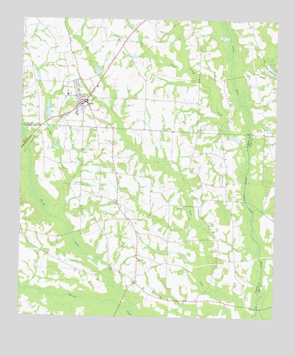
Omega, GA USGS Topographic Map
Click on map above to begin viewing in our Map Viewer.

This topographic map contains these locations and features:
Feature Name Type Latitude Longitude GNIS ID View Map
Antioch ChurchChurchN31.2980°W83.5771°354330View Map
Arnold CreekStreamN31.3207°W83.5154°310631View Map
City of OmegaCivilN31.3389°W83.5949°2404432View Map
Colquitt County Volunteer Firefighters Association Fire Station 22 Livingston BridgeBuildingN31.2906°W83.5699°2604967View Map
Cross Roads School (historical)SchoolN31.3102°W83.5777°343946View Map
Cypress Pond School (historical)SchoolN31.2655°W83.5304°343948View Map
Gator BranchStreamN31.3530°W83.5407°355987View Map
Kinard BridgeBridgeN31.2541°W83.5079°343892View Map
Lake LarryReservoirN31.3537°W83.5020°316654View Map
Lake Larry DamDamN31.3555°W83.5038°338085View Map
Leila ChurchChurchN31.2621°W83.5716°316757View Map
Leila Church (historical)ChurchN31.3030°W83.5957°343978View Map
Lindsey LakeReservoirN31.2623°W83.5596°341772View Map
Lindsey Lake DamDamN31.2619°W83.5582°341771View Map
Lotts BridgeBridgeN31.2991°W83.5143°343895View Map
McMillan CemeteryCemeteryN31.2574°W83.5266°343983View Map
Mount Vernon CemeteryCemeteryN31.3523°W83.5051°318898View Map
New Hope ChurchChurchN31.2735°W83.5660°319370View Map
Old Cypress Pond School (historical)SchoolN31.2749°W83.5349°344005View Map
OmegaPopulated PlaceN31.3410°W83.5935°332576View Map
Omega DivisionCivilN31.3683°W83.5843°1936456View Map
Omega Elementary SchoolSchoolN31.3432°W83.6021°342596View Map
Omega Police DepartmentBuildingN31.3401°W83.5957°2733838View Map
Omega Volunteer Fire DepartmentBuildingN31.3410°W83.5907°2604743View Map
Patrick LakeReservoirN31.3332°W83.6127°341840View Map
Patrick Lake DamDamN31.3335°W83.6116°341839View Map
Ponder LakeReservoirN31.3728°W83.5722°338076View Map
Powells BridgeBridgeN31.2849°W83.5993°344009View Map
Rutland LakeReservoirN31.3481°W83.5115°338084View Map
Rutland Lake DamDamN31.3485°W83.5132°338083View Map
Rutland Lake SouthReservoirN31.3405°W83.5118°341842View Map
Rutland Lake South DamDamN31.3419°W83.5132°341841View Map
Saint Pauls ChurchChurchN31.3282°W83.5377°322249View Map
Sapp CreekStreamN31.2919°W83.6091°322516View Map
Sumner School (historical)SchoolN31.3210°W83.5396°344020View Map
Ty Ty CreekStreamN31.2521°W83.5688°324467View Map
Union Grove Church (historical)ChurchN31.3544°W83.5052°342624View Map
Willington LakeReservoirN31.3635°W83.6232°342253View Map
Willington Lake DamDamN31.3635°W83.6232°342252View Map

Note: Coordinates in the location and feature list above are referenced to NAD83 datum.


Copyright (C) 2008-2024 Ryan Niemi / Sunset Dynamics ... All Rights Reserved