TopoQuest Logo
Do you find TopoQuest useful?
Help keep TopoQuest running and adding new maps/features by donating!
Bitcoin:  19c7KJd3qBynnjoSw5npx9KScwjBe4ifkT
Litecoin:  LXs6TkuXGGXo1vDsWCkWVdjQX94eUKd6ui
Home View Maps Find Maps Find Places Resources & Links


Lenox, Georgia Topographic Map

USGS Map Title: Lenox, GA
USGS Map MRC: 31083C4
DRG (GeoTIFF) Download: o31083c4.tif


Neighboring USGS Topographic Map Quads:


  Tifton West, GA  
31083D5
 

  Tifton East, GA  
31083D4
 

  Enigma, GA  
31083D3
 

  Omega, GA  
31083C5
 

  Lenox, GA  
31083C4
 

  Sapps Lake, GA  
31083C3
 

  Ellenton, GA  
31083B5
 

  Adel, GA  
31083B4
 

  Nashville West, GA  
31083B3


Map MRC Location:

N32°
W84°
N32°
W83°
H8 H7 H6 H5 H4 H3 H2 H1
G8 G7 G6 G5 G4 G3 G2 G1
F8 F7 F6 F5 F4 F3 F2 F1
E8 E7 E6 E5 E4 E3 E2 E1
D8 D7 D6 D5 D4 D3 D2 D1
C8 C7 C6 C5 C4 C3 C2 C1
B8 B7 B6 B5 B4 B3 B2 B1
A8 A7 A6 A5 A4 A3 A2 A1
N31°
W84°
N31°
W83°

Lenox, GA USGS 1:24K Topographic Map Preview:
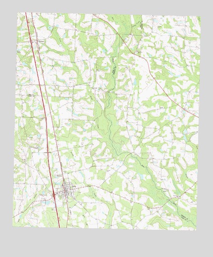
Lenox, GA USGS Topographic Map
Click on map above to begin viewing in our Map Viewer.

This topographic map contains these locations and features:
Feature Name Type Latitude Longitude GNIS ID View Map
Bethlehem Primitive Baptist ChurchChurchN31.2966°W83.4841°354660View Map
Betts LakeReservoirN31.2646°W83.4763°341794View Map
Betts Lake DamDamN31.2652°W83.4782°341793View Map
Brown BridgeBridgeN31.2677°W83.3938°343872View Map
Cherry Grove ChurchChurchN31.3674°W83.4885°342564View Map
Community ChurchChurchN31.3669°W83.3854°346059View Map
EldoradoPopulated PlaceN31.3538°W83.4854°355666View Map
Eldorado ChurchChurchN31.3574°W83.4863°342573View Map
Eldorado Consolidated School (historical)SchoolN31.3596°W83.4852°342574View Map
Exit 13CrossingN31.2688°W83.4721°1672947View Map
Exit 14CrossingN31.3585°W83.4902°1672948View Map
Fender Post Office (historical)Post OfficeN31.3669°W83.4866°325836View Map
Griffin LakeReservoirN31.3034°W83.4834°341792View Map
Griffin Lake DamDamN31.3035°W83.4832°341791View Map
Hand LakeReservoirN31.3560°W83.4148°341940View Map
Hand Lake DamDamN31.3552°W83.4149°341939View Map
Hesters BridgeBridgeN31.2944°W83.4207°343890View Map
Lakeview ChurchChurchN31.2882°W83.4927°316578View Map
LenoxPopulated PlaceN31.2716°W83.4649°316766View Map
Lenox DivisionCivilN31.2647°W83.4365°1936357View Map
Lenox Elementary SchoolSchoolN31.2752°W83.4666°343893View Map
Lenox Police DepartmentBuildingN31.2714°W83.4636°2733665View Map
Lenox Volunteer Fire DepartmentBuildingN31.2718°W83.4634°2604299View Map
Little CreekStreamN31.3682°W83.4215°317022View Map
Mathis CemeteryCemeteryN31.2955°W83.4696°343897View Map
New River ChurchChurchN31.2735°W83.3954°319524View Map
New River School (historical)SchoolN31.3235°W83.3907°346098View Map
Oak Grove ChurchChurchN31.3535°W83.4171°319767View Map
Oaky Grove CemeteryCemeteryN31.3538°W83.4179°346100View Map
Pine Grove ChurchChurchN31.2699°W83.3879°320563View Map
Reedy CreekStreamN31.3032°W83.4382°321458View Map
Rutland CemeteryCemeteryN31.3447°W83.4975°342600View Map
StauntonPopulated PlaceN31.2813°W83.4668°333120View Map
Temple ChurchChurchN31.3210°W83.4010°323982View Map
Tift County Volunteer Fire Department Station 7BuildingN31.3586°W83.4862°2604745View Map
Town of LenoxCivilN31.2673°W83.4672°2406004View Map
Union Grove ChurchChurchN31.3557°W83.4860°342623View Map
West Central Avenue Church of GodChurchN31.2707°W83.4694°2612058View Map

Note: Coordinates in the location and feature list above are referenced to NAD83 datum.


Copyright (C) 2008-2024 Ryan Niemi / Sunset Dynamics ... All Rights Reserved