TopoQuest Logo
Do you find TopoQuest useful?
Help keep TopoQuest running and adding new maps/features by donating!
Bitcoin:  19c7KJd3qBynnjoSw5npx9KScwjBe4ifkT
Litecoin:  LXs6TkuXGGXo1vDsWCkWVdjQX94eUKd6ui
Home View Maps Find Maps Find Places Resources & Links


Mountain City, Nevada Topographic Map

USGS Map Title: Mountain City, NV
USGS Map MRC: 41115G8
DRG (GeoTIFF) Download: o41115g8.tif


Neighboring USGS Topographic Map Quads:


  Owyhee, NV  
41116H1
 

  Winter Ridge, NV  
41115H8
 

  Hicks Mountain, NV  
41115H7
 

  Ungina Wongo, NV  
41116G1
 

  Mountain City, NV  
41115G8
 

  Merritt Mountain, NV  
41115G7
 

  Maggie Summit, NV  
41116F1
 

  Badger Creek, NV  
41115F8
 

  Wild Horse, NV  
41115F7


Map MRC Location:

N42°
W116°
N42°
W115°
H8 H7 H6 H5 H4 H3 H2 H1
G8 G7 G6 G5 G4 G3 G2 G1
F8 F7 F6 F5 F4 F3 F2 F1
E8 E7 E6 E5 E4 E3 E2 E1
D8 D7 D6 D5 D4 D3 D2 D1
C8 C7 C6 C5 C4 C3 C2 C1
B8 B7 B6 B5 B4 B3 B2 B1
A8 A7 A6 A5 A4 A3 A2 A1
N41°
W116°
N41°
W115°

Mountain City, NV USGS 1:24K Topographic Map Preview:
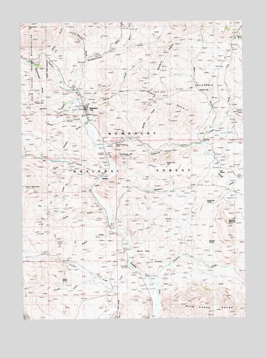
Mountain City, NV USGS Topographic Map
Click on map above to begin viewing in our Map Viewer.

This topographic map contains these locations and features:
Feature Name Type Latitude Longitude GNIS ID View Map
Allegheny CreekStreamN41.7666°W115.9301°858688View Map
Allegheny School (historical)SchoolN41.7624°W115.9359°858689View Map
Argenta MineMineN41.7999°W115.9493°857413View Map
Bald MountainSummitN41.8055°W115.9987°858794View Map
Banner HillSummitN41.8471°W115.9620°847080View Map
Bear Foot MountainSummitN41.8535°W115.9512°847079View Map
Bieroth RanchLocaleN41.8246°W115.8984°858877View Map
Boyle CabinLocaleN41.8671°W115.8809°858998View Map
Browns GulchValleyN41.8599°W115.9648°859032View Map
Bull SpringSpringN41.8113°W115.8896°859078View Map
California BasinBasinN41.8485°W115.8954°859124View Map
California CreekStreamN41.8230°W115.9584°859126View Map
California HillSummitN41.8182°W115.9459°859128View Map
China GulchValleyN41.8593°W115.9845°859238View Map
Crescent MineMineN41.7999°W115.9493°857408View Map
Crosby RanchLocaleN41.7685°W115.9579°859425View Map
Devils GateGapN41.7810°W115.9368°859517View Map
Dip CreekStreamN41.8680°W115.8795°859527View Map
Dry CreekStreamN41.8088°W115.9565°859572View Map
Eldorado MineMineN41.7999°W115.9493°857409View Map
Emmet GulchValleyN41.8313°W115.9665°859677View Map
Emmett MineMineN41.7999°W115.9493°857405View Map
Excelsior MineMineN41.7999°W115.9493°857412View Map
Golden Ensign MineMineN41.8227°W115.9476°859848View Map
Granite RidgeRidgeN41.8610°W115.9181°859875View Map
Grasshopper GulchValleyN41.8568°W115.9931°859888View Map
Hansen GulchValleyN41.8338°W115.9679°859937View Map
Harris GulchValleyN41.8399°W115.9651°859943View Map
Haystack CreekStreamN41.7945°W115.9518°859959View Map
Haystack MountainSummitN41.7902°W115.8845°859957View Map
Haystack SpringSpringN41.7818°W115.8963°859958View Map
Hot SpringSpringN41.7737°W115.9223°860055View Map
Huber HillsSummitN41.8368°W115.9131°860066View Map
Idaho MineMineN41.7999°W115.9493°857407View Map
Independent MineMineN41.7999°W115.9493°857411View Map
Little Chicken CreekStreamN41.7660°W115.9576°860354View Map
Mill CreekStreamN41.8099°W115.9551°860588View Map
Miller CreekStreamN41.8632°W115.9501°860593View Map
Mountain CityPopulated PlaceN41.8385°W115.9654°860665View Map
Mountain City District Ranger OfficeLocaleN41.8363°W115.9648°862372View Map
Mountain City Landing Field (historical)AirportN41.8207°W115.9606°863114View Map
Mountain City MineMineN41.8235°W115.9718°855524View Map
Mountain City Mining DistrictCivilN41.7999°W115.9493°858477View Map
Mountain City Post OfficePost OfficeN41.8388°W115.9655°864903View Map
Mountain City Ranger StationLocaleN41.7868°W115.9515°860666View Map
Mountain City Volunteer Fire DepartmentBuildingN41.8379°W115.9650°2581403View Map
Muddy Flat SpringSpringN41.7980°W115.8969°860686View Map
Nelson MineMineN41.8441°W115.9670°854324View Map
Nelson RanchLocaleN41.8191°W115.9823°860720View Map
Nevada MineMineN41.7999°W115.9493°857406View Map
Nevada Noname One DamDamN41.7832°W115.8776°863564View Map
North Fork California CreekStreamN41.8349°W115.8848°860757View Map
PatsvillePopulated PlaceN41.8102°W115.9576°860892View Map
Peck RanchLocaleN41.7674°W115.9226°860910View Map
Pride of the West MineMineN41.7999°W115.9493°857414View Map
Protection MineMineN41.8285°W115.9570°855523View Map
Quartzite HillSummitN41.8155°W115.9190°861037View Map
Rabbit DrawValleyN41.7868°W115.9515°861047View Map
Reservation HillSummitN41.8716°W115.9987°861102View Map
Resurrection MineMineN41.8418°W115.9656°855525View Map
Rio TintoStreamN41.8163°W115.9809°862703View Map
Rio Tinto MineMineN41.8121°W115.9809°861122View Map
Rio Tinto Post Office (historical)Post OfficeN41.8118°W115.9770°864902View Map
Roach SpringSpringN41.7664°W115.9758°861127View Map
Rocky GulchValleyN41.7952°W115.9551°861161View Map
Rosella MineMineN41.8402°W115.9279°862716View Map
Ross GulchValleyN41.8310°W115.8940°861176View Map
Rough DrawValleyN41.8230°W115.8970°861179View Map
Russel GulchValleyN41.8335°W115.9681°861206View Map
Saint Nicholas MineMineN41.7999°W115.9493°857404View Map
Schlag DrawValleyN41.8263°W115.9370°861281View Map
Silver Banner MineLocaleN41.8457°W115.9640°846487View Map
Slaughterhouse CreekStreamN41.8463°W115.9720°861409View Map
SugarloafSummitN41.8416°W115.9937°861621View Map
Trail CreekStreamN41.7532°W115.9470°861767View Map
U S Grant MineMineN41.7999°W115.9493°857410View Map
Van Duzer CreekStreamN41.7716°W115.9404°861838View Map
West Fork Slaughterhouse CreekStreamN41.8655°W115.9390°861947View Map

Note: Coordinates in the location and feature list above are referenced to NAD83 datum.


Copyright (C) 2008-2024 Ryan Niemi / Sunset Dynamics ... All Rights Reserved