TopoQuest Logo
Do you find TopoQuest useful?
Help keep TopoQuest running and adding new maps/features by donating!
Bitcoin:  19c7KJd3qBynnjoSw5npx9KScwjBe4ifkT
Litecoin:  LXs6TkuXGGXo1vDsWCkWVdjQX94eUKd6ui
Home View Maps Find Maps Find Places Resources & Links


Mill Run, Pennsylvania Topographic Map

USGS Map Title: Mill Run, PA
USGS Map MRC: 39079H4
DRG (GeoTIFF) Download: o39079h4.tif


Neighboring USGS Topographic Map Quads:


  Connellsville, PA  
40079A5
 

  Donegal, PA  
40079A4
 

  Seven Springs, PA  
40079A3
 

  South Connellsville, PA  
39079H5
 

  Mill Run, PA  
39079H4
 

  Kingwood, PA  
39079H3
 

  Fort Necessity, PA  
39079G5
 

  Ohiopyle, PA  
39079G4
 

  Confluence, PA  
39079G3


Map MRC Location:

N40°
W80°
N40°
W79°
H8 H7 H6 H5 H4 H3 H2 H1
G8 G7 G6 G5 G4 G3 G2 G1
F8 F7 F6 F5 F4 F3 F2 F1
E8 E7 E6 E5 E4 E3 E2 E1
D8 D7 D6 D5 D4 D3 D2 D1
C8 C7 C6 C5 C4 C3 C2 C1
B8 B7 B6 B5 B4 B3 B2 B1
A8 A7 A6 A5 A4 A3 A2 A1
N39°
W80°
N39°
W79°

Mill Run, PA USGS 1:24K Topographic Map Preview:
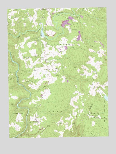
Mill Run, PA USGS Topographic Map
Click on map above to begin viewing in our Map Viewer.

This topographic map contains these locations and features:
Feature Name Type Latitude Longitude GNIS ID View Map
Bear RunStreamN39.9031°W79.4745°1168914View Map
Bear Run ChurchChurchN39.9062°W79.4620°1168935View Map
Buck RunStreamN39.9934°W79.4100°1170548View Map
Camp AchievementLocaleN39.9998°W79.4873°1170966View Map
Camp ChristianLocaleN39.9692°W79.4609°1170994View Map
Camp WildwoodLocaleN39.9926°W79.4206°1205303View Map
Clay RunStreamN39.9534°W79.4270°1171948View Map
Clay Run SchoolSchoolN39.9490°W79.3845°1205300View Map
Critchfield SchoolSchoolN39.9820°W79.4206°1205302View Map
Critchfield Stone ChurchChurchN39.9792°W79.4123°1172705View Map
Crooked RunStreamN39.9256°W79.4803°1172723View Map
FairmontPopulated PlaceN39.9415°W79.4411°1203545View Map
Falling Waters MuseumBuildingN39.9051°W79.4664°1213448View Map
Free Gospel ChurchChurchN39.8859°W79.4517°1175203View Map
Fulton RunStreamN39.9501°W79.4323°1175336View Map
Hampton SchoolSchoolN39.9601°W79.4864°1205305View Map
Hickman ChapelChurchN39.8909°W79.4636°1176944View Map
Hillview CemeteryCemeteryN39.9937°W79.3907°1177129View Map
Hillview ChurchChurchN39.9940°W79.3898°1205301View Map
House of PrayerChurchN39.9956°W79.4723°1177504View Map
Imel CemeteryCemeteryN39.9376°W79.3917°1177690View Map
Indian Creek DamDamN39.9817°W79.4548°1194453View Map
Indian Creek ReservoirReservoirN39.9761°W79.4558°1194452View Map
Jim RunStreamN39.8806°W79.4809°1178080View Map
Johnson RunStreamN39.9337°W79.4884°1178123View Map
Jonathan RunStreamN39.9048°W79.4889°1178144View Map
Jonathan Run FallsFallsN39.9023°W79.4917°1202391View Map
KaufmannPopulated PlaceN39.9017°W79.4659°1203914View Map
Killarney ParkLocaleN39.9701°W79.4623°1205306View Map
Laurel RunStreamN39.9181°W79.4717°1178970View Map
Laurel RunStreamN39.9931°W79.4153°1179001View Map
Maple Summit ChurchChurchN39.8987°W79.4123°1180369View Map
Maple Summit SchoolSchoolN39.9009°W79.4114°1206662View Map
Mason SchoolSchoolN39.9401°W79.4614°1205304View Map
Middle Fork Laurel RunStreamN39.9970°W79.4042°1181031View Map
Mill RunPopulated PlaceN39.9512°W79.4545°1181173View Map
Mill RunStreamN39.9734°W79.4550°1181178View Map
Mill Run ChurchChurchN39.9401°W79.4495°1181191View Map
Mill Run JunctionPopulated PlaceN39.9640°W79.4531°1181193View Map
Mill Run Post OfficePost OfficeN39.9506°W79.4547°2772839View Map
Mill Run ReservoirReservoirN39.9812°W79.4548°1181195View Map
Mount Tabor CemeteryCemeteryN39.9907°W79.4954°1181853View Map
NormalvillePopulated PlaceN39.9987°W79.4481°1182503View Map
Normalville Area Volunteer Fire Department Station 51BuildingN39.9984°W79.4484°2645290View Map
Rasler RunStreamN39.9776°W79.4842°1184663View Map
Rogers MillPopulated PlaceN39.9923°W79.4109°1204537View Map
Rogers Mill ChurchChurchN39.9992°W79.3986°1185393View Map
Saint John SchoolSchoolN39.9951°W79.4848°1205308View Map
Sands CemeteryCemeteryN39.8884°W79.4198°1186939View Map
Sands ChurchChurchN39.8890°W79.4198°1205298View Map
Springfield Township Volunteer Hose Company Station 35BuildingN39.9541°W79.4548°2645765View Map
StewartonPopulated PlaceN39.9234°W79.4773°1204735View Map
Stewarton StationLocaleN39.9229°W79.4775°1212278View Map
Stony RunStreamN39.9934°W79.4353°1188802View Map
Stulls RunStreamN39.8898°W79.4773°1209342View Map
Sugar RunStreamN39.9059°W79.4889°1188968View Map
Sugar Run FallsFallsN39.9059°W79.4906°1202390View Map
Sugarcamp HollowValleyN39.9682°W79.3973°1188983View Map
Three Maples SchoolSchoolN39.8840°W79.4623°1205299View Map
Township of SpringfieldCivilN39.9794°W79.4389°1216445View Map
Township of StewartCivilN39.8764°W79.4825°1216447View Map
White BridgeLocaleN39.9951°W79.4348°1191252View Map
Windy Gap ChurchChurchN39.9904°W79.4964°1205307View Map
Workman RunStreamN39.9412°W79.4864°1191791View Map

Note: Coordinates in the location and feature list above are referenced to NAD83 datum.


Copyright (C) 2008-2024 Ryan Niemi / Sunset Dynamics ... All Rights Reserved