TopoQuest Logo
Do you find TopoQuest useful?
Help keep TopoQuest running and adding new maps/features by donating!
Bitcoin:  19c7KJd3qBynnjoSw5npx9KScwjBe4ifkT
Litecoin:  LXs6TkuXGGXo1vDsWCkWVdjQX94eUKd6ui
Home View Maps Find Maps Find Places Resources & Links


MacDonald Pass, Montana Topographic Map

USGS Map Title: MacDonald Pass, MT
USGS Map MRC: 46112E3
DRG (GeoTIFF) Download: o46112e3.tif


Neighboring USGS Topographic Map Quads:


  Esmeralda Hill, MT  
46112F4
 

  Greenhorn Mountain, MT  
46112F3
 

  Austin, MT  
46112F2
 

  Elliston, MT  
46112E4
 

  MacDonald Pass, MT  
46112E3
 

  Black Mountain, MT  
46112E2
 

  Bison Mountain, MT  
46112D4
 

  Three Brothers, MT  
46112D3
 

  Chessman Reservoir, MT  
46112D2


Map MRC Location:

N47°
W113°
N47°
W112°
H8 H7 H6 H5 H4 H3 H2 H1
G8 G7 G6 G5 G4 G3 G2 G1
F8 F7 F6 F5 F4 F3 F2 F1
E8 E7 E6 E5 E4 E3 E2 E1
D8 D7 D6 D5 D4 D3 D2 D1
C8 C7 C6 C5 C4 C3 C2 C1
B8 B7 B6 B5 B4 B3 B2 B1
A8 A7 A6 A5 A4 A3 A2 A1
N46°
W113°
N46°
W112°

MacDonald Pass, MT USGS 1:24K Topographic Map Preview:
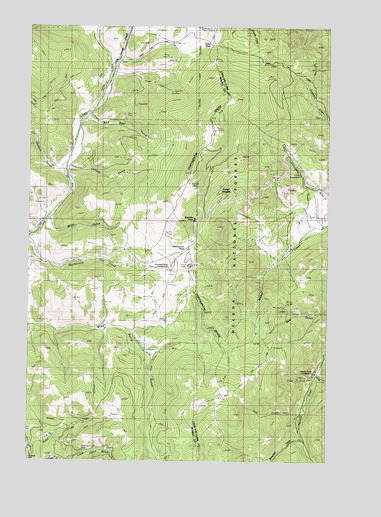
MacDonald Pass, MT USGS Topographic Map
Click on map above to begin viewing in our Map Viewer.

This topographic map contains these locations and features:
Feature Name Type Latitude Longitude GNIS ID View Map
Bear Gulch TrailTrailN46.5177°W112.2978°800413View Map
Boulder MountainsRangeN46.5499°W112.3509°1888618View Map
Boy Scout CampLocaleN46.5247°W112.2581°806347View Map
Camp ThunderbirdLocaleN46.5833°W112.2628°794899View Map
Clarkston Post Office (historical)Post OfficeN46.5138°W112.2633°1789215View Map
Cromwell Dixon CampgroundLocaleN46.5547°W112.3139°781906View Map
Deer CreekStreamN46.5133°W112.2620°800689View Map
Forest HeightsPopulated PlaceN46.5783°W112.2964°800804View Map
Frontier TownPopulated PlaceN46.5694°W112.3064°800819View Map
Hahn CreekStreamN46.5030°W112.3747°784444View Map
Latham GulchValleyN46.5838°W112.3564°785980View Map
Little Flume GulchValleyN46.5002°W112.3572°786291View Map
Little Porcupine CreekStreamN46.5677°W112.2558°801077View Map
MacDonald PassGapN46.5613°W112.3086°801113View Map
MacDonald Pass CampgroundLocaleN46.5602°W112.3039°801114View Map
MacDonald Pass CampgroundLocaleN46.5613°W112.3050°794900View Map
Miles GulchValleyN46.5683°W112.3664°787346View Map
Minnehaha (historical)LocaleN46.5055°W112.2592°1789083View Map
Minnehaha CreekStreamN46.5063°W112.2611°801175View Map
Moose CreekStreamN46.5252°W112.2558°801192View Map
Moose Creek (historical)LocaleN46.5263°W112.2550°1789078View Map
Moose Creek CampgroundLocaleN46.5252°W112.2606°801194View Map
Porcupine CampgroundLocaleN46.5880°W112.2675°801311View Map
Porcupine CampgroundLocaleN46.5880°W112.2689°794923View Map
Priest PassGapN46.6194°W112.2986°801323View Map
Rich (historical)LocaleN46.5999°W112.3509°1803369View Map
Rich Spur GulchValleyN46.5977°W112.3492°789564View Map
Sawmill GulchValleyN46.5835°W112.3645°790073View Map
Terra Firma (historical)LocaleN46.5833°W112.3509°1803363View Map
Third Term MineMineN46.5030°W112.3525°792067View Map
Third Term MineMineN46.5022°W112.3534°805019View Map
Uncle George CreekStreamN46.6060°W112.3456°801636View Map
Vista Point of InterestLocaleN46.5555°W112.3095°794901View Map

Note: Coordinates in the location and feature list above are referenced to NAD83 datum.


Copyright (C) 2008-2024 Ryan Niemi / Sunset Dynamics ... All Rights Reserved