TopoQuest Logo
Do you find TopoQuest useful?
Help keep TopoQuest running and adding new maps/features by donating!
Bitcoin:  19c7KJd3qBynnjoSw5npx9KScwjBe4ifkT
Litecoin:  LXs6TkuXGGXo1vDsWCkWVdjQX94eUKd6ui
Home View Maps Find Maps Find Places Resources & Links


Chessman Reservoir, Montana Topographic Map

USGS Map Title: Chessman Reservoir, MT
USGS Map MRC: 46112D2
DRG (GeoTIFF) Download: o46112d2.tif


Neighboring USGS Topographic Map Quads:


  MacDonald Pass, MT  
46112E3
 

  Black Mountain, MT  
46112E2
 

  Helena, MT  
46112E1
 

  Three Brothers, MT  
46112D3
 

  Chessman Reservoir, MT  
46112D2
 

  Jefferson City, MT  
46112D1
 

  Basin, MT  
46112C3
 

  Mount Thompson, MT  
46112C2
 

  Wickes, MT  
46112C1


Map MRC Location:

N47°
W113°
N47°
W112°
H8 H7 H6 H5 H4 H3 H2 H1
G8 G7 G6 G5 G4 G3 G2 G1
F8 F7 F6 F5 F4 F3 F2 F1
E8 E7 E6 E5 E4 E3 E2 E1
D8 D7 D6 D5 D4 D3 D2 D1
C8 C7 C6 C5 C4 C3 C2 C1
B8 B7 B6 B5 B4 B3 B2 B1
A8 A7 A6 A5 A4 A3 A2 A1
N46°
W113°
N46°
W112°

Chessman Reservoir, MT USGS 1:24K Topographic Map Preview:
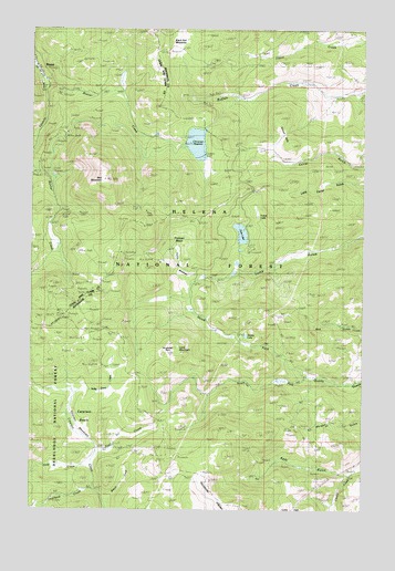
Chessman Reservoir, MT USGS Topographic Map
Click on map above to begin viewing in our Map Viewer.

This topographic map contains these locations and features:
Feature Name Type Latitude Longitude GNIS ID View Map
07N04W05CDCD01 WellWellN46.3797°W112.1353°815888View Map
07N04W08BDBB01 WellWellN46.3752°W112.1361°815854View Map
Alsace MineMineN46.4213°W112.2417°803349View Map
Argentine MineMineN46.3888°W112.1989°803317View Map
Atlanta MineMineN46.3902°W112.2008°803508View Map
Beaver CreekStreamN46.4863°W112.2470°800426View Map
BelleMineN46.4749°W112.2370°803904View Map
Black Hall MeadowsFlatN46.4980°W112.1942°800466View Map
Black HawkMineN46.4297°W112.2347°803933View Map
Branch CreekStreamN46.3755°W112.2214°780361View Map
Bunker HillMineN46.4694°W112.2453°803898View Map
Cataract BasinBasinN46.4013°W112.2364°781048View Map
Chessman Main DamDamN46.4699°W112.1925°796208View Map
Chessman ReservoirReservoirN46.4702°W112.1888°800583View Map
Chessman Saddle DamDamN46.4733°W112.1858°796683View Map
Clontart/CarpMineN46.4888°W112.2431°803945View Map
ConflictMineN46.4824°W112.2478°803922View Map
Corbitt MineMineN46.4188°W112.2278°803352View Map
Crescent MineMineN46.4210°W112.2464°781884View Map
Crescent MineMineN46.4213°W112.2467°803321View Map
Crescent Post Office (historical)Post OfficeN46.4547°W112.2467°1762577View Map
DalneyMineN46.4763°W112.2295°803911View Map
Deep CreekStreamN46.3855°W112.2281°782197View Map
Delanie MineMineN46.3958°W112.1767°803517View Map
EurekaMineN46.4730°W112.2397°803902View Map
Evergreen - Lower Evergreen MineMineN46.4672°W112.2447°803897View Map
FairviewMineN46.4730°W112.2389°803901View Map
Forest LakeLakeN46.4516°W112.1656°783601View Map
Frohner BasinBasinN46.4463°W112.1939°806131View Map
Frohner MeadowsFlatN46.4441°W112.1936°783768View Map
Frohner MineMineN46.4410°W112.2142°803458View Map
Frohner MineMineN46.4413°W112.2086°783769View Map
GarfieldMineN46.4258°W112.2383°803932View Map
General Grant MineMineN46.4230°W112.2053°803460View Map
Gould DiggingsAreaN46.4341°W112.2486°800868View Map
Green TreeMineN46.4358°W112.2356°803927View Map
H GrattanMineN46.4913°W112.2389°803947View Map
HelenaMineN46.4616°W112.2472°803919View Map
Horsethief ParkFlatN46.4166°W112.1995°806132View Map
Ida May MineMineN46.4191°W112.2306°785214View Map
Ida May MineMineN46.4208°W112.2295°803350View Map
JumboMineN46.4758°W112.2425°803915View Map
Kady GulchValleyN46.3849°W112.1333°785617View Map
Knight GwinneMineN46.4819°W112.2445°803921View Map
Lava MountainSummitN46.4166°W112.1970°785983View Map
LexingtonMineN46.4713°W112.2411°803899View Map
Little Sampson MineMineN46.4744°W112.2425°803912View Map
Lone Eagle MineMineN46.4074°W112.1583°803445View Map
LuluMineN46.4388°W112.2425°803936View Map
Mary AloysMineN46.4341°W112.2433°803931View Map
MicawberMineN46.4705°W112.2417°803907View Map
Morgan Gulch MineMineN46.3963°W112.1522°803444View Map
National Extension 79 MineMineN46.4505°W112.2103°803953View Map
NE NE Section 28 MineMineN46.4208°W112.2467°803361View Map
NE SE Section 4MineN46.4733°W112.2272°803951View Map
NE SW Section 34 MineMineN46.4902°W112.2208°803944View Map
NE Three Brothers MineMineN46.3977°W112.2486°803366View Map
Nellie Grant CreekStreamN46.4049°W112.2345°787939View Map
Nellie Grant MineMineN46.4369°W112.2022°803459View Map
New CastleMineN46.4402°W112.2247°803937View Map
North Fork Quartz CreekStreamN46.4094°W112.1456°788230View Map
North PacificMineN46.4722°W112.2370°803905View Map
NW NE Section 16MineN46.4513°W112.2331°803938View Map
NW NW Section 34MineN46.4963°W112.2270°803949View Map
NW NW Section 9MineN46.4633°W112.2425°803906View Map
NW SE S33MineN46.4910°W112.2408°803946View Map
NW SE Section 16MineN46.4422°W112.2328°803935View Map
NW SW Section 27 MineMineN46.4116°W112.2231°803363View Map
NW SW Section 3 MineMineN46.4727°W112.2217°803950View Map
Occidental PlateauPlainN46.3791°W112.1936°788383View Map
Ousley MineMineN46.4147°W112.2342°803351View Map
Overland CreekStreamN46.3794°W112.2256°788532View Map
Park LakeReservoirN46.4470°W112.1718°788644View Map
Park Lake CampgroundLocaleN46.4422°W112.1689°1762604View Map
Park Lake Fishing Access SiteLocaleN46.4413°W112.1692°1744432View Map
Peerles JennyMineN46.4313°W112.2389°803672View Map
Peerless KingMineN46.4322°W112.2389°803929View Map
Peerless MineMineN46.4308°W112.2406°801293View Map
PerseveranceMineN46.4374°W112.2495°803926View Map
PilgrimMineN46.4416°W112.2333°803903View Map
Quartz LakeLakeN46.4203°W112.1698°806133View Map
QueensburyMineN46.4324°W112.2350°803928View Map
Red MountainSummitN46.4608°W112.2239°801346View Map
Red MountainMineN46.4708°W112.2217°803685View Map
Red Mountain Junction (historical)LocaleN46.4749°W112.2453°1789273View Map
RiminiPopulated PlaceN46.4880°W112.2467°806966View Map
Rimini (historical)LocaleN46.4880°W112.2467°1789267View Map
Rimini Post Office (historical)Post OfficeN46.4880°W112.2467°1789268View Map
Rimini School (historical)SchoolN46.4880°W112.2467°1789269View Map
Rob RoyMineN46.4697°W112.2425°803908View Map
S P BassettMineN46.4666°W112.2342°803896View Map
Sallie BellMineN46.4524°W112.2078°803952View Map
SE NE Section 28 MineMineN46.4149°W112.2100°803362View Map
SE NE Section 33MineN46.4933°W112.2361°803948View Map
SE NE Section 4MineN46.4783°W112.2283°803910View Map
SE NW Section 30 MineMineN46.4152°W112.1575°803442View Map
SE SE Section 10MineN46.4533°W112.2058°803954View Map
SE SE Section 21 MineMineN46.4227°W112.2278°803392View Map
SE SE Section 3MineN46.4716°W112.2083°803955View Map
SE SW Section 2 MineMineN46.3791°W112.1981°803364View Map
SE SW Section 9 MineMineN46.4527°W112.2397°803920View Map
South Fork Quartz CreekStreamN46.4094°W112.1461°791031View Map
South PacificMineN46.4722°W112.2403°803900View Map
Spruce HillsSummitN46.4763°W112.1586°791342View Map
SW SW Section 23 MineMineN46.4230°W112.2000°803441View Map
Trail CreekStreamN46.3894°W112.2258°792304View Map
Treasury Number 1MineN46.4322°W112.2281°803939View Map
Vandalia MineMineN46.3847°W112.1861°803524View Map
Vaughn Post Office (historical)Post OfficeN46.4249°W112.2411°1789237View Map
W A AlleyMineN46.4619°W112.2481°803918View Map

Note: Coordinates in the location and feature list above are referenced to NAD83 datum.


Copyright (C) 2008-2024 Ryan Niemi / Sunset Dynamics ... All Rights Reserved