TopoQuest Logo
Do you find TopoQuest useful?
Help keep TopoQuest running and adding new maps/features by donating!
Bitcoin:  19c7KJd3qBynnjoSw5npx9KScwjBe4ifkT
Litecoin:  LXs6TkuXGGXo1vDsWCkWVdjQX94eUKd6ui
Home View Maps Find Maps Find Places Resources & Links


Helton, Kentucky Topographic Map

USGS Map Title: Helton, KY
USGS Map MRC: 36083H4
DRG (GeoTIFF) Download: o36083h4.tif


Neighboring USGS Topographic Map Quads:


  Creekville, KY  
37083A5
 

  Hoskinston, KY  
37083A4
 

  Cutshin, KY  
37083A3
 

  Beverly, KY  
36083H5
 

  Helton, KY  
36083H4
 

  Bledsoe, KY  
36083H3
 

  Balkan, KY  
36083G5
 

  Wallins Creek, KY  
36083G4
 

  Harlan, KY  
36083G3


Map MRC Location:

N37°
W84°
N37°
W83°
H8 H7 H6 H5 H4 H3 H2 H1
G8 G7 G6 G5 G4 G3 G2 G1
F8 F7 F6 F5 F4 F3 F2 F1
E8 E7 E6 E5 E4 E3 E2 E1
D8 D7 D6 D5 D4 D3 D2 D1
C8 C7 C6 C5 C4 C3 C2 C1
B8 B7 B6 B5 B4 B3 B2 B1
A8 A7 A6 A5 A4 A3 A2 A1
N36°
W84°
N36°
W83°

Helton, KY USGS 1:24K Topographic Map Preview:
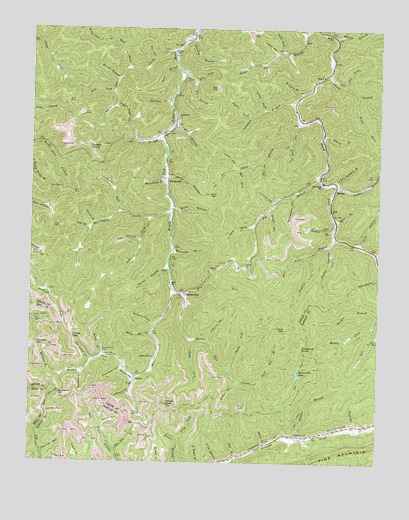
Helton, KY USGS Topographic Map
Click on map above to begin viewing in our Map Viewer.

This topographic map contains these locations and features:
Feature Name Type Latitude Longitude GNIS ID View Map
Adams BranchStreamN36.9765°W83.4160°510212View Map
Apple Orchard BranchStreamN36.9559°W83.3910°510293View Map
Arrow HollowValleyN36.8855°W83.4741°510302View Map
Bear BranchStreamN36.9390°W83.4613°510443View Map
Bear BranchStreamN36.9893°W83.4477°510445View Map
Beech Fork MissionChurchN36.9554°W83.3949°2363108View Map
Beech Fork Settlement School (historical)SchoolN36.9556°W83.3955°510519View Map
Big BranchStreamN36.8765°W83.4260°510602View Map
Big BranchStreamN36.9568°W83.3966°510608View Map
Buck GapGapN36.9523°W83.4363°511007View Map
Buck HollowValleyN36.9569°W83.4513°511009View Map
Buckeye HollowValleyN36.9008°W83.4813°511022View Map
Buzzard HollowValleyN36.9151°W83.4555°511111View Map
Cawood BranchStreamN36.9356°W83.3763°511286View Map
Chestnut GapGapN36.9087°W83.4038°511332View Map
Chestnut KnobSummitN36.9084°W83.4038°516638View Map
Coalfield HollowValleyN36.9017°W83.4668°511442View Map
Collins HollowValleyN36.9503°W83.4135°511476View Map
Deep GapGapN36.9126°W83.4088°511765View Map
Deep Gap BranchStreamN36.8979°W83.4180°511767View Map
Does ForkStreamN36.9431°W83.4205°511850View Map
Dry ForkStreamN36.9240°W83.4480°511920View Map
Dry ForkStreamN36.9848°W83.4421°511921View Map
Dug ForkStreamN36.9843°W83.3880°511944View Map
Edd ForkStreamN36.9601°W83.4263°512009View Map
Elk BranchStreamN36.9862°W83.4455°512031View Map
Fern BranchStreamN36.9376°W83.3830°512150View Map
Foundation GapGapN36.8954°W83.4894°512224View Map
Franks BranchStreamN36.8818°W83.4030°512241View Map
Ginseng BranchStreamN36.9970°W83.4424°512319View Map
Harvey BranchStreamN36.9856°W83.4694°512581View Map
HeltonPopulated PlaceN36.9540°W83.3907°512641View Map
Helton BranchStreamN36.9968°W83.4991°512643View Map
Helton Post Office (historical)Post OfficeN36.9555°W83.3909°2363142View Map
Hobbs HollowValleyN36.9604°W83.4275°512719View Map
Honey BranchStreamN36.9056°W83.4730°512762View Map
Honey Branch CemeteryCemeteryN36.9065°W83.4727°512764View Map
Hoskin BranchStreamN36.9415°W83.3913°512804View Map
Hurricane BranchStreamN36.9362°W83.4491°512856View Map
Imlay Post Office (historical)Post OfficeN36.9572°W83.3960°2362736View Map
Isaacs ForkStreamN36.9470°W83.4677°512931View Map
Johnson ForkStreamN36.9101°W83.4366°513049View Map
Kentucky BranchStreamN36.8995°W83.4613°513127View Map
Kentucky RidgeRidgeN36.9044°W83.4193°2362740View Map
Laurel BranchStreamN36.9437°W83.4774°513215View Map
Laurel BranchStreamN36.9695°W83.3955°513216View Map
Left Fork Marrowbone CreekStreamN36.9448°W83.4571°513320View Map
Left Fork Reuben BranchStreamN36.9148°W83.3766°513323View Map
Lick ForkStreamN36.9673°W83.4074°513403View Map
Lizzie HollowValleyN36.9930°W83.4125°513552View Map
Long BranchStreamN36.9423°W83.4785°513589View Map
Long ForkStreamN36.8812°W83.4466°513616View Map
Long ForkStreamN36.9098°W83.4421°513617View Map
Long ForkStreamN36.9818°W83.4710°513618View Map
Marbone School (historical)SchoolN36.9447°W83.4576°2362747View Map
Mare BranchStreamN36.9448°W83.3907°513784View Map
Marion BranchStreamN36.9976°W83.3910°513791View Map
Marlon Branch School (historical)SchoolN36.9981°W83.3906°2362748View Map
Marrowbone CreekStreamN36.9468°W83.4496°513796View Map
Mazie BranchStreamN36.9118°W83.4555°513842View Map
Middle Fork ChurchChurchN36.9051°W83.4544°513926View Map
Mill HollowValleyN36.9621°W83.4169°513990View Map
Mill HollowValleyN36.9914°W83.4567°513992View Map
Mozelle DivisionCivilN36.9991°W83.3946°1937162View Map
Mozelle Post Office (historical)Post OfficeN36.9998°W83.4008°2362752View Map
Mudlick BranchStreamN36.9790°W83.4505°514144View Map
Nantz Post Office (historical)Post OfficeN36.9871°W83.3937°2362754View Map
Old Lease HollowValleyN36.9042°W83.4779°514329View Map
Oldhouse BranchStreamN36.9790°W83.4071°514341View Map
Onemile BranchStreamN36.9401°W83.3905°514358View Map
Owl HollowValleyN36.8780°W83.4687°514396View Map
Pace BranchStreamN36.8845°W83.3830°514407View Map
Peters BranchStreamN36.9876°W83.3932°514518View Map
Peters KnobSummitN36.8915°W83.4496°514521View Map
Phillips GapGapN36.9109°W83.4844°514531View Map
Pigeon Roost HollowValleyN36.9775°W83.4703°514550View Map
Potato KnobSummitN36.9654°W83.4788°514731View Map
Rainbow BranchStreamN36.9012°W83.4921°514828View Map
Rainbow GapGapN36.9093°W83.4974°514829View Map
Rattlesnake HollowValleyN36.9520°W83.4069°514846View Map
Reuben Branch SchoolSchoolN36.9173°W83.3752°516797View Map
Right Fork Oldhouse BranchStreamN36.9790°W83.4069°514949View Map
Right Fork Onemile BranchStreamN36.9351°W83.3994°514950View Map
Right Fork Peters BranchStreamN36.9815°W83.3838°514953View Map
Right Fork Stone Coal BranchStreamN36.9995°W83.4024°514956View Map
Road ForkStreamN36.9887°W83.4652°514980View Map
Road ForkStreamN36.9934°W83.4094°514984View Map
Roark BranchStreamN36.9487°W83.4488°514995View Map
Rocky HollowValleyN36.9378°W83.3927°515076View Map
Rye Cove BranchStreamN36.9687°W83.4532°515163View Map
Rye Cove School (historical)SchoolN36.9705°W83.4523°2362761View Map
Salt Trace School (historical)SchoolN36.8816°W83.4720°2565800View Map
Sandy ForkStreamN36.9026°W83.4288°515240View Map
SaylorPopulated PlaceN36.8993°W83.4621°515270View Map
Saylor HollowValleyN36.8891°W83.4937°515272View Map
Saylor Post Office (historical)Post OfficeN36.8994°W83.4619°2362764View Map
Saylor School (historical)SchoolN36.8987°W83.4622°2362765View Map
Shade BranchStreamN36.8798°W83.4149°515333View Map
Simms BranchStreamN36.9548°W83.3907°515427View Map
Spruce PinePopulated PlaceN36.9234°W83.4452°515626View Map
Spruce Pine CreekStreamN36.9231°W83.4446°515628View Map
Spruce Pine LakeLakeN36.9007°W83.4038°515631View Map
Spruce Pine School (historical)SchoolN36.9228°W83.4452°2362775View Map
Squirrel HollowValleyN36.8775°W83.4952°515641View Map
Trace BranchStreamN36.9729°W83.4049°515994View Map
Turkey BranchStreamN36.9306°W83.4502°516039View Map
War BranchStreamN36.9715°W83.4485°516223View Map
War Branch Post OfficePost OfficeN36.9936°W83.4483°2362784View Map
WarbranchPopulated PlaceN36.9568°W83.4502°516225View Map
Warbranch ChurchChurchN36.9748°W83.4480°516226View Map
White Oak CreekStreamN36.9937°W83.4488°516316View Map
White Oak School (historical)SchoolN36.9858°W83.4690°2362786View Map
Whitehead BranchStreamN36.9562°W83.4524°516331View Map
Wilson HollowValleyN36.8979°W83.4256°516406View Map
Wilson HollowValleyN36.9473°W83.4147°516408View Map
Wolfpen BranchStreamN36.9812°W83.4035°516456View Map

Note: Coordinates in the location and feature list above are referenced to NAD83 datum.


Copyright (C) 2008-2024 Ryan Niemi / Sunset Dynamics ... All Rights Reserved