TopoQuest Logo
Do you find TopoQuest useful?
Help keep TopoQuest running and adding new maps/features by donating!
Bitcoin:  19c7KJd3qBynnjoSw5npx9KScwjBe4ifkT
Litecoin:  LXs6TkuXGGXo1vDsWCkWVdjQX94eUKd6ui
Home View Maps Find Maps Find Places Resources & Links


Adelaide, Nevada Topographic Map

USGS Map Title: Adelaide, NV
USGS Map MRC: 40117G5
DRG (GeoTIFF) Download: o40117g5.tif


Neighboring USGS Topographic Map Quads:


  Winnemucca East, NV  
40117H6
 

  Pole Creek, NV  
40117H5
 

  Golconda, NV  
40117H4
 

  Sonoma Canyon, NV  
40117G6
 

  Adelaide, NV  
40117G5
 

  Goldrun Creek, NV  
40117G4
 

  Clear Creek Ranch, NV  
40117F6
 

  Sheep Ranch Canyon, NV  
40117F5
 

  Smelser Pass, NV  
40117F4


Map MRC Location:

N41°
W118°
N41°
W117°
H8 H7 H6 H5 H4 H3 H2 H1
G8 G7 G6 G5 G4 G3 G2 G1
F8 F7 F6 F5 F4 F3 F2 F1
E8 E7 E6 E5 E4 E3 E2 E1
D8 D7 D6 D5 D4 D3 D2 D1
C8 C7 C6 C5 C4 C3 C2 C1
B8 B7 B6 B5 B4 B3 B2 B1
A8 A7 A6 A5 A4 A3 A2 A1
N40°
W118°
N40°
W117°

Adelaide, NV USGS 1:24K Topographic Map Preview:
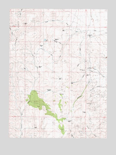
Adelaide, NV USGS Topographic Map
Click on map above to begin viewing in our Map Viewer.

This topographic map contains these locations and features:
Feature Name Type Latitude Longitude GNIS ID View Map
Adelaide (historical)Populated PlaceN40.8166°W117.5257°848206View Map
Adelaide Crown MinesMineN40.8110°W117.5273°854345View Map
Big Squaw ValleyBasinN40.8385°W117.5851°849669View Map
Broad Gulch CreekStreamN40.8527°W117.5393°849666View Map
Cumberland (historical)LocaleN40.8057°W117.5212°852118View Map
Cumberland MineMineN40.7832°W117.5201°839896View Map
Cumberland SpringSpringN40.7668°W117.5504°849677View Map
George Baine MeadowsFlatN40.7955°W117.5751°849675View Map
Gold Run (historical)Populated PlaceN40.8096°W117.5015°857557View Map
Gold Run Mining DistrictCivilN40.8099°W117.5068°854082View Map
Granite SpringSpringN40.8031°W117.5485°849674View Map
Harry Kaul SpringSpringN40.7736°W117.5278°849676View Map
Layson CreekStreamN40.8124°W117.5087°849673View Map
Little Squaw ValleyFlatN40.8421°W117.5660°841735View Map
Reinhart SpringSpringN40.7601°W117.5935°849678View Map
Ridge SpringSpringN40.8075°W117.5594°849672View Map
Ridge Top SpringSpringN40.8180°W117.5865°849671View Map
Rock Creek RanchLocaleN40.8493°W117.5243°843276View Map
Sibbald CorralLocaleN40.8168°W117.6048°849670View Map
Sonoma LakeLakeN40.8449°W117.5808°843821View Map
Sonoma PeakSummitN40.8599°W117.6085°843823View Map
Squaw Valley CreekStreamN40.8402°W117.5573°849668View Map
Stony BasinBasinN40.7924°W117.5573°844039View Map
Willow SpringSpringN40.8542°W117.5555°849667View Map

Note: Coordinates in the location and feature list above are referenced to NAD83 datum.


Copyright (C) 2008-2024 Ryan Niemi / Sunset Dynamics ... All Rights Reserved