TopoQuest Logo
Do you find TopoQuest useful?
Help keep TopoQuest running and adding new maps/features by donating!
Bitcoin:  19c7KJd3qBynnjoSw5npx9KScwjBe4ifkT
Litecoin:  LXs6TkuXGGXo1vDsWCkWVdjQX94eUKd6ui
Home View Maps Find Maps Find Places Resources & Links


Gibsland, Louisiana Topographic Map

USGS Map Title: Gibsland, LA
USGS Map MRC: 32093E1
DRG (GeoTIFF) Download: o32093e1.tif


Neighboring USGS Topographic Map Quads:


  Langston, LA  
32093F2
 

  Athens, LA  
32093F1
 

  Marsalis, LA  
32092F8
 

  Ada, LA  
32093E2
 

  Gibsland, LA  
32093E1
 

  Arcadia, LA  
32092E8
 

  Fryeburg, LA  
32093D2
 

  Sailes, LA  
32093D1
 

  Bryceland, LA  
32092D8


Map MRC Location:

N33°
W94°
N33°
W93°
H8 H7 H6 H5 H4 H3 H2 H1
G8 G7 G6 G5 G4 G3 G2 G1
F8 F7 F6 F5 F4 F3 F2 F1
E8 E7 E6 E5 E4 E3 E2 E1
D8 D7 D6 D5 D4 D3 D2 D1
C8 C7 C6 C5 C4 C3 C2 C1
B8 B7 B6 B5 B4 B3 B2 B1
A8 A7 A6 A5 A4 A3 A2 A1
N32°
W94°
N32°
W93°

Gibsland, LA USGS 1:24K Topographic Map Preview:
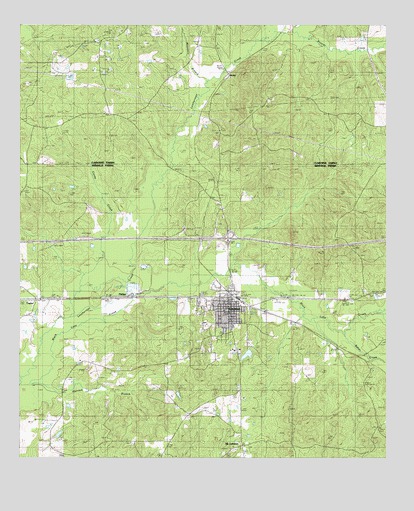
Gibsland, LA USGS Topographic Map
Click on map above to begin viewing in our Map Viewer.

This topographic map contains these locations and features:
Feature Name Type Latitude Longitude GNIS ID View Map
Baker CreekStreamN32.5379°W93.0124°532286View Map
Black Lake CreekStreamN32.5374°W93.1129°553696View Map
Caldwell CemeteryCemeteryN32.6207°W93.0646°533619View Map
Calhoun SchoolSchoolN32.5993°W93.1021°533627View Map
Caney CreekStreamN32.5407°W93.1091°553882View Map
DarleyPopulated PlaceN32.6110°W93.0541°541083View Map
Frazier CreekStreamN32.6232°W93.0329°535090View Map
Frazier SchoolSchoolN32.5988°W93.0171°535092View Map
Gibbs Plantation (historical)LocaleN32.5418°W93.0529°549080View Map
GibslandPopulated PlaceN32.5440°W93.0529°535207View Map
Gibsland Coleman High SchoolSchoolN32.5385°W93.0619°549081View Map
Gibsland Police DepartmentBuildingN32.5451°W93.0532°2755310View Map
Gibsland Post OfficePost OfficeN32.5454°W93.0521°1630970View Map
Hurried BranchStreamN32.5213°W93.1207°535885View Map
Interchange 61CrossingN32.5632°W93.0543°541478View Map
Machens SpurLocaleN32.5379°W93.0279°549087View Map
Moccasin BranchStreamN32.6096°W93.0621°537174View Map
Mount LebanonPopulated PlaceN32.5038°W93.0491°537331View Map
Mount Lebanon Baptist ChurchChurchN32.5024°W93.0524°549088View Map
Nelson StationLocaleN32.5474°W93.1179°555465View Map
North Bienville Fire Protection District Station 5BuildingN32.5444°W93.0528°2673061View Map
PhillipsPopulated PlaceN32.5465°W93.0891°540983View Map
TaylorPopulated PlaceN32.5457°W93.1193°543715View Map
Taylor Post OfficePost OfficeN32.5457°W93.1179°1630995View Map
Town of GibslandCivilN32.5394°W93.0540°2406562View Map
Town of Mount LebanonCivilN32.5052°W93.0499°2406207View Map
Walker ChurchChurchN32.5743°W93.0585°540198View Map
Ward ThreeCivilN32.5360°W93.0743°544931View Map
Whitley CemeteryCemeteryN32.5263°W93.0353°540384View Map

Note: Coordinates in the location and feature list above are referenced to NAD83 datum.


Copyright (C) 2008-2024 Ryan Niemi / Sunset Dynamics ... All Rights Reserved