TopoQuest Logo
Do you find TopoQuest useful?
Help keep TopoQuest running and adding new maps/features by donating!
Bitcoin:  19c7KJd3qBynnjoSw5npx9KScwjBe4ifkT
Litecoin:  LXs6TkuXGGXo1vDsWCkWVdjQX94eUKd6ui
Home View Maps Find Maps Find Places Resources & Links


Bryceland, Louisiana Topographic Map

USGS Map Title: Bryceland, LA
USGS Map MRC: 32092D8
DRG (GeoTIFF) Download: o32092d8.tif


Neighboring USGS Topographic Map Quads:


  Gibsland, LA  
32093E1
 

  Arcadia, LA  
32092E8
 

  Simsboro, LA  
32092E7
 

  Sailes, LA  
32093D1
 

  Bryceland, LA  
32092D8
 

  Wilson Creek, LA  
32092D7
 

  Sparta, LA  
32093C1
 

  Bienville, LA  
32092C8
 

  Mount Olive, LA  
32092C7


Map MRC Location:

N33°
W93°
N33°
W92°
H8 H7 H6 H5 H4 H3 H2 H1
G8 G7 G6 G5 G4 G3 G2 G1
F8 F7 F6 F5 F4 F3 F2 F1
E8 E7 E6 E5 E4 E3 E2 E1
D8 D7 D6 D5 D4 D3 D2 D1
C8 C7 C6 C5 C4 C3 C2 C1
B8 B7 B6 B5 B4 B3 B2 B1
A8 A7 A6 A5 A4 A3 A2 A1
N32°
W93°
N32°
W92°

Bryceland, LA USGS 1:24K Topographic Map Preview:
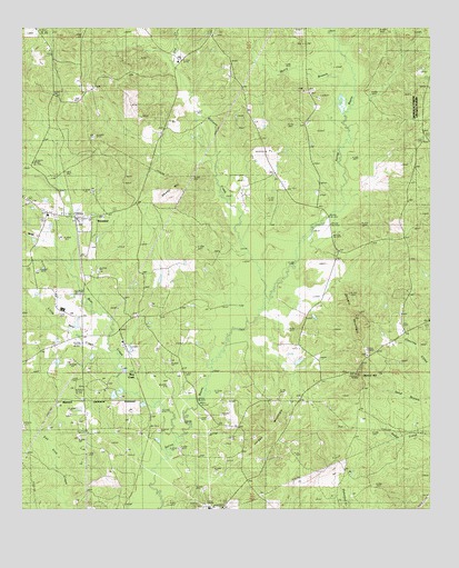
Bryceland, LA USGS Topographic Map
Click on map above to begin viewing in our Map Viewer.

This topographic map contains these locations and features:
Feature Name Type Latitude Longitude GNIS ID View Map
Bear CreekPopulated PlaceN32.4096°W92.9652°553543View Map
Bear CreekStreamN32.4043°W92.9604°532831View Map
Bear Creek ChurchChurchN32.4254°W92.9654°532839View Map
Brice Plantation (historical)LocaleN32.4502°W92.9821°549066View Map
Brice StationLocaleN32.4499°W92.9838°533387View Map
BrycelandPopulated PlaceN32.4510°W92.9793°553818View Map
Bryceland Post OfficePost OfficeN32.4499°W92.9832°1630961View Map
Driscoll (historical)Populated PlaceN32.4146°W92.8949°549075View Map
Driskill ChurchChurchN32.4152°W92.8952°534586View Map
Driskill MountainSummitN32.4248°W92.8967°542199View Map
Dry CreekStreamN32.4910°W92.9546°534614View Map
Gentry HillSummitN32.4102°W92.8977°535201View Map
Gentry Hill Lookout TowerTowerN32.4099°W92.8971°549079View Map
Holder CemeteryCemeteryN32.4038°W92.9151°535711View Map
Jordan MountainSummitN32.3982°W92.9260°536119View Map
Little Bear CreekStreamN32.4115°W92.9715°536494View Map
Mossy HillSummitN32.4582°W92.9546°537265View Map
Mount Gillard CemeteryCemeteryN32.4888°W92.9668°537320View Map
Mount Kingdom ChurchChurchN32.4138°W92.9821°537330View Map
Mount Zion ChurchChurchN32.4840°W92.8768°537449View Map
Murry BranchStreamN32.4765°W92.9027°537500View Map
New Fellowship ChurchChurchN32.4846°W92.9788°537566View Map
North Bienville Fire Protection District Station 1BuildingN32.4503°W92.9832°2673091View Map
North Bienville Fire Protection District Station 2BuildingN32.4420°W92.9032°2673064View Map
Parish Governing Authority District 1CivilN32.4416°W92.8831°1929724View Map
Parish Governing Authority District 2CivilN32.4948°W92.9890°1929879View Map
PrattPopulated PlaceN32.4915°W92.9893°543601View Map
Pratt Hill ChurchChurchN32.4829°W92.9813°538392View Map
Saline Baptist ChurchChurchN32.4840°W92.9146°555958View Map
Village of BrycelandCivilN32.4485°W92.9924°2407424View Map
Ward OneCivilN32.4996°W92.9057°544929View Map
Williams CreekStreamN32.4296°W92.9252°540435View Map

Note: Coordinates in the location and feature list above are referenced to NAD83 datum.


Copyright (C) 2008-2024 Ryan Niemi / Sunset Dynamics ... All Rights Reserved