TopoQuest Logo
Do you find TopoQuest useful?
Help keep TopoQuest running and adding new maps/features by donating!
Bitcoin:  19c7KJd3qBynnjoSw5npx9KScwjBe4ifkT
Litecoin:  LXs6TkuXGGXo1vDsWCkWVdjQX94eUKd6ui
Home View Maps Find Maps Find Places Resources & Links


Frankstown, Pennsylvania Topographic Map

USGS Map Title: Frankstown, PA
USGS Map MRC: 40078D3
DRG (GeoTIFF) Download: o40078d3.tif


Neighboring USGS Topographic Map Quads:


  Altoona, PA  
40078E4
 

  Bellwood, PA  
40078E3
 

  Spruce Creek, PA  
40078E2
 

  Hollidaysburg, PA  
40078D4
 

  Frankstown, PA  
40078D3
 

  Williamsburg, PA  
40078D2
 

  Roaring Spring, PA  
40078C4
 

  Martinsburg, PA  
40078C3
 

  Entriken, PA  
40078C2


Map MRC Location:

N41°
W79°
N41°
W78°
H8 H7 H6 H5 H4 H3 H2 H1
G8 G7 G6 G5 G4 G3 G2 G1
F8 F7 F6 F5 F4 F3 F2 F1
E8 E7 E6 E5 E4 E3 E2 E1
D8 D7 D6 D5 D4 D3 D2 D1
C8 C7 C6 C5 C4 C3 C2 C1
B8 B7 B6 B5 B4 B3 B2 B1
A8 A7 A6 A5 A4 A3 A2 A1
N40°
W79°
N40°
W78°

Frankstown, PA USGS 1:24K Topographic Map Preview:
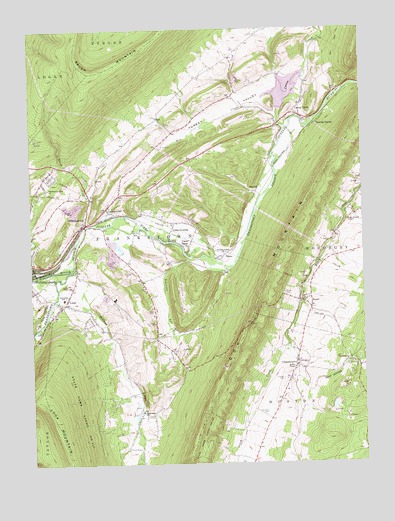
Frankstown, PA USGS Topographic Map
Click on map above to begin viewing in our Map Viewer.

This topographic map contains these locations and features:
Feature Name Type Latitude Longitude GNIS ID View Map
Barbara MinesMineN40.4056°W78.2706°1201285View Map
Beaverdam BranchStreamN40.4326°W78.3583°1169057View Map
Blair CountyCivilN40.4810°W78.3486°1213659View Map
Brush CreekStreamN40.4440°W78.3528°1170435View Map
Brush RunStreamN40.4295°W78.3725°1170458View Map
Canoe CreekPopulated PlaceN40.4784°W78.2714°1171166View Map
Canoe CreekStreamN40.4737°W78.2761°1171167View Map
Canoe Creek DamDamN40.4772°W78.2807°1194845View Map
Canoe Creek LakeReservoirN40.4826°W78.2780°1194846View Map
Canoe Creek Post Office (historical)Post OfficeN40.4762°W78.2714°1214490View Map
Canoe Creek State ParkParkN40.4867°W78.2697°1196521View Map
Clapper CemeteryCemeteryN40.3992°W78.2806°1171893View Map
ClappertownPopulated PlaceN40.4031°W78.2753°1171894View Map
Claycomb Burial SiteCemeteryN40.4727°W78.2843°2776333View Map
Eight Square ChapelChurchN40.4448°W78.2556°1174056View Map
Flowing SpringPopulated PlaceN40.4723°W78.2681°1174920View Map
FrankstownPopulated PlaceN40.4440°W78.3547°1213966View Map
Frankstown Elementary SchoolSchoolN40.4226°W78.3628°1207344View Map
Frankstown Park ChurchChurchN40.4545°W78.3681°1175182View Map
GeeseytownPopulated PlaceN40.4487°W78.3456°1175501View Map
Geeseytown CemeteryCemeteryN40.4472°W78.3483°2776348View Map
Geeseytown Community Fire Company Station 30BuildingN40.4503°W78.3451°2644896View Map
Goods - Wallstown CemeteryCemeteryN40.4756°W78.2703°2776349View Map
HorrellPopulated PlaceN40.4531°W78.2892°1177435View Map
Juniata Valley ChurchChurchN40.4354°W78.3017°1178201View Map
Linds CrossingPopulated PlaceN40.4420°W78.3217°1179415View Map
LoopPopulated PlaceN40.4220°W78.3617°1179940View Map
Loop MountainSummitN40.3873°W78.3670°1179941View Map
Markey - Shinnefelt Burial GroundCemeteryN40.4619°W78.3478°2776360View Map
Mines Methodist Church CemeteryCemeteryN40.4029°W78.2561°2776362View Map
Morrel ChapelChurchN40.4026°W78.2758°1181564View Map
New Canoe Creek CemeteryCemeteryN40.4733°W78.2831°2776366View Map
New CreekStreamN40.4756°W78.2811°1182304View Map
Old Canoe Creek CemeteryCemeteryN40.4766°W78.2867°2776368View Map
Oldtown RunStreamN40.4304°W78.3583°1182961View Map
OremineaPopulated PlaceN40.4048°W78.2553°1183041View Map
Pennsylvania Fish Commission SpringSpringN40.4198°W78.2714°1202475View Map
ReesePopulated PlaceN40.4345°W78.3022°1184841View Map
Rhodes CemeteryCemeteryN40.3897°W78.2867°2776372View Map
Robinson RunStreamN40.4309°W78.3000°1185231View Map
RoyerPopulated PlaceN40.4220°W78.2733°1185591View Map
Royer CemeteryCemeteryN40.4245°W78.2794°1185592View Map
Smith CemeteryCemeteryN40.3750°W78.2969°2776387View Map
The LoopValleyN40.4280°W78.3560°1202463View Map
Township of FrankstownCivilN40.4453°W78.3185°1215960View Map
Turkey ValleyValleyN40.4823°W78.2841°1189953View Map
Upper ReesePopulated PlaceN40.4390°W78.3197°1190251View Map
West Loop ChurchChurchN40.3904°W78.3336°1191065View Map
White BridgeBridgeN40.4462°W78.3389°1201286View Map
WHPA-FM (Hollidaysburg)TowerN40.4876°W78.3522°1200233View Map

Note: Coordinates in the location and feature list above are referenced to NAD83 datum.


Copyright (C) 2008-2024 Ryan Niemi / Sunset Dynamics ... All Rights Reserved