TopoQuest Logo
Do you find TopoQuest useful?
Help keep TopoQuest running and adding new maps/features by donating!
Bitcoin:  19c7KJd3qBynnjoSw5npx9KScwjBe4ifkT
Litecoin:  LXs6TkuXGGXo1vDsWCkWVdjQX94eUKd6ui
Home View Maps Find Maps Find Places Resources & Links


Ellery Center, New York Topographic Map

USGS Map Title: Ellery Center, NY
USGS Map MRC: 42079B3
DRG (GeoTIFF) Download: o42079b3.tif


Neighboring USGS Topographic Map Quads:


  Hartfield, NY  
42079C4
 

  Cassadaga, NY  
42079C3
 

  Hamlet, NY  
42079C2
 

  Chautauqua, NY  
42079B4
 

  Ellery Center, NY  
42079B3
 

  Gerry, NY  
42079B2
 

  Panama, NY  
42079A4
 

  Lakewood, NY  
42079A3
 

  Jamestown, NY  
42079A2


Map MRC Location:

N43°
W80°
N43°
W79°
H8 H7 H6 H5 H4 H3 H2 H1
G8 G7 G6 G5 G4 G3 G2 G1
F8 F7 F6 F5 F4 F3 F2 F1
E8 E7 E6 E5 E4 E3 E2 E1
D8 D7 D6 D5 D4 D3 D2 D1
C8 C7 C6 C5 C4 C3 C2 C1
B8 B7 B6 B5 B4 B3 B2 B1
A8 A7 A6 A5 A4 A3 A2 A1
N42°
W80°
N42°
W79°

Ellery Center, NY USGS 1:24K Topographic Map Preview:
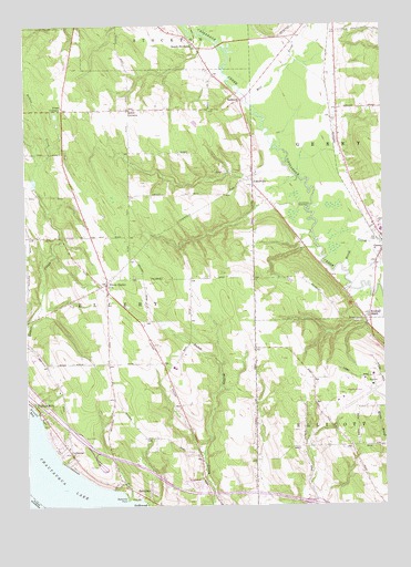
Ellery Center, NY USGS Topographic Map
Click on map above to begin viewing in our Map Viewer.

This topographic map contains these locations and features:
Feature Name Type Latitude Longitude GNIS ID View Map
Arnold BayBayN42.1484°W79.3742°942576View Map
BelleviewPopulated PlaceN42.1292°W79.3387°943610View Map
Belleview PointCapeN42.1273°W79.3398°943611View Map
Bergquist Adult HomeBuildingN42.1963°W79.2506°2614595View Map
Chautauqua County LandfillLocaleN42.2022°W79.3192°2496000View Map
Chautauqua County/Jamestown AirportAirportN42.1527°W79.2647°975792View Map
ColburnsPopulated PlaceN42.1389°W79.3598°947019View Map
Ellery Baptist ChurchChurchN42.1818°W79.3468°2615871View Map
Ellery CenterPopulated PlaceN42.1828°W79.3470°949511View Map
Ellery Center Volunteer Fire DepartmentBuildingN42.1793°W79.3436°2700832View Map
Free Methodist Church of GerryChurchN42.1935°W79.2502°2616041View Map
Gerry CemeteryCemeteryN42.2005°W79.2542°2554256View Map
Hatch CreekStreamN42.1862°W79.2642°952359View Map
Jamestown SpeedwayLocaleN42.2028°W79.2806°974684View Map
Jones CornersLocaleN42.2281°W79.3617°954163View Map
Kimball StandPopulated PlaceN42.1748°W79.2550°954615View Map
Maple Grove Junior - Senior High SchoolSchoolN42.1609°W79.3227°2669061View Map
Mill CreekStreamN42.2292°W79.2956°957222View Map
New York State Police Troop A Zone 3 Ellery StationBuildingN42.1347°W79.3485°2780752View Map
Peterson FarmLocaleN42.1311°W79.2722°2516353View Map
Phillips MillsPopulated PlaceN42.1520°W79.3731°960305View Map
Red Bird CemeteryCemeteryN42.2325°W79.3005°2554269View Map
RedbirdPopulated PlaceN42.2303°W79.2992°972992View Map
Saint Timothy Lutheran ChurchChurchN42.1435°W79.3634°2617048View Map
South StocktonPopulated PlaceN42.2445°W79.3153°965878View Map
TowervillePopulated PlaceN42.2087°W79.2953°967697View Map
Town of ElleryCivilN42.1921°W79.3552°978932View Map
Wolcott DairyLocaleN42.2269°W79.3258°2704002View Map

Note: Coordinates in the location and feature list above are referenced to NAD83 datum.


Copyright (C) 2008-2024 Ryan Niemi / Sunset Dynamics ... All Rights Reserved