TopoQuest Logo
Do you find TopoQuest useful?
Help keep TopoQuest running and adding new maps/features by donating!
Bitcoin:  19c7KJd3qBynnjoSw5npx9KScwjBe4ifkT
Litecoin:  LXs6TkuXGGXo1vDsWCkWVdjQX94eUKd6ui
Home View Maps Find Maps Find Places Resources & Links


Hartfield, New York Topographic Map

USGS Map Title: Hartfield, NY
USGS Map MRC: 42079C4
DRG (GeoTIFF) Download: o42079c4.tif


Neighboring USGS Topographic Map Quads:


  Brocton, NY  
42079D4
 

  Dunkirk, NY  
42079D3
 

  Westfield, NY  
42079C5
 

  Hartfield, NY  
42079C4
 

  Cassadaga, NY  
42079C3
 

  Sherman, NY  
42079B5
 

  Chautauqua, NY  
42079B4
 

  Ellery Center, NY  
42079B3


Map MRC Location:

N43°
W80°
N43°
W79°
H8 H7 H6 H5 H4 H3 H2 H1
G8 G7 G6 G5 G4 G3 G2 G1
F8 F7 F6 F5 F4 F3 F2 F1
E8 E7 E6 E5 E4 E3 E2 E1
D8 D7 D6 D5 D4 D3 D2 D1
C8 C7 C6 C5 C4 C3 C2 C1
B8 B7 B6 B5 B4 B3 B2 B1
A8 A7 A6 A5 A4 A3 A2 A1
N42°
W80°
N42°
W79°

Hartfield, NY USGS 1:24K Topographic Map Preview:
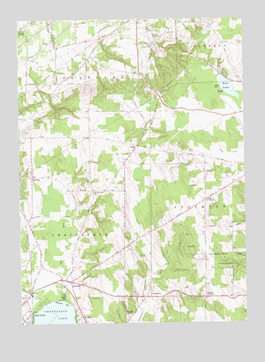
Hartfield, NY USGS Topographic Map
Click on map above to begin viewing in our Map Viewer.

This topographic map contains these locations and features:
Feature Name Type Latitude Longitude GNIS ID View Map
Bear LakeLakeN42.3464°W79.3832°943277View Map
Big InletStreamN42.2598°W79.4767°943908View Map
Black CreekStreamN42.2623°W79.4920°944105View Map
Brocton ReservoirReservoirN42.3681°W79.4259°944809View Map
Burdick Road Amish SchoolSchoolN42.2931°W79.4628°2668987View Map
Burr ReservoirReservoirN42.3638°W79.4246°945280View Map
Chautauqua CountyCivilN42.3029°W79.4058°974105View Map
Chautauqua Lake AirparkAirportN42.2844°W79.4445°978139View Map
Christian Missionary Alliance ChurchChurchN42.2537°W79.4384°2615738View Map
Coes CornersLocaleN42.3006°W79.3973°946995View Map
Dart AirportAirportN42.2698°W79.4808°978140View Map
DeanPopulated PlaceN42.3231°W79.4345°972369View Map
Denton CornersLocaleN42.2609°W79.3975°948327View Map
Elm Flats ChurchChurchN42.3098°W79.4928°949543View Map
Evergreen CemeteryCemeteryN42.3643°W79.4820°949750View Map
Gravel PointCapeN42.3453°W79.3867°951585View Map
HartfieldPopulated PlaceN42.2673°W79.4723°952304View Map
Hartfield BayBayN42.2584°W79.4759°952305View Map
Howard Hill ChurchChurchN42.3042°W79.4589°953308View Map
Kelley CemeteryCemeteryN42.3506°W79.3787°954452View Map
Little InletStreamN42.2576°W79.4878°955563View Map
Pleasant View SchoolSchoolN42.2942°W79.4621°2669082View Map
PleasantvillePopulated PlaceN42.2609°W79.4284°972959View Map
Pleasantville CemeteryCemeteryN42.2605°W79.4211°2554261View Map
Saint Mark Lutheran ChurchChurchN42.2503°W79.4969°2437634View Map
Skinners SwitchLocaleN42.3709°W79.4989°965362View Map
State Reforestation AreaForestN42.2762°W79.3875°966279View Map
Town of PortlandCivilN42.3666°W79.4670°979388View Map
Triangle CampLocaleN42.2537°W79.4384°967800View Map
WCQA-FM (Fredonia)TowerN42.3673°W79.3864°977725View Map
WooglinPopulated PlaceN42.2526°W79.4653°971736View Map

Note: Coordinates in the location and feature list above are referenced to NAD83 datum.


Copyright (C) 2008-2024 Ryan Niemi / Sunset Dynamics ... All Rights Reserved