TopoQuest Logo
Do you find TopoQuest useful?
Help keep TopoQuest running and adding new maps/features by donating!
Bitcoin:  19c7KJd3qBynnjoSw5npx9KScwjBe4ifkT
Litecoin:  LXs6TkuXGGXo1vDsWCkWVdjQX94eUKd6ui
Home View Maps Find Maps Find Places Resources & Links


East Stoneham, Maine Topographic Map

USGS Map Title: East Stoneham, ME
USGS Map MRC: 44070C7
DRG (GeoTIFF) Download: o44070c7.tif


Neighboring USGS Topographic Map Quads:


  Gilead, ME  
44070D8
 

  Bethel, ME  
44070D7
 

  Bryant Pond, ME  
44070D6
 

  Speckled Mountain, ME  
44070C8
 

  East Stoneham, ME  
44070C7
 

  Greenwood, ME  
44070C6
 

  Center Lovell, ME  
44070B8
 

  North Waterford, ME  
44070B7
 

  Waterford Flat, ME  
44070B6


Map MRC Location:

N45°
W71°
N45°
W70°
H8 H7 H6 H5 H4 H3 H2 H1
G8 G7 G6 G5 G4 G3 G2 G1
F8 F7 F6 F5 F4 F3 F2 F1
E8 E7 E6 E5 E4 E3 E2 E1
D8 D7 D6 D5 D4 D3 D2 D1
C8 C7 C6 C5 C4 C3 C2 C1
B8 B7 B6 B5 B4 B3 B2 B1
A8 A7 A6 A5 A4 A3 A2 A1
N44°
W71°
N44°
W70°

East Stoneham, ME USGS 1:24K Topographic Map Preview:
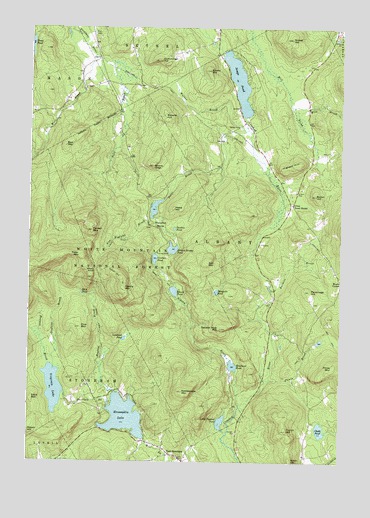
East Stoneham, ME USGS Topographic Map
Click on map above to begin viewing in our Map Viewer.

This topographic map contains these locations and features:
Feature Name Type Latitude Longitude GNIS ID View Map
Albany BrookStreamN44.2667°W70.7898°580906View Map
Albany Brook TrailTrailN44.3031°W70.8215°580907View Map
Albany MountainSummitN44.3006°W70.8366°580908View Map
Albany Mountain TrailTrailN44.3034°W70.8378°580909View Map
Albany NotchGapN44.3048°W70.8478°580910View Map
Albany Notch TrailTrailN44.3087°W70.8462°580911View Map
Albany TownshipCivilN44.3153°W70.7828°1987268View Map
Bacon HillSummitN44.3269°W70.7601°580920View Map
Bad MountainSummitN44.3409°W70.8606°580921View Map
Barkers BrookStreamN44.2995°W70.7773°580924View Map
Bartlett BrookStreamN44.2667°W70.8423°561661View Map
Bell MountainSummitN44.3070°W70.8034°580931View Map
Bennett School (historical)SchoolN44.3301°W70.8320°1907923View Map
Broken Bridge PondLakeN44.3113°W70.8172°580954View Map
Browns HillSummitN44.3504°W70.8209°580955View Map
Browns LedgeCliffN44.3348°W70.8253°580956View Map
Cecil MountainSummitN44.2678°W70.8731°580974View Map
Chalk PondLakeN44.2594°W70.7573°580976View Map
Congregational ChurchChurchN44.2517°W70.8134°1907972View Map
Crocker PondLakeN44.3084°W70.8242°580995View Map
Crocker Pond CampgroundLocaleN44.3103°W70.8234°581280View Map
Cummings HillSummitN44.3657°W70.8239°580997View Map
East Branch Pleasant RiverStreamN44.3651°W70.8415°581006View Map
East StonehamPopulated PlaceN44.2503°W70.8126°581009View Map
Emery HillSummitN44.3628°W70.8031°581015View Map
Farwell MountainSummitN44.3165°W70.8497°581022View Map
Flat CemeteryCemeteryN44.3731°W70.8492°581025View Map
Flat School (historical)SchoolN44.3728°W70.8495°1908017View Map
Flints BrookStreamN44.2737°W70.7795°581027View Map
Flints MountainSummitN44.2776°W70.7523°566314View Map
French HillSummitN44.2592°W70.7709°581033View Map
Goodwin BrookStreamN44.2767°W70.8642°581039View Map
Grover HillSummitN44.3720°W70.7706°581044View Map
Hannah BrookStreamN44.2776°W70.8662°581046View Map
Hunts Corner CemeteryCemeteryN44.2959°W70.7607°2736366View Map
Ingham HillSummitN44.3351°W70.7698°581066View Map
Keewaydin LakeReservoirN44.2629°W70.8359°581073View Map
Keewaydin Lake DamDamN44.2565°W70.8281°1773643View Map
Kneeland PondLakeN44.2777°W70.7926°581085View Map
Little Papoose PondLakeN44.2615°W70.7972°581097View Map
Lombard PondLakeN44.2853°W70.8363°581102View Map
Mason School (historical)SchoolN44.3509°W70.8620°1908077View Map
Meadow BrookStreamN44.2701°W70.8398°581119View Map
Mosquito PondLakeN44.2990°W70.7994°581136View Map
New England BrookStreamN44.3203°W70.8248°581142View Map
Number Eight PondSwampN44.2983°W70.8538°581144View Map
Parsonage HillSummitN44.2994°W70.7621°581156View Map
Patte BrookStreamN44.3453°W70.7884°581157View Map
Patte Brook DamDamN44.3256°W70.8208°1774061View Map
Patte Brook Waterfowl Impoundment ReservoirReservoirN44.3230°W70.8245°1774062View Map
Patte HillSummitN44.3228°W70.8170°581158View Map
Peter MountainSummitN44.3087°W70.8534°581168View Map
Pine MountainSummitN44.2885°W70.8542°581176View Map
Rattlesnake MountainSummitN44.2703°W70.8129°581188View Map
Round PondLakeN44.2991°W70.8164°581196View Map
Sawin HillSummitN44.2503°W70.7692°580936View Map
Songo CemeteryCemeteryN44.3463°W70.7905°581210View Map
Songo PondLakeN44.3595°W70.7913°581211View Map
Square Dock MountainSummitN44.2884°W70.7977°581218View Map
Stoneham Rescue Service Emergency Medical ResponseBuildingN44.2518°W70.8178°2666816View Map
Stoneham Volunteer Fire DepartmentBuildingN44.2516°W70.8191°2552995View Map
Sunken PondLakeN44.3171°W70.8164°581234View Map
Town HouseLocaleN44.3242°W70.7692°581243View Map
Trout PondLakeN44.3699°W70.8743°581245View Map
Unorganized Territory of South OxfordCivilN44.3213°W70.8538°582736View Map
Virginia LakeReservoirN44.2712°W70.8645°581252View Map
Virginia Lake DamDamN44.2691°W70.8600°1773645View Map
Walker BrookStreamN44.3448°W70.7853°581253View Map
Waterfowl MarshSwampN44.3181°W70.8212°581255View Map
West Branch Pleasant RiverStreamN44.3665°W70.8487°581259View Map
Wild BrookStreamN44.3523°W70.7698°581271View Map

Note: Coordinates in the location and feature list above are referenced to NAD83 datum.


Copyright (C) 2008-2024 Ryan Niemi / Sunset Dynamics ... All Rights Reserved