TopoQuest Logo
Do you find TopoQuest useful?
Help keep TopoQuest running and adding new maps/features by donating!
Bitcoin:  19c7KJd3qBynnjoSw5npx9KScwjBe4ifkT
Litecoin:  LXs6TkuXGGXo1vDsWCkWVdjQX94eUKd6ui
Home View Maps Find Maps Find Places Resources & Links


Speckled Mountain, Maine Topographic Map

USGS Map Title: Speckled Mountain, ME
USGS Map MRC: 44070C8
DRG (GeoTIFF) Download: o44070c8.tif


Neighboring USGS Topographic Map Quads:


  Shelburne, NH  
44071D1
 

  Gilead, ME  
44070D8
 

  Bethel, ME  
44070D7
 

  Wild River, NH  
44071C1
 

  Speckled Mountain, ME  
44070C8
 

  East Stoneham, ME  
44070C7
 

  Chatham, NH  
44071B1
 

  Center Lovell, ME  
44070B8
 

  North Waterford, ME  
44070B7


Map MRC Location:

N45°
W71°
N45°
W70°
H8 H7 H6 H5 H4 H3 H2 H1
G8 G7 G6 G5 G4 G3 G2 G1
F8 F7 F6 F5 F4 F3 F2 F1
E8 E7 E6 E5 E4 E3 E2 E1
D8 D7 D6 D5 D4 D3 D2 D1
C8 C7 C6 C5 C4 C3 C2 C1
B8 B7 B6 B5 B4 B3 B2 B1
A8 A7 A6 A5 A4 A3 A2 A1
N44°
W71°
N44°
W70°

Speckled Mountain, ME USGS 1:24K Topographic Map Preview:
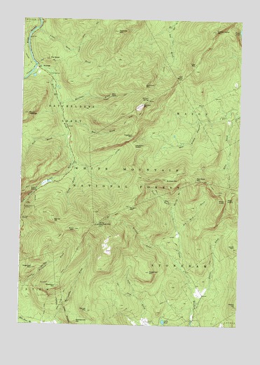
Speckled Mountain, ME USGS Topographic Map
Click on map above to begin viewing in our Map Viewer.

This topographic map contains these locations and features:
Feature Name Type Latitude Longitude GNIS ID View Map
Ames MountainSummitN44.2892°W70.9684°580915View Map
Batchelders Grant TownshipCivilN44.3262°W70.9864°1987271View Map
Beaver BrookStreamN44.2595°W70.8976°580929View Map
Bickford Brook TrailTrailN44.2815°W70.9829°580935View Map
Blueberry MountainSummitN44.2659°W70.9787°580943View Map
Blueberry Ridge TrailTrailN44.2731°W70.9728°580944View Map
Bull BrookStreamN44.3273°W70.9740°580960View Map
Butters MountainSummitN44.3100°W70.9167°580962View Map
Caribou MountainSummitN44.3403°W70.9304°580966View Map
Caribou SpringSpringN44.3423°W70.9270°580967View Map
Caribou TrailTrailN44.3515°W70.9209°580968View Map
Caribou-Speckled Mountain WildernessReserveN44.3085°W70.9439°1907960View Map
Cold Brook TrailTrailN44.2623°W70.9340°580988View Map
Cold River OverlookLocaleN44.2931°W70.9992°580990View Map
Durgin MountainSummitN44.2984°W70.9375°581004View Map
Evans BrookStreamN44.3567°W70.9917°581016View Map
Evans NotchGapN44.3053°W70.9898°581018View Map
Evans Notch OverlookLocaleN44.2978°W70.9973°581019View Map
Gammon MountainSummitN44.3484°W70.9292°581037View Map
Great Brook TrailTrailN44.3020°W70.9181°581042View Map
HastingsPopulated PlaceN44.3548°W70.9901°581050View Map
Hastings CampgroundLocaleN44.3523°W70.9840°581284View Map
Hastings TrailTrailN44.3620°W70.9990°581052View Map
Haystack MountainSummitN44.3275°W70.9363°581055View Map
Haystack NotchGapN44.3234°W70.9348°581056View Map
Haystack Notch TrailTrailN44.3262°W70.9320°581057View Map
Hut Road CemeteryCemeteryN44.2663°W70.8983°2736367View Map
Isaiah MountainSummitN44.2817°W70.8756°581067View Map
Kees FallsFallsN44.3434°W70.9481°581072View Map
Little Lary BrookStreamN44.3709°W70.9912°581096View Map
Little PondLakeN44.2516°W70.9169°581098View Map
Mason HillSummitN44.2581°W70.8754°581115View Map
Mason TownshipCivilN44.3461°W70.8849°1987277View Map
Miles BrookStreamN44.3353°W70.8770°581126View Map
Miles KnobSummitN44.3015°W70.8828°581127View Map
Miles NotchGapN44.3017°W70.8812°581128View Map
Miles Notch TrailTrailN44.2931°W70.8848°581129View Map
Morrison BrookStreamN44.3440°W70.9804°581134View Map
Mount HastingsSummitN44.3364°W70.9962°581053View Map
Mud BrookStreamN44.3309°W70.9737°581138View Map
Mud Brook TrailTrailN44.3315°W70.9420°581139View Map
Palmer MountainSummitN44.2558°W70.9605°581154View Map
Peabody MountainSummitN44.3703°W70.9455°581164View Map
Pickett Henry MountainSummitN44.3706°W70.8894°581170View Map
Rattlesnake MountainSummitN44.2516°W70.9673°581187View Map
Red Rock BrookStreamN44.2876°W70.9081°581189View Map
Red Rock MountainSummitN44.3095°W70.8983°581190View Map
Red Rock TrailTrailN44.3098°W70.9273°581191View Map
Roost TrailTrailN44.3565°W70.9809°581195View Map
Shirley BrookStreamN44.2940°W70.9112°581204View Map
Speckled MountainSummitN44.2911°W70.9550°581215View Map
Spruce HillSummitN44.2927°W70.9809°581216View Map
Spruce Hill TrailTrailN44.2959°W70.9892°581217View Map
Stone House TrailTrailN44.2609°W70.9748°581224View Map
Stony BrookStreamN44.3156°W70.9695°576393View Map
Sugarloaf MountainSummitN44.2718°W70.9255°581230View Map
Sugarloaf MountainSummitN44.2731°W70.9926°581231View Map
The RoostSummitN44.3586°W70.9846°581241View Map
Town of StonehamCivilN44.2643°W70.8882°582750View Map
Tyler MountainSummitN44.3573°W70.9008°581250View Map
Tyler NotchGapN44.3517°W70.9076°577520View Map
Wheeler Brook TrailTrailN44.3717°W70.9598°581263View Map
White Cairn TrailTrailN44.2587°W70.9840°581265View Map
White Mountain National Forest Caribou ShelterLocaleN44.3417°W70.9273°581285View Map
Willard BrookStreamN44.2767°W70.9106°581275View Map

Note: Coordinates in the location and feature list above are referenced to NAD83 datum.


Copyright (C) 2008-2024 Ryan Niemi / Sunset Dynamics ... All Rights Reserved