TopoQuest Logo
Do you find TopoQuest useful?
Help keep TopoQuest running and adding new maps/features by donating!
Bitcoin:  19c7KJd3qBynnjoSw5npx9KScwjBe4ifkT
Litecoin:  LXs6TkuXGGXo1vDsWCkWVdjQX94eUKd6ui
Home View Maps Find Maps Find Places Resources & Links


Coon Creek, Nevada Topographic Map

USGS Map Title: Coon Creek, NV
USGS Map MRC: 41115G5
DRG (GeoTIFF) Download: o41115g5.tif


Neighboring USGS Topographic Map Quads:


  Big Table, ID  
41115H6
 

  Bearpaw Mountain, NV  
41115H5
 

  Jarbidge North, NV  
41115H4
 

  Tennessee Mountain, NV  
41115G6
 

  Coon Creek, NV  
41115G5
 

  Jarbidge South, NV  
41115G4
 

  Cornwall Mountain, NV  
41115F6
 

  Annie Creek, NV  
41115F5
 

  Marys River Basin NW, NV  
41115F4


Map MRC Location:

N42°
W116°
N42°
W115°
H8 H7 H6 H5 H4 H3 H2 H1
G8 G7 G6 G5 G4 G3 G2 G1
F8 F7 F6 F5 F4 F3 F2 F1
E8 E7 E6 E5 E4 E3 E2 E1
D8 D7 D6 D5 D4 D3 D2 D1
C8 C7 C6 C5 C4 C3 C2 C1
B8 B7 B6 B5 B4 B3 B2 B1
A8 A7 A6 A5 A4 A3 A2 A1
N41°
W116°
N41°
W115°

Coon Creek, NV USGS 1:24K Topographic Map Preview:
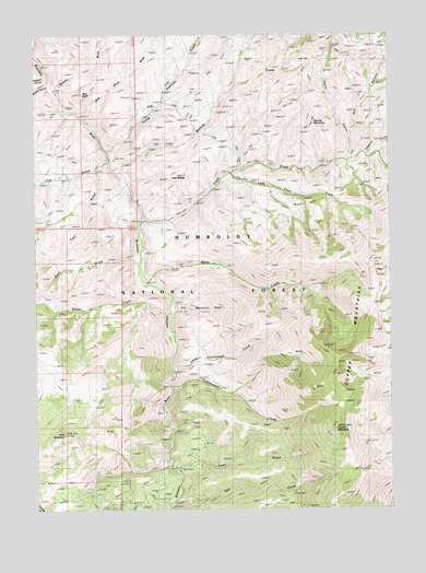
Coon Creek, NV USGS Topographic Map
Click on map above to begin viewing in our Map Viewer.

This topographic map contains these locations and features:
Feature Name Type Latitude Longitude GNIS ID View Map
Badger CreekStreamN41.8002°W115.5795°858782View Map
Bruneau School (historical)SchoolN41.8071°W115.5809°859038View Map
Bruno City (historical)Populated PlaceN41.7702°W115.5676°858379View Map
Coon CreekStreamN41.8255°W115.5890°859323View Map
Copper MountainSummitN41.7707°W115.5209°859335View Map
Copper MountainsRangeN41.7913°W115.5084°859337View Map
Cottonwood CreekStreamN41.7819°W115.5776°859373View Map
Culver RanchLocaleN41.7894°W115.5665°859433View Map
Deer CreekStreamN41.7521°W115.5767°859491View Map
Fawn GulchValleyN41.7596°W115.5754°859701View Map
Granite MountainSummitN41.8513°W115.5276°859871View Map
Hoy CanyonValleyN41.8468°W115.5154°860061View Map
Humphries CabinLocaleN41.7516°W115.5962°860072View Map
Johns CreekStreamN41.8416°W115.5167°857154View Map
Johns GulchValleyN41.8471°W115.5154°860217View Map
Little Coon CreekStreamN41.8385°W115.5565°862347View Map
Little Cottonwood CreekStreamN41.7863°W115.5776°860357View Map
Lost GulchValleyN41.8416°W115.5998°860420View Map
Marcellini DrawValleyN41.8030°W115.5762°862346View Map
McKnight CabinLocaleN41.8663°W115.5723°860530View Map
Miller CreekStreamN41.8085°W115.5876°860592View Map
Murphy WashStreamN41.8593°W115.6184°860696View Map
Palacio CabinsLocaleN41.8355°W115.5476°860869View Map
Palacio RanchLocaleN41.8043°W115.5790°860870View Map
Pine MountainSummitN41.7696°W115.6159°860962View Map
Red BluffCliffN41.8585°W115.6087°861079View Map
Red Bluff WashStreamN41.8535°W115.6092°861080View Map
Road GulchValleyN41.8160°W115.5901°861133View Map
Rocky GulchValleyN41.8613°W115.6209°861162View Map
Rowher GulchValleyN41.8641°W115.6209°862353View Map
Silver MountainSummitN41.7538°W115.5170°847701View Map
Telephone CanyonValleyN41.8432°W115.5101°861686View Map
Trail GulchValleyN41.8391°W115.6045°861769View Map
Tucker RanchLocaleN41.8096°W115.5856°861794View Map
Twin ButtesSummitN41.8377°W115.5754°861807View Map
Wickiup CreekStreamN41.8393°W115.5981°861993View Map
Young American CreekStreamN41.8443°W115.6001°862120View Map

Note: Coordinates in the location and feature list above are referenced to NAD83 datum.


Copyright (C) 2008-2024 Ryan Niemi / Sunset Dynamics ... All Rights Reserved