TopoQuest Logo
Do you find TopoQuest useful?
Help keep TopoQuest running and adding new maps/features by donating!
Bitcoin:  19c7KJd3qBynnjoSw5npx9KScwjBe4ifkT
Litecoin:  LXs6TkuXGGXo1vDsWCkWVdjQX94eUKd6ui
Home View Maps Find Maps Find Places Resources & Links


Coleman, Wisconsin Topographic Map

USGS Map Title: Coleman, WI
USGS Map MRC: 45088A1
DRG (GeoTIFF) Download: o45088a1.tif


Neighboring USGS Topographic Map Quads:


  White Potato Lake, WI  
45088B2
 

  Crivitz, WI  
45088B1
 

  Loomis, WI  
45087B8
 

  Kelly Lake, WI  
45088A2
 

  Coleman, WI  
45088A1
 

  Porterfield SW, WI  
45087A8
 

  Oconto Falls North, WI  
44088H2
 

  Lena, WI  
44088H1
 

  Oconto West, WI  
44087H8


Map MRC Location:

N46°
W89°
N46°
W88°
H8 H7 H6 H5 H4 H3 H2 H1
G8 G7 G6 G5 G4 G3 G2 G1
F8 F7 F6 F5 F4 F3 F2 F1
E8 E7 E6 E5 E4 E3 E2 E1
D8 D7 D6 D5 D4 D3 D2 D1
C8 C7 C6 C5 C4 C3 C2 C1
B8 B7 B6 B5 B4 B3 B2 B1
A8 A7 A6 A5 A4 A3 A2 A1
N45°
W89°
N45°
W88°

Coleman, WI USGS 1:24K Topographic Map Preview:
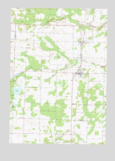
Coleman, WI USGS Topographic Map
Click on map above to begin viewing in our Map Viewer.

This topographic map contains these locations and features:
Feature Name Type Latitude Longitude GNIS ID View Map
1.99 ReservoirReservoirN45.1217°W88.0976°1792578View Map
Beaver CemeteryCemeteryN45.1247°W88.0287°1561426View Map
Brult School (historical)SchoolN45.0589°W88.0857°1845547View Map
ColemanPopulated PlaceN45.0650°W88.0343°1563252View Map
Coleman High SchoolSchoolN45.0705°W88.0358°1845551View Map
Coleman Middle SchoolSchoolN45.0716°W88.0366°2713440View Map
Coleman Police DepartmentBuildingN45.0654°W88.0317°2759419View Map
Coleman Post OfficePost OfficeN45.0651°W88.0369°2768311View Map
Coleman Rescue SquadBuildingN45.0800°W88.0329°2696829View Map
Coleman Volunteer Fire DepartmentBuildingN45.0649°W88.0350°2696905View Map
Ermis-Ridgeview AirportAirportN45.0761°W88.0043°1581019View Map
Faith Christian SchoolSchoolN45.0647°W88.0387°2713394View Map
Jones CreekStreamN45.0572°W88.0837°1567263View Map
Jones LakeLakeN45.0625°W88.1168°1567268View Map
Lena Road School (historical)SchoolN45.0386°W88.0451°1845579View Map
Lincoln School (historical)SchoolN45.0653°W88.0545°1845580View Map
Low Valley School (historical)SchoolN45.0089°W88.1068°1843983View Map
McDonald CreekStreamN45.0447°W88.1193°1569202View Map
Messenger CreekStreamN45.0444°W88.1159°1569377View Map
Montana LakeLakeN45.0484°W88.1159°1569668View Map
Murphy CreekStreamN45.1189°W88.0770°1570039View Map
Murphy Creek 3WR223 DamDamN45.1216°W88.0951°1792577View Map
PoundPopulated PlaceN45.0941°W88.0340°1571850View Map
Pound PitMineN45.1069°W88.0147°2711443View Map
Pound Volunteer Fire DepartmentBuildingN45.0940°W88.0344°2696863View Map
Saint Johns CemeteryCemeteryN45.0647°W88.0309°1573068View Map
Saint Leos CemeteryCemeteryN45.0930°W88.0295°1573217View Map
School CreekStreamN45.0583°W88.0865°1573799View Map
Section Eight ChurchChurchN45.0886°W88.1045°1573886View Map
Section Eight School (historical)SchoolN45.0919°W88.0957°1845641View Map
Sunny Brook School (historical)SchoolN45.0008°W88.0251°1844023View Map
Trinity CemeteryCemeteryN45.0655°W88.0129°1575618View Map
Victory School (historical)SchoolN45.0586°W88.0040°1845651View Map
Village of ColemanCivilN45.0695°W88.0348°1583000View Map
Village of PoundCivilN45.0957°W88.0335°1583966View Map
Weber School (historical)SchoolN45.0378°W88.0893°1845655View Map
Whisky CreekStreamN45.1178°W88.0776°1576614View Map
Wilson School (historical)SchoolN45.1016°W88.0445°1845658View Map

Note: Coordinates in the location and feature list above are referenced to NAD83 datum.


Copyright (C) 2008-2024 Ryan Niemi / Sunset Dynamics ... All Rights Reserved