TopoQuest Logo
Do you find TopoQuest useful?
Help keep TopoQuest running and adding new maps/features by donating!
Bitcoin:  19c7KJd3qBynnjoSw5npx9KScwjBe4ifkT
Litecoin:  LXs6TkuXGGXo1vDsWCkWVdjQX94eUKd6ui
Home View Maps Find Maps Find Places Resources & Links


Anadarko East, Oklahoma Topographic Map

USGS Map Title: Anadarko East, OK
USGS Map MRC: 35098A2
DRG (GeoTIFF) Download: o35098a2.tif


Neighboring USGS Topographic Map Quads:


  Gracemont, OK  
35098B3
 

  Anadarko NW, OK  
35098B2
 

  Anadarko NE, OK  
35098B1
 

  Anadarko West, OK  
35098A3
 

  Anadarko East, OK  
35098A2
 

  Verden, OK  
35098A1
 

  Apache, OK  
34098H3
 

  Cyril, OK  
34098H2
 

  Laverty, OK  
34098H1


Map MRC Location:

N36°
W99°
N36°
W98°
H8 H7 H6 H5 H4 H3 H2 H1
G8 G7 G6 G5 G4 G3 G2 G1
F8 F7 F6 F5 F4 F3 F2 F1
E8 E7 E6 E5 E4 E3 E2 E1
D8 D7 D6 D5 D4 D3 D2 D1
C8 C7 C6 C5 C4 C3 C2 C1
B8 B7 B6 B5 B4 B3 B2 B1
A8 A7 A6 A5 A4 A3 A2 A1
N35°
W99°
N35°
W98°

Anadarko East, OK USGS 1:24K Topographic Map Preview:
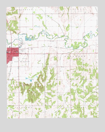
Anadarko East, OK USGS Topographic Map
Click on map above to begin viewing in our Map Viewer.

This topographic map contains these locations and features:
Feature Name Type Latitude Longitude GNIS ID View Map
AnadarkoPopulated PlaceN35.0726°W98.2437°1089618View Map
Anadarko Fire DepartmentBuildingN35.0717°W98.2450°2658256View Map
Anadarko Police DepartmentBuildingN35.0765°W98.2434°2757675View Map
Anadarko Post OfficePost OfficeN35.0740°W98.2440°1794388View Map
Caddo Country ClubLocaleN35.0670°W98.2217°1101993View Map
Caddo County JailBuildingN35.0741°W98.2459°2757812View Map
Caddo County Sheriff's OfficeBuildingN35.0743°W98.2459°2757784View Map
Church of the NazareneChurchN35.0703°W98.2498°1778606View Map
City of AnadarkoCivilN35.0652°W98.2441°2409703View Map
Delaware CreekStreamN35.0773°W98.1575°1092032View Map
Delaware Creek Site 8 DamDamN35.0317°W98.1537°1754935View Map
Delaware Creek Site 8 ReservoirReservoirN35.0317°W98.1537°1754936View Map
East Elementary SchoolSchoolN35.0743°W98.2365°1092437View Map
East Fork Delaware CreekStreamN35.0348°W98.1681°1092391View Map
First Christian ChurchChurchN35.0748°W98.2456°1778608View Map
Grace ChurchChurchN35.0728°W98.2417°1778610View Map
Greater First Baptist ChurchChurchN35.0787°W98.2362°1778611View Map
Indian Capital Baptist ChurchChurchN35.0795°W98.2409°1778612View Map
Indian CityPopulated PlaceN35.0373°W98.2259°1100523View Map
Kiowa CemeteryCemeteryN35.1003°W98.2434°1094400View Map
Lincoln SchoolSchoolN35.0781°W98.2401°1094668View Map
New Hope ChurchChurchN35.0003°W98.1812°1095812View Map
New Hope Volunteer Fire AssociationBuildingN35.0001°W98.1770°2658450View Map
Roach CemeteryCemeteryN35.0528°W98.1776°1097242View Map
Saint Pauls United Methodist ChurchChurchN35.0781°W98.2384°1778613View Map
Saint Thomas Lutheran ChurchChurchN35.0581°W98.2448°1778614View Map
South HillsRangeN35.0320°W98.2214°1098253View Map
Spring Creek Site 102 DamDamN35.1184°W98.1553°1754965View Map
Spring Creek Site 102 ReservoirReservoirN35.1196°W98.1562°1754966View Map
Spring Creek Site 2 DamDamN35.1151°W98.1653°1754963View Map
Spring Creek Site 2 ReservoirReservoirN35.1151°W98.1653°1754964View Map
Sugar CreekStreamN35.0917°W98.1695°1098599View Map
Tonkawa CreekStreamN35.0903°W98.1792°1098942View Map
Tonkawa Creek Site 1 DamDamN35.0084°W98.2453°1754624View Map
Tonkawa Creek Site 1 ReservoirReservoirN35.0101°W98.2473°1754625View Map
Tonkawa Creek Site 5 DamDamN35.0334°W98.2170°1754633View Map
Tonkawa Creek Site 5 ReservoirReservoirN35.0320°W98.2173°1754634View Map
Township of DelawareCivilN35.0695°W98.1587°1825306View Map
Township of East McKinleyCivilN35.0640°W98.2448°1825305View Map
Victory Assembly of GodChurchN35.0706°W98.2373°1778615View Map
Virginia Avenue Baptist ChurchChurchN35.0703°W98.2364°1778616View Map
West Fork Delaware CreekStreamN35.0267°W98.1709°1099553View Map
West SchoolSchoolN35.0745°W98.2492°1099605View Map

Note: Coordinates in the location and feature list above are referenced to NAD83 datum.


Copyright (C) 2008-2024 Ryan Niemi / Sunset Dynamics ... All Rights Reserved