TopoQuest Logo
Do you find TopoQuest useful?
Help keep TopoQuest running and adding new maps/features by donating!
Bitcoin:  19c7KJd3qBynnjoSw5npx9KScwjBe4ifkT
Litecoin:  LXs6TkuXGGXo1vDsWCkWVdjQX94eUKd6ui
Home View Maps Find Maps Find Places Resources & Links


Anaconda South, Montana Topographic Map

USGS Map Title: Anaconda South, MT
USGS Map MRC: 46112A8
DRG (GeoTIFF) Download: o46112a8.tif


Neighboring USGS Topographic Map Quads:


  West Valley, MT  
46113B1
 

  Anaconda North, MT  
46112B8
 

  Warm Springs, MT  
46112B7
 

  Mount Haggin, MT  
46113A1
 

  Anaconda South, MT  
46112A8
 

  Opportunity, MT  
46112A7
 

  Lincoln Gulch, MT  
45113H1
 

  Dickie Peak, MT  
45112H8
 

  Burnt Mountain, MT  
45112H7


Map MRC Location:

N47°
W113°
N47°
W112°
H8 H7 H6 H5 H4 H3 H2 H1
G8 G7 G6 G5 G4 G3 G2 G1
F8 F7 F6 F5 F4 F3 F2 F1
E8 E7 E6 E5 E4 E3 E2 E1
D8 D7 D6 D5 D4 D3 D2 D1
C8 C7 C6 C5 C4 C3 C2 C1
B8 B7 B6 B5 B4 B3 B2 B1
A8 A7 A6 A5 A4 A3 A2 A1
N46°
W113°
N46°
W112°

Anaconda South, MT USGS 1:24K Topographic Map Preview:
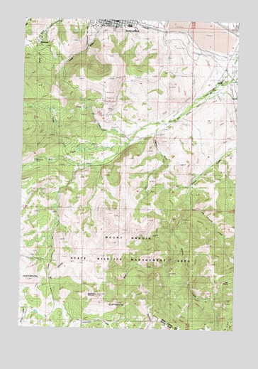
Anaconda South, MT USGS Topographic Map
Click on map above to begin viewing in our Map Viewer.

This topographic map contains these locations and features:
Feature Name Type Latitude Longitude GNIS ID View Map
04N10W17BB__01 WellWellN46.1046°W112.8787°814020View Map
04N10W18AC__01 WellWellN46.1010°W112.8892°814002View Map
04N10W18DB__01 WellWellN46.0974°W112.8892°813989View Map
04N11W08ADBB01 WellWellN46.1174°W112.9900°814063View Map
Alpha MineMineN46.0871°W112.9348°802835View Map
Anaconda - Deer Lodge County Police DepartmentBuildingN46.1229°W112.9541°1786427View Map
Anaconda SmelterLocaleN46.1141°W112.9139°799283View Map
Anaconda Smelter Stack State ParkParkN46.1110°W112.9134°1786423View Map
Brick Plant SpurLocaleN46.1221°W112.9281°1786421View Map
Cabbage GulchValleyN46.0783°W112.9237°780720View Map
Clear CreekStreamN46.0746°W112.9398°781353View Map
Deer Lodge County CourthouseBuildingN46.1230°W112.9553°1786428View Map
Deer SpringSpringN46.0185°W112.8788°782273View Map
East Anaconda (historical)LocaleN46.1221°W112.9273°1786420View Map
Elk CreekStreamN46.0383°W112.9120°783055View Map
First Christian ChurchChurchN46.1246°W112.9506°793774View Map
Ironton (historical)LocaleN46.1208°W112.9092°1786402View Map
KGLM-FM (Anaconda)TowerN46.1019°W112.9506°806641View Map
Long Canyon CreekStreamN46.0496°W112.9028°786517View Map
Long Canyon TrailTrailN46.0363°W112.8998°786518View Map
Lower Hill CemeteryCemeteryN46.1227°W112.9584°1786449View Map
Mill CreekPopulated PlaceN46.1005°W112.8842°1786392View Map
Mill Creek (historical)LocaleN46.1194°W112.8753°1786390View Map
Mill Creek School (historical)SchoolN46.1083°W112.8828°1786393View Map
Mine CreekPopulated PlaceN46.1052°W112.8837°790486View Map
Moonlight MineMineN46.0802°W112.9537°802858View Map
Mount Carmel CemeteryCemeteryN46.1244°W112.9620°1786447View Map
Mount Haggin State Wildlife Management AreaParkN46.0013°W112.9675°799372View Map
Pennsylvania MineMineN46.0888°W112.9506°802855View Map
Sheep GulchValleyN46.1227°W112.9550°790348View Map
Silver CreekStreamN46.0766°W112.9378°790509View Map
Smelter Tailings Ponds DamDamN46.1199°W112.8842°796537View Map
Smelters (historical)LocaleN46.1110°W112.9092°1786366View Map
Sugarloaf MountainSummitN46.0130°W112.9564°802207View Map
SunnysidePopulated PlaceN46.1155°W112.9937°802212View Map
SW SE Section 33 MineMineN46.0513°W112.9739°802857View Map
Upper Hill CemeteryCemeteryN46.1227°W112.9675°1786448View Map
West Fork Willow CreekStreamN46.0310°W112.9075°793100View Map

Note: Coordinates in the location and feature list above are referenced to NAD83 datum.


Copyright (C) 2008-2024 Ryan Niemi / Sunset Dynamics ... All Rights Reserved