TopoQuest Logo
Do you find TopoQuest useful?
Help keep TopoQuest running and adding new maps/features by donating!
Bitcoin:  19c7KJd3qBynnjoSw5npx9KScwjBe4ifkT
Litecoin:  LXs6TkuXGGXo1vDsWCkWVdjQX94eUKd6ui
Home View Maps Find Maps Find Places Resources & Links


Christine West, Texas Topographic Map

USGS Map Title: Christine West, TX
USGS Map MRC: 28098G5
DRG (GeoTIFF) Download: o28098g5.tif


Neighboring USGS Topographic Map Quads:


  Dobrowolski, TX  
28098H6
 

  Jourdanton, TX  
28098H5
 

  Pleasanton, TX  
28098H4
 

  Charlotte, TX  
28098G6
 

  Christine West, TX  
28098G5
 

  Christine East, TX  
28098G4
 

  San Miguel Ranch, TX  
28098F6
 

  Cross NE, TX  
28098F5
 

  Caballos Creek, TX  
28098F4


Map MRC Location:

N29°
W99°
N29°
W98°
H8 H7 H6 H5 H4 H3 H2 H1
G8 G7 G6 G5 G4 G3 G2 G1
F8 F7 F6 F5 F4 F3 F2 F1
E8 E7 E6 E5 E4 E3 E2 E1
D8 D7 D6 D5 D4 D3 D2 D1
C8 C7 C6 C5 C4 C3 C2 C1
B8 B7 B6 B5 B4 B3 B2 B1
A8 A7 A6 A5 A4 A3 A2 A1
N28°
W99°
N28°
W98°

Christine West, TX USGS 1:24K Topographic Map Preview:
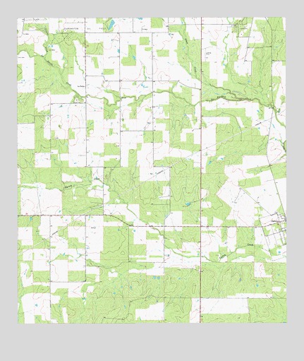
Christine West, TX USGS Topographic Map
Click on map above to begin viewing in our Map Viewer.

This topographic map contains these locations and features:
Feature Name Type Latitude Longitude GNIS ID View Map
Christine Post OfficePost OfficeN28.7902°W98.5071°2731447View Map
Goose CreekStreamN28.8416°W98.5197°1358177View Map
Jourdanton DivisionCivilN28.7965°W98.5113°1938872View Map
Jourdanton Oil FieldOilfieldN28.8711°W98.6086°1360437View Map
La ParitaPopulated PlaceN28.8472°W98.5934°1380045View Map
Pan American Branch LibraryBuildingN28.8189°W98.5214°2014845View Map
Schorsch DamDamN28.8736°W98.5803°1860492View Map
Schorsch LakeReservoirN28.8732°W98.5809°1860493View Map
Stancel CreekStreamN28.8591°W98.6125°1369094View Map

Note: Coordinates in the location and feature list above are referenced to NAD83 datum.


Copyright (C) 2008-2024 Ryan Niemi / Sunset Dynamics ... All Rights Reserved