TopoQuest Logo
Do you find TopoQuest useful?
Help keep TopoQuest running and adding new maps/features by donating!
Bitcoin:  19c7KJd3qBynnjoSw5npx9KScwjBe4ifkT
Litecoin:  LXs6TkuXGGXo1vDsWCkWVdjQX94eUKd6ui
Home View Maps Find Maps Find Places Resources & Links


Chokio, Minnesota Topographic Map

USGS Map Title: Chokio, MN
USGS Map MRC: 45096E2
DRG (GeoTIFF) Download: o45096e2.tif


Neighboring USGS Topographic Map Quads:


  Graceville NE, MN  
45096F3
 

  Chokio NW, MN  
45096F2
 

  Donnelly, MN  
45096F1
 

  Johnson, MN  
45096E3
 

  Chokio, MN  
45096E2
 

  Alberta, MN  
45096E1
 

  Dismal Swamp, MN  
45096D3
 

  Artichoke Lake NW, MN  
45096D2
 

  Dry Wood Lake, MN  
45096D1


Map MRC Location:

N46°
W97°
N46°
W96°
H8 H7 H6 H5 H4 H3 H2 H1
G8 G7 G6 G5 G4 G3 G2 G1
F8 F7 F6 F5 F4 F3 F2 F1
E8 E7 E6 E5 E4 E3 E2 E1
D8 D7 D6 D5 D4 D3 D2 D1
C8 C7 C6 C5 C4 C3 C2 C1
B8 B7 B6 B5 B4 B3 B2 B1
A8 A7 A6 A5 A4 A3 A2 A1
N45°
W97°
N45°
W96°

Chokio, MN USGS 1:24K Topographic Map Preview:
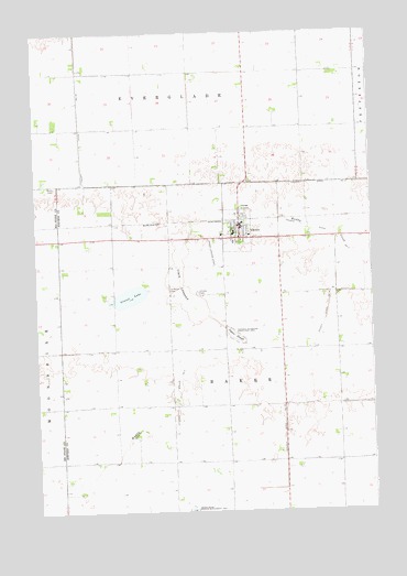
Chokio, MN USGS Topographic Map
Click on map above to begin viewing in our Map Viewer.

This topographic map contains these locations and features:
Feature Name Type Latitude Longitude GNIS ID View Map
ChokioLocaleN45.5758°W96.1731°2067026View Map
ChokioPopulated PlaceN45.5716°W96.1734°641177View Map
Chokio CemeteryCemeteryN45.5575°W96.1895°641178View Map
Chokio Fire DepartmentBuildingN45.5734°W96.1744°2666478View Map
Chokio Medical CenterHospitalN45.5717°W96.1731°2067029View Map
Chokio Post OfficePost OfficeN45.5717°W96.1731°2067028View Map
Chokio-Alberta Elementary SchoolSchoolN45.5725°W96.1758°2067027View Map
City of ChokioCivilN45.5731°W96.1747°2393519View Map
Clark LakebedFlatN45.5594°W96.1962°641247View Map
County Ditch Number FifteenCanalN45.6111°W96.2328°641703View Map
County Ditch Number TwentyfiveCanalN45.5383°W96.1551°641856View Map
County Ditch Number TwoCanalN45.5264°W96.1987°641778View Map
Gravel LakeLakeN45.5563°W96.2152°644392View Map
Jipson SloughGutN45.5461°W96.1759°645655View Map
Our Saviour's Lutheran ChurchChurchN45.5722°W96.1700°2067025View Map
Saint Mary's ChurchChurchN45.5722°W96.1803°2067024View Map
Saint Marys CemeteryCemeteryN45.5583°W96.2003°650860View Map
School Number 32 (historical)SchoolN45.5203°W96.2097°2110093View Map
School Number 55 (historical)SchoolN45.5775°W96.2214°2110092View Map
School Number 57 (historical)SchoolN45.5203°W96.1475°2110094View Map
School Number 62 (historical)SchoolN45.6150°W96.1611°2110090View Map
Township of BakerCivilN45.5417°W96.1794°663494View Map

Note: Coordinates in the location and feature list above are referenced to NAD83 datum.


Copyright (C) 2008-2024 Ryan Niemi / Sunset Dynamics ... All Rights Reserved