TopoQuest Logo
Do you find TopoQuest useful?
Help keep TopoQuest running and adding new maps/features by donating!
Bitcoin:  19c7KJd3qBynnjoSw5npx9KScwjBe4ifkT
Litecoin:  LXs6TkuXGGXo1vDsWCkWVdjQX94eUKd6ui
Home View Maps Find Maps Find Places Resources & Links


Ambrose Valley, California Topographic Map

USGS Map Title: Ambrose Valley, CA
USGS Map MRC: 41120B7
DRG (GeoTIFF) Download: o41120b7.tif


Neighboring USGS Topographic Map Quads:


  Adin Pass, CA  
41120C8
 

  Hermit Butte, CA  
41120C7
 

  Graven Ridge, CA  
41120C6
 

  Adin, CA  
41120B8
 

  Ambrose Valley, CA  
41120B7
 

  Knox Mountain, CA  
41120B6
 

  Letterbox Hill, CA  
41120A8
 

  Lane Reservoir, CA  
41120A7
 

  Ash Valley, CA  
41120A6


Map MRC Location:

N42°
W121°
N42°
W120°
H8 H7 H6 H5 H4 H3 H2 H1
G8 G7 G6 G5 G4 G3 G2 G1
F8 F7 F6 F5 F4 F3 F2 F1
E8 E7 E6 E5 E4 E3 E2 E1
D8 D7 D6 D5 D4 D3 D2 D1
C8 C7 C6 C5 C4 C3 C2 C1
B8 B7 B6 B5 B4 B3 B2 B1
A8 A7 A6 A5 A4 A3 A2 A1
N41°
W121°
N41°
W120°

Ambrose Valley, CA USGS 1:24K Topographic Map Preview:
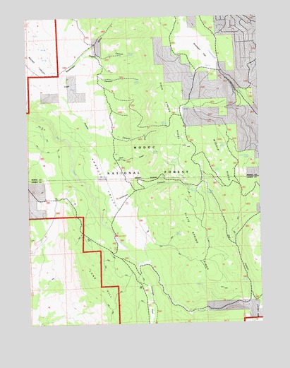
Ambrose Valley, CA USGS Topographic Map
Click on map above to begin viewing in our Map Viewer.

This topographic map contains these locations and features:
Feature Name Type Latitude Longitude GNIS ID View Map
Ambrose CanyonValleyN41.1766°W120.8258°218219View Map
Ambrose ValleyBenchN41.1818°W120.8330°253148View Map
Ash Creek CampgroundLocaleN41.1610°W120.8305°1655117View Map
Bear SpringSpringN41.1874°W120.7720°218879View Map
Big Pine SpringSpringN41.2342°W120.8213°219229View Map
Clark CanyonValleyN41.2193°W120.8596°221151View Map
Clark SpringSpringN41.2234°W120.8145°253123View Map
Cottonwood SpringSpringN41.1793°W120.7851°221664View Map
Dan Ryan PlacePopulated PlaceN41.1496°W120.8172°1658372View Map
Deer SpringSpringN41.1912°W120.7958°222209View Map
Deer Spring RidgeRidgeN41.2124°W120.8016°222211View Map
Hunsinger DrawValleyN41.1468°W120.8177°225778View Map
John SpringSpringN41.2067°W120.8033°226281View Map
Long HillSummitN41.1393°W120.8375°227570View Map
Messenger GulchValleyN41.2166°W120.8716°228538View Map
Middle RidgeRidgeN41.1921°W120.7733°253176View Map
Pothole SpringSpringN41.2126°W120.7918°230981View Map
Rail CanyonValleyN41.1346°W120.7569°231169View Map
Reid DrawValleyN41.1888°W120.8316°255031View Map
Rivalier CanyonValleyN41.2179°W120.8569°231636View Map
Sager CanyonValleyN41.2341°W120.8433°232117View Map
Slate SpringSpringN41.1613°W120.7968°233249View Map
Slate Spring RidgeRidgeN41.1596°W120.7847°233250View Map
Snell SpringSpringN41.1965°W120.7692°234754View Map
Stump SpringSpringN41.1949°W120.8052°235624View Map
Sunflower SpringSpringN41.1787°W120.7802°235782View Map
Sweagert FlatFlatN41.2391°W120.7830°1665978View Map
Yellow Jacket SpringSpringN41.1925°W120.7564°238246View Map

Note: Coordinates in the location and feature list above are referenced to NAD83 datum.


Copyright (C) 2008-2024 Ryan Niemi / Sunset Dynamics ... All Rights Reserved