TopoQuest Logo
Do you find TopoQuest useful?
Help keep TopoQuest running and adding new maps/features by donating!
Bitcoin:  19c7KJd3qBynnjoSw5npx9KScwjBe4ifkT
Litecoin:  LXs6TkuXGGXo1vDsWCkWVdjQX94eUKd6ui
Home View Maps Find Maps Find Places Resources & Links


Chatom, Alabama Topographic Map

USGS Map Title: Chatom, AL
USGS Map MRC: 31088D3
DRG (GeoTIFF) Download: o31088d3.tif


Neighboring USGS Topographic Map Quads:


  Copeland, AL  
31088E4
 

  Millry South, AL  
31088E3
 

  Bigbee, AL  
31088E2
 

  State Line, MS  
31088D4
 

  Chatom, AL  
31088D3
 

  Rutan, AL  
31088D2
 

  Fruitdale, AL  
31088C4
 

  Vinegar Bend, AL  
31088C3
 

  Seaboard, AL  
31088C2


Map MRC Location:

N32°
W89°
N32°
W88°
H8 H7 H6 H5 H4 H3 H2 H1
G8 G7 G6 G5 G4 G3 G2 G1
F8 F7 F6 F5 F4 F3 F2 F1
E8 E7 E6 E5 E4 E3 E2 E1
D8 D7 D6 D5 D4 D3 D2 D1
C8 C7 C6 C5 C4 C3 C2 C1
B8 B7 B6 B5 B4 B3 B2 B1
A8 A7 A6 A5 A4 A3 A2 A1
N31°
W89°
N31°
W88°

Chatom, AL USGS 1:24K Topographic Map Preview:
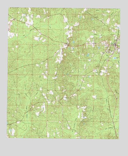
Chatom, AL USGS Topographic Map
Click on map above to begin viewing in our Map Viewer.

This topographic map contains these locations and features:
Feature Name Type Latitude Longitude GNIS ID View Map
Beech Tree BranchStreamN31.4096°W88.3520°113825View Map
Camp ChatomLocaleN31.4510°W88.2636°138869View Map
Center Ridge Baptist ChurchChurchN31.4913°W88.2778°115865View Map
ChatomPopulated PlaceN31.4652°W88.2545°115982View Map
Chatom Elementary SchoolSchoolN31.4618°W88.2506°149548View Map
Chatom Middle SchoolSchoolN31.4618°W88.2517°149547View Map
Chatom Police DepartmentBuildingN31.4616°W88.2548°2752053View Map
Chatom Post OfficePost OfficeN31.4629°W88.2540°166937View Map
Chatom Volunteer Fire DepartmentBuildingN31.4575°W88.2574°2691145View Map
Church of GodChurchN31.4666°W88.2789°116127View Map
Cypress Pond BranchStreamN31.4999°W88.2506°117003View Map
Fairhope Baptist ChurchChurchN31.4149°W88.2533°138896View Map
Fairhope CemeteryCemeteryN31.4149°W88.2528°157563View Map
George Keen DamDamN31.4902°W88.2950°129859View Map
George Keen PondReservoirN31.4914°W88.2942°129860View Map
Laton HillPopulated PlaceN31.4891°W88.3681°138939View Map
Laton Hill Baptist ChurchChurchN31.4891°W88.3686°151999View Map
Laton Hill CemeteryCemeteryN31.4910°W88.3608°121412View Map
Laton Hill Volunteer Fire DepartmentBuildingN31.4890°W88.3691°2691563View Map
Maple BranchStreamN31.4263°W88.3370°122263View Map
Spring Bank Baptist ChurchChurchN31.4654°W88.3092°153522View Map
Spring Bank CemeteryCemeteryN31.4654°W88.3081°157617View Map
Turner CemeteryCemeteryN31.4382°W88.2717°128189View Map
Washington County CourthouseBuildingN31.4657°W88.2567°157633View Map
Washington County High SchoolSchoolN31.4574°W88.2683°149549View Map
Washington County Nursing HomeBuildingN31.4660°W88.2545°2578951View Map
Washington County Sheriff's OfficeBuildingN31.4657°W88.2566°2751927View Map

Note: Coordinates in the location and feature list above are referenced to NAD83 datum.


Copyright (C) 2008-2024 Ryan Niemi / Sunset Dynamics ... All Rights Reserved