TopoQuest Logo
Do you find TopoQuest useful?
Help keep TopoQuest running and adding new maps/features by donating!
Bitcoin:  19c7KJd3qBynnjoSw5npx9KScwjBe4ifkT
Litecoin:  LXs6TkuXGGXo1vDsWCkWVdjQX94eUKd6ui
Home View Maps Find Maps Find Places Resources & Links


Chatham, New Hampshire Topographic Map

USGS Map Title: Chatham, NH
USGS Map MRC: 44071B1
DRG (GeoTIFF) Download: o44071b1.tif


Neighboring USGS Topographic Map Quads:


  Carter Dome, NH  
44071C2
 

  Wild River, NH  
44071C1
 

  Speckled Mountain, ME  
44070C8
 

  Jackson, NH  
44071B2
 

  Chatham, NH  
44071B1
 

  Center Lovell, ME  
44070B8
 

  North Conway West, NH  
44071A2
 

  North Conway East, NH  
44071A1
 

  Fryeburg, ME  
44070A8


Map MRC Location:

N45°
W72°
N45°
W71°
H8 H7 H6 H5 H4 H3 H2 H1
G8 G7 G6 G5 G4 G3 G2 G1
F8 F7 F6 F5 F4 F3 F2 F1
E8 E7 E6 E5 E4 E3 E2 E1
D8 D7 D6 D5 D4 D3 D2 D1
C8 C7 C6 C5 C4 C3 C2 C1
B8 B7 B6 B5 B4 B3 B2 B1
A8 A7 A6 A5 A4 A3 A2 A1
N44°
W72°
N44°
W71°

Chatham, NH USGS 1:24K Topographic Map Preview:
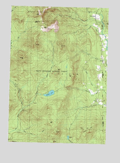
Chatham, NH USGS Topographic Map
Click on map above to begin viewing in our Map Viewer.

This topographic map contains these locations and features:
Feature Name Type Latitude Longitude GNIS ID View Map
Baldface ShelterLocaleN44.2342°W71.0623°873190View Map
Baldface TrailTrailN44.2303°W71.0959°871440View Map
Bilknell Ridge TrailTrailN44.2459°W71.0606°872984View Map
Bradley Brook TrailTrailN44.2031°W71.0451°871571View Map
Brucknell Ridge TrailTrailN44.2476°W71.0634°871585View Map
Burnt Knoll BrookStreamN44.1376°W71.1203°871594View Map
Chandler BrookStreamN44.2262°W71.0076°871658View Map
Chandler MountainSummitN44.2028°W71.1059°871661View Map
Charles BrookStreamN44.2381°W71.0090°871664View Map
Charles RavineValleyN44.2381°W71.0109°871665View Map
ChathamPopulated PlaceN44.1645°W71.0112°871667View Map
Cold River AMC CampLocaleN44.2359°W71.0112°871712View Map
East Fork East Branch Saco RiverStreamN44.2165°W71.1237°871832View Map
Eastman MountainSummitN44.2156°W71.0620°871842View Map
Eastman SchoolSchoolN44.2081°W71.0081°871843View Map
Major MountainSummitN44.1378°W71.0309°872251View Map
Mill BrookStreamN44.2448°W71.0104°872299View Map
Mountain Eastman TrailTrailN44.2098°W71.0603°872361View Map
Mountain PondLakeN44.1703°W71.0725°872363View Map
Mountain Pond ShelterLocaleN44.1734°W71.0717°872986View Map
Mountain Pond TrailTrailN44.1734°W71.0626°872983View Map
Mountain ShawSummitN44.1359°W71.0653°872364View Map
Mountain Shaw TrailTrailN44.1587°W71.0753°872365View Map
North BaldfaceSummitN44.2428°W71.0873°872388View Map
North ChathamPopulated PlaceN44.2423°W71.0167°872394View Map
Province PondLakeN44.1304°W71.0479°872529View Map
Province Pond ShelterLocaleN44.1320°W71.0481°872985View Map
Robbins RidgeRidgeN44.1373°W71.0231°872576View Map
Sable MountainSummitN44.2153°W71.0945°872603View Map
Sable Mountain TrailTrailN44.1865°W71.0981°872604View Map
Shell Pond BrookStreamN44.2440°W71.0090°581203View Map
Slippery BrookStreamN44.1567°W71.1078°872679View Map
Slippery Brook TrailTrailN44.2251°W71.0637°872680View Map
Slope MountainSummitN44.1865°W71.0440°872681View Map
South BaldfaceSummitN44.2306°W71.0779°872692View Map
Spruce KnollSummitN44.2359°W71.0595°872982View Map
Stillwater TrailTrailN44.1776°W71.1020°872740View Map
Town of ChathamCivilN44.1655°W71.0482°873563View Map
Walter MountainSummitN44.1437°W71.0728°872861View Map
Watson BrookStreamN44.1737°W71.0109°872871View Map

Note: Coordinates in the location and feature list above are referenced to NAD83 datum.


Copyright (C) 2008-2024 Ryan Niemi / Sunset Dynamics ... All Rights Reserved