TopoQuest Logo
Do you find TopoQuest useful?
Help keep TopoQuest running and adding new maps/features by donating!
Bitcoin:  19c7KJd3qBynnjoSw5npx9KScwjBe4ifkT
Litecoin:  LXs6TkuXGGXo1vDsWCkWVdjQX94eUKd6ui
Home View Maps Find Maps Find Places Resources & Links


Wilson, Florida Topographic Map

USGS Map Title: Wilson, FL
USGS Map MRC: 28080F6
DRG (GeoTIFF) Download: o28080f6.tif


Neighboring USGS Topographic Map Quads:


  Oak Hill, FL  
28080G7
 

  Pardon Island, FL  
28080G6


  Mims, FL  
28080F7
 

  Wilson, FL  
28080F6


  Titusville, FL  
28080E7
 

  Orsino, FL  
28080E6
 

  False Cape, FL  
28080E5


Map MRC Location:

N29°
W81°
N29°
W80°
H8 H7 H6 H5 H4 H3 H2 H1
G8 G7 G6 G5 G4 G3 G2 G1
F8 F7 F6 F5 F4 F3 F2 F1
E8 E7 E6 E5 E4 E3 E2 E1
D8 D7 D6 D5 D4 D3 D2 D1
C8 C7 C6 C5 C4 C3 C2 C1
B8 B7 B6 B5 B4 B3 B2 B1
A8 A7 A6 A5 A4 A3 A2 A1
N28°
W81°
N28°
W80°

Wilson, FL USGS 1:24K Topographic Map Preview:
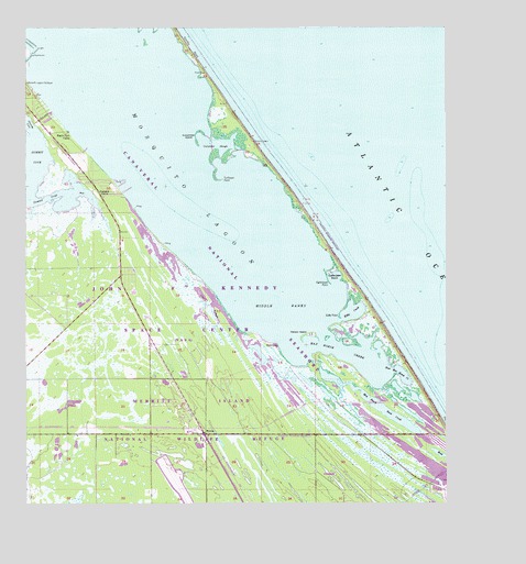
Wilson, FL USGS Topographic Map
Click on map above to begin viewing in our Map Viewer.

This topographic map contains these locations and features:
Feature Name Type Latitude Longitude GNIS ID View Map
Bull CampLocaleN28.6661°W80.6750°307729View Map
Clark SloughBayN28.6748°W80.6967°307731View Map
Cucumber IslandIslandN28.7225°W80.6987°307732View Map
Cucumber SloughBayN28.7191°W80.6922°307733View Map
Dummit CoveBayN28.7142°W80.7495°307734View Map
Dummit CreekBayN28.7062°W80.7368°307735View Map
Dummit GrovePopulated PlaceN28.7069°W80.7278°307736View Map
East Max Hoeck CreekBayN28.6603°W80.6394°307737View Map
Eddy CreekBayN28.6755°W80.6527°307738View Map
Eddy PointCapeN28.6747°W80.6564°307739View Map
Gallinipper BasinBayN28.6846°W80.6579°307740View Map
Gallinipper PointCapeN28.6828°W80.6592°307741View Map
Granny CoveBayN28.7256°W80.7494°307742View Map
John F Kennedy Space CenterReserveN28.6355°W80.7023°307744View Map
Klondike BeachBeachN28.7447°W80.7009°307745View Map
Max Hoeck Back CreekBayN28.6499°W80.6431°307747View Map
Max Hoeck CreekBayN28.6638°W80.6518°307748View Map
Middle BanksBarN28.6769°W80.6739°307750View Map
Old CanalCanalN28.7267°W80.7442°307752View Map
Pelican IslandIslandN28.6697°W80.6656°307753View Map
Ragin Fish CampLocaleN28.7230°W80.7373°307755View Map
Shoppes of West MelbourneLocaleN28.6775°W80.6809°296465View Map
Turtlepen PointCapeN28.7103°W80.6914°307756View Map
WilsonPopulated PlaceN28.6433°W80.6964°307757View Map

Note: Coordinates in the location and feature list above are referenced to NAD83 datum.


Copyright (C) 2008-2024 Ryan Niemi / Sunset Dynamics ... All Rights Reserved