TopoQuest Logo
Do you find TopoQuest useful?
Help keep TopoQuest running and adding new maps/features by donating!
Bitcoin:  19c7KJd3qBynnjoSw5npx9KScwjBe4ifkT
Litecoin:  LXs6TkuXGGXo1vDsWCkWVdjQX94eUKd6ui
Home View Maps Find Maps Find Places Resources & Links


Schoolmarm Basin, Nevada Topographic Map

USGS Map Title: Schoolmarm Basin, NV
USGS Map MRC: 38114C4
DRG (GeoTIFF) Download: o38114c4.tif


Neighboring USGS Topographic Map Quads:


  Mustang Well, NV  
38114D5
 

  Horse Corral Pass, NV  
38114D4
 

  Atlanta, NV  
38114D3
 

  Pony Springs, NV  
38114C5
 

  Schoolmarm Basin, NV  
38114C4
 

  Trail Canyon, NV  
38114C3
 

  Bristol Range NE, NV  
38114B5
 

  Mount Wilson, NV  
38114B4
 

  Parsnip Peak, NV  
38114B3


Map MRC Location:

N39°
W115°
N39°
W114°
H8 H7 H6 H5 H4 H3 H2 H1
G8 G7 G6 G5 G4 G3 G2 G1
F8 F7 F6 F5 F4 F3 F2 F1
E8 E7 E6 E5 E4 E3 E2 E1
D8 D7 D6 D5 D4 D3 D2 D1
C8 C7 C6 C5 C4 C3 C2 C1
B8 B7 B6 B5 B4 B3 B2 B1
A8 A7 A6 A5 A4 A3 A2 A1
N38°
W115°
N38°
W114°

Schoolmarm Basin, NV USGS 1:24K Topographic Map Preview:
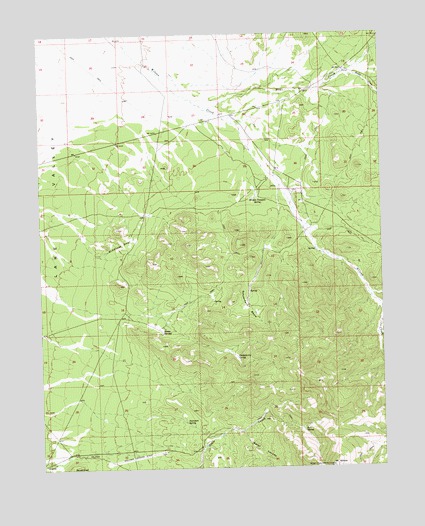
Schoolmarm Basin, NV USGS Topographic Map
Click on map above to begin viewing in our Map Viewer.

This topographic map contains these locations and features:
Feature Name Type Latitude Longitude GNIS ID View Map
Bailey CreekStreamN38.3616°W114.3914°845760View Map
Brown SpringsSpringN38.2889°W114.4564°839079View Map
Cedar FlatFlatN38.2822°W114.4847°851119View Map
Chokecherry SpringSpringN38.2819°W114.4292°854397View Map
Cole and Dolan RanchLocaleN38.3291°W114.4075°851120View Map
Fairween SpringSpringN38.2632°W114.4483°840407View Map
Happy Hollow SpringSpringN38.3021°W114.4345°851138View Map
Hidden Treasure SpringSpringN38.3277°W114.4212°840973View Map
Hogwallow SpringSpringN38.2666°W114.4128°851107View Map
Karo (historical)Populated PlaceN38.2597°W114.3753°851192View Map
Karo Post Office (historical)Post OfficeN38.2597°W114.3753°864953View Map
Ledge SpringSpringN38.2608°W114.4183°851108View Map
Log SpringSpringN38.2655°W114.4180°851109View Map
Middleton SeepsSpringN38.3127°W114.4760°842097View Map
Mount Wilson Guest Ranch Airport (historical)AirportN38.2575°W114.4583°864112View Map
Nores RanchLocaleN38.2561°W114.4430°851118View Map
Salt SpringSpringN38.2603°W114.4051°843456View Map
Schoolmarm BasinBasinN38.2977°W114.4247°845953View Map
Upper Wilson Creek RanchLocaleN38.3186°W114.4028°851106View Map
Valley View Farm (historical)LocaleN38.3708°W114.4692°851132View Map
Water CanyonValleyN38.2602°W114.4278°844666View Map
Winz CreekStreamN38.3538°W114.4400°845008View Map

Note: Coordinates in the location and feature list above are referenced to NAD83 datum.


Copyright (C) 2008-2024 Ryan Niemi / Sunset Dynamics ... All Rights Reserved