TopoQuest Logo
Do you find TopoQuest useful?
Help keep TopoQuest running and adding new maps/features by donating!
Bitcoin:  19c7KJd3qBynnjoSw5npx9KScwjBe4ifkT
Litecoin:  LXs6TkuXGGXo1vDsWCkWVdjQX94eUKd6ui
Home View Maps Find Maps Find Places Resources & Links


Saint Albans Bay, Vermont Topographic Map

USGS Map Title: Saint Albans Bay, VT
USGS Map MRC: 44073G2
DRG (GeoTIFF) Download: o44073g2.tif


Neighboring USGS Topographic Map Quads:


  Rouses Point, NY  
44073H3
 

  East Alburg, VT  
44073H2
 

  Highgate Center, VT  
44073H1
 

  North Hero, VT  
44073G3
 

  Saint Albans Bay, VT  
44073G2
 

  Saint Albans, VT  
44073G1
 

  South Hero, VT  
44073F3
 

  Georgia Plains, VT  
44073F2
 

  Milton, VT  
44073F1


Map MRC Location:

N45°
W74°
N45°
W73°
H8 H7 H6 H5 H4 H3 H2 H1
G8 G7 G6 G5 G4 G3 G2 G1
F8 F7 F6 F5 F4 F3 F2 F1
E8 E7 E6 E5 E4 E3 E2 E1
D8 D7 D6 D5 D4 D3 D2 D1
C8 C7 C6 C5 C4 C3 C2 C1
B8 B7 B6 B5 B4 B3 B2 B1
A8 A7 A6 A5 A4 A3 A2 A1
N44°
W74°
N44°
W73°

Saint Albans Bay, VT USGS 1:24K Topographic Map Preview:
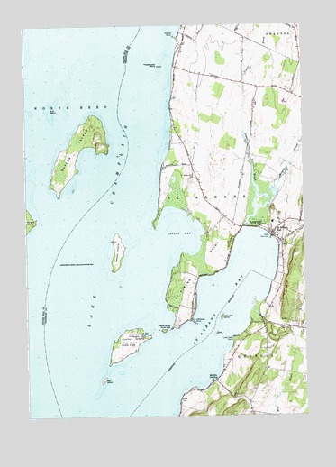
Saint Albans Bay, VT USGS Topographic Map
Click on map above to begin viewing in our Map Viewer.

This topographic map contains these locations and features:
Feature Name Type Latitude Longitude GNIS ID View Map
Ball IslandIslandN44.7617°W73.2160°1456236View Map
Burtland FarmsLocaleN44.7589°W73.1433°2633593View Map
Burton IslandIslandN44.7745°W73.2043°1456688View Map
Burton Island State ParkParkN44.7725°W73.2049°1456689View Map
Burton Island State Park Nature CenterBuildingN44.7712°W73.2018°1920549View Map
Butler IslandIslandN44.8349°W73.2257°1456692View Map
Cheney PointCapeN44.8714°W73.1821°1456868View Map
Eagle BayBayN44.7748°W73.2101°1920568View Map
Evarts CemeteryCemeteryN44.7781°W73.1339°1457382View Map
Gull IslandIslandN44.8481°W73.2382°1457673View Map
Hathaway PointCapeN44.7800°W73.1746°1457760View Map
Hurlbut CemeteryCemeteryN44.7554°W73.1814°1460053View Map
Island Farm Nature TrailTrailN44.7709°W73.2046°1920668View Map
Jewett BrookStreamN44.8106°W73.1518°1458009View Map
Kamp Kill Kare (historical)LocaleN44.7648°W73.1815°1920670View Map
Killkare State ParkParkN44.7792°W73.1826°1920672View Map
Knight Island State ParkParkN44.8131°W73.2468°1918532View Map
Lapans BayBayN44.8092°W73.1799°1458162View Map
Lazy Lady IslandIslandN44.7820°W73.1621°1458177View Map
Lime Rock PointCapeN44.7753°W73.1576°1458218View Map
Melville LandingPopulated PlaceN44.7614°W73.1654°1458417View Map
Mill RiverStreamN44.7859°W73.1474°1458470View Map
North Shore TrailTrailN44.7737°W73.2068°1920711View Map
Northwest State Correctional Facility - SwantonBuildingN44.8502°W73.1323°1920742View Map
Popasquash IslandIslandN44.8620°W73.1899°1459040View Map
Rock IslandIslandN44.7767°W73.1646°1459232View Map
Rugg BrookStreamN44.7748°W73.1296°1459280View Map
Saint Albans BayBayN44.7842°W73.1592°1459307View Map
Saint Albans BayPopulated PlaceN44.8078°W73.1393°1459308View Map
Saint Albans Bay Post OfficePost OfficeN44.8090°W73.1387°1920738View Map
Saint Albans Bay State ParkParkN44.8109°W73.1446°1459310View Map
Saint Albans PointCapeN44.7975°W73.1746°1459312View Map
Saint Albans Point CemeteryCemeteryN44.8263°W73.1731°1459313View Map
Southern Tip TrailTrailN44.7698°W73.2068°1920784View Map
Stevens BrookStreamN44.8164°W73.1457°1459701View Map
Torrey CemeteryCemeteryN44.7564°W73.1583°1459929View Map
Town of Saint AlbansCivilN44.8107°W73.1456°1462197View Map
West Shore TrailTrailN44.7712°W73.2121°1920812View Map
Woods IslandIslandN44.8028°W73.2087°1460315View Map
Woods Island State ParkParkN44.8025°W73.2093°1920818View Map

Note: Coordinates in the location and feature list above are referenced to NAD83 datum.


Copyright (C) 2008-2024 Ryan Niemi / Sunset Dynamics ... All Rights Reserved