TopoQuest Logo
Do you find TopoQuest useful?
Help keep TopoQuest running and adding new maps/features by donating!
Bitcoin:  19c7KJd3qBynnjoSw5npx9KScwjBe4ifkT
Litecoin:  LXs6TkuXGGXo1vDsWCkWVdjQX94eUKd6ui
Home View Maps Find Maps Find Places Resources & Links


Canyon Ferry, Montana Topographic Map

USGS Map Title: Canyon Ferry, MT
USGS Map MRC: 46111F6
DRG (GeoTIFF) Download: o46111f6.tif


Neighboring USGS Topographic Map Quads:


  Nelson, MT  
46111G7
 

  Hogback Mountain, MT  
46111G6
 

  Snedaker Basin, MT  
46111G5
 

  Hauser Lake, MT  
46111F7
 

  Canyon Ferry, MT  
46111F6
 

  Hellgate Gulch, MT  
46111F5
 

  Louisville, MT  
46111E7
 

  Canyon Ferry SW, MT  
46111E6
 

  Canyon Ferry SE, MT  
46111E5


Map MRC Location:

N47°
W112°
N47°
W111°
H8 H7 H6 H5 H4 H3 H2 H1
G8 G7 G6 G5 G4 G3 G2 G1
F8 F7 F6 F5 F4 F3 F2 F1
E8 E7 E6 E5 E4 E3 E2 E1
D8 D7 D6 D5 D4 D3 D2 D1
C8 C7 C6 C5 C4 C3 C2 C1
B8 B7 B6 B5 B4 B3 B2 B1
A8 A7 A6 A5 A4 A3 A2 A1
N46°
W112°
N46°
W111°

Canyon Ferry, MT USGS 1:24K Topographic Map Preview:
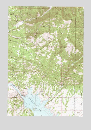
Canyon Ferry, MT USGS Topographic Map
Click on map above to begin viewing in our Map Viewer.

This topographic map contains these locations and features:
Feature Name Type Latitude Longitude GNIS ID View Map
10N01W02CABB01 WellWellN46.6530°W111.6978°817499View Map
10N01W02CAC_01 WellWellN46.6499°W111.6978°817470View Map
Beards GulchValleyN46.7363°W111.7111°800416View Map
Big Rattlesnake GulchValleyN46.7274°W111.6958°800448View Map
Blacksmith GulchValleyN46.7491°W111.6789°800477View Map
Browns GulchValleyN46.7285°W111.7358°800504View Map
Canyon FerryPopulated PlaceN46.6555°W111.7183°806909View Map
Canyon Ferry DamDamN46.6485°W111.7278°795605View Map
Canyon Ferry Post Office (historical)Post OfficeN46.6555°W111.7183°1789220View Map
Canyon Ferry RV ParkLocaleN46.6541°W111.7036°1789592View Map
Canyon Ferry School (historical)SchoolN46.6555°W111.7183°1789219View Map
Cave BayBayN46.6494°W111.7014°800568View Map
Cave Bay CampgroundLocaleN46.6510°W111.7000°794760View Map
Cave GulchValleyN46.6485°W111.7041°800571View Map
CavetownPopulated PlaceN46.6541°W111.7008°1789217View Map
Cavetown Post Office (historical)Post OfficeN46.6541°W111.7008°1789218View Map
Cemetery HillSummitN46.6341°W111.7064°800576View Map
Cemetery Island / Canyon Ferry CemeteryCemeteryN46.6347°W111.7058°1789420View Map
Cemetery Island Recreation AreaLocaleN46.6349°W111.7055°794757View Map
Chinaman CoveBayN46.6505°W111.7097°800587View Map
Chinaman Cove CampgroundLocaleN46.6513°W111.7100°794759View Map
Clarks GulchValleyN46.6691°W111.7336°800600View Map
Collins GulchValleyN46.6930°W111.6269°781513View Map
Cooper GulchValleyN46.6588°W111.7080°800621View Map
Court Sheriff Recreation AreaLocaleN46.6572°W111.7091°800638View Map
Coxcy GulchValleyN46.6855°W111.6430°800640View Map
Coxcy Gulch MineMineN46.6869°W111.6444°803973View Map
Daytown (historical)Populated PlaceN46.6610°W111.6972°1789204View Map
Fox GulchValleyN46.6841°W111.6428°800810View Map
French BarBarN46.6605°W111.7444°800814View Map
French Bar MountainSummitN46.6399°W111.7372°800815View Map
Gennian GulchValleyN46.7119°W111.7289°800839View Map
Golden Messenger MineMineN46.7408°W111.7416°803680View Map
Golden Messenger MineMineN46.7402°W111.7400°800860View Map
Goon HillSummitN46.6524°W111.7250°800864View Map
Gruells BarBarN46.6591°W111.7372°800899View Map
Gruells Bar MineMineN46.6583°W111.7355°803974View Map
Hedges MountainSummitN46.7349°W111.6478°800921View Map
Holiday GulchValleyN46.6908°W111.7111°800952View Map
Horse GulchValleyN46.6580°W111.7330°800960View Map
Jo Bonner CampgroundLocaleN46.6416°W111.6425°1789598View Map
Johnnys GulchValleyN46.6660°W111.7344°800994View Map
Kelly GulchValleyN46.7341°W111.7269°801009View Map
Kingsberry GulchValleyN46.7138°W111.7322°801015View Map
Korizek MineMineN46.6505°W111.7480°801021View Map
Little Dandy MineMineN46.7402°W111.7341°801072View Map
Magpie (historical)LocaleN46.6458°W111.6814°1789142View Map
Magpie CreekStreamN46.6380°W111.6922°801121View Map
Magpie Recreation AreaLocaleN46.6435°W111.6836°801122View Map
NE SE Section 16/Gennian Gulch MineMineN46.7088°W111.7266°803970View Map
NW SE Section 30 MineMineN46.6802°W111.6486°803962View Map
Oregon GulchValleyN46.6569°W111.7341°801263View Map
Overlook Recreation AreaLocaleN46.6305°W111.7130°801268View Map
Ponderosa CampgroundLocaleN46.6505°W111.7169°1789599View Map
Ponderosa Picnic AreaLocaleN46.6508°W111.7169°794758View Map
Riverside CampgroundLocaleN46.6560°W111.7333°801369View Map
SE NE Section 14/Kingsberry Gulch MineMineN46.7149°W111.6853°803967View Map
SE NW S11/Big Rattlesnake Gulch MineMineN46.7297°W111.6950°803969View Map
SE SE Section 19 MineMineN46.6916°W111.6414°803963View Map
Shannon Recreation SiteLocaleN46.6505°W111.7041°794761View Map
Sheriff GulchValleyN46.6358°W111.7205°801446View Map
SW NE S11/Big Rattlesnake Gulch MineMineN46.7280°W111.6886°803968View Map
Tri - Lakes Volunteer Fire Department Station 4BuildingN46.6350°W111.7237°2546679View Map
Tri - Lakes Volunteer Fire Department Station 5BuildingN46.6444°W111.6850°2546634View Map
Washout GulchValleyN46.6713°W111.6561°801655View Map
York GulchValleyN46.7141°W111.7322°801725View Map

Note: Coordinates in the location and feature list above are referenced to NAD83 datum.


Copyright (C) 2008-2024 Ryan Niemi / Sunset Dynamics ... All Rights Reserved