TopoQuest Logo
Do you find TopoQuest useful?
Help keep TopoQuest running and adding new maps/features by donating!
Bitcoin:  19c7KJd3qBynnjoSw5npx9KScwjBe4ifkT
Litecoin:  LXs6TkuXGGXo1vDsWCkWVdjQX94eUKd6ui
Home View Maps Find Maps Find Places Resources & Links


Hayden Peak, Utah Topographic Map

USGS Map Title: Hayden Peak, UT
USGS Map MRC: 40110F7
DRG (GeoTIFF) Download: o40110f7.tif


Neighboring USGS Topographic Map Quads:


  Whitney Reservoir, UT  
40110G8
 

  Christmas Meadows, UT  
40110G7
 

  Red Knob, UT  
40110G6
 

  Mirror Lake, UT  
40110F8
 

  Hayden Peak, UT  
40110F7
 

  Explorer Peak, UT  
40110F6
 

  Iron Mine Mountain, UT  
40110E8
 

  Grandaddy Lake, UT  
40110E7
 

  Tworoose Pass, UT  
40110E6


Map MRC Location:

N41°
W111°
N41°
W110°
H8 H7 H6 H5 H4 H3 H2 H1
G8 G7 G6 G5 G4 G3 G2 G1
F8 F7 F6 F5 F4 F3 F2 F1
E8 E7 E6 E5 E4 E3 E2 E1
D8 D7 D6 D5 D4 D3 D2 D1
C8 C7 C6 C5 C4 C3 C2 C1
B8 B7 B6 B5 B4 B3 B2 B1
A8 A7 A6 A5 A4 A3 A2 A1
N40°
W111°
N40°
W110°

Hayden Peak, UT USGS 1:24K Topographic Map Preview:
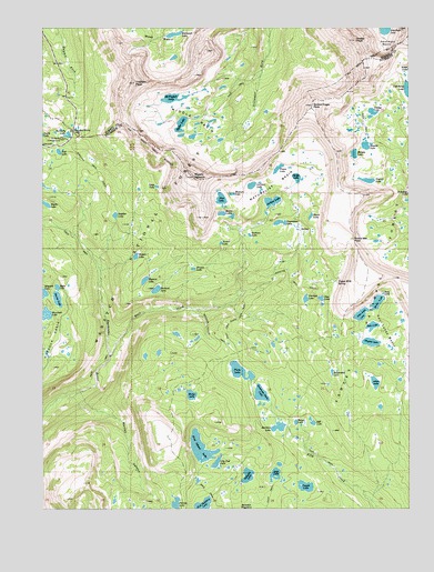
Hayden Peak, UT USGS Topographic Map
Click on map above to begin viewing in our Map Viewer.

This topographic map contains these locations and features:
Feature Name Type Latitude Longitude GNIS ID View Map
Allen LakeLakeN40.6576°W110.7623°1425086View Map
Amy LakeLakeN40.6808°W110.7596°1425103View Map
Bedground LakeLakeN40.6604°W110.7770°1425393View Map
Blue LakeLakeN40.7054°W110.8147°1425809View Map
Blythe LakeLakeN40.7041°W110.8745°1438973View Map
Brooks LakeLakeN40.6873°W110.8243°1425997View Map
Bud LakeLakeN40.7177°W110.8701°1426090View Map
Butterfly CampgroundLocaleN40.7213°W110.8691°1426236View Map
Butterfly LakeLakeN40.7222°W110.8667°1426237View Map
Carolyn LakeLakeN40.6795°W110.7859°1426363View Map
Dale LakeLakeN40.6724°W110.7632°1427188View Map
Daynes LakeLakeN40.6681°W110.7638°1427237View Map
Dean LakeLakeN40.6786°W110.7615°1427268View Map
East Fork Duchesne RiverStreamN40.6647°W110.8527°1427691View Map
East Fork Pinto Lake TrailTrailN40.6741°W110.8085°1427695View Map
Evermann LakeLakeN40.6993°W110.7947°1440974View Map
Farney LakeLakeN40.6265°W110.8304°1427888View Map
Faxon LakeLakeN40.7134°W110.7952°1427896View Map
Fish Hatchery LakeLakeN40.6261°W110.8210°1427957View Map
Four Lakes BasinBasinN40.6708°W110.7582°1428055View Map
Gatman LakeLakeN40.6960°W110.8050°1428161View Map
Gladys LakeLakeN40.7280°W110.7630°1428197View Map
Governor Dern LakeLakeN40.6548°W110.8013°1454329View Map
Hayden PassGapN40.7233°W110.8652°1428601View Map
Hayden PeakSummitN40.7347°W110.8438°1428602View Map
Highline TrailTrailN40.6886°W110.8174°1428713View Map
Highline Trail Head CampgroundLocaleN40.7238°W110.8635°1455318View Map
Hoover LakeLakeN40.6795°W110.8706°1428812View Map
Hyatt LakeLakeN40.7009°W110.7842°1428955View Map
Jean LakeLakeN40.6754°W110.7670°1429131View Map
Jeff LakeLakeN40.6472°W110.7836°1429133View Map
Jordan LakeLakeN40.7048°W110.7973°1429246View Map
Kermsuh LakeLakeN40.7482°W110.8307°1429329View Map
LeConte LakeLakeN40.7089°W110.8043°1429504View Map
Lightning LakeLakeN40.7340°W110.7511°1442585View Map
Lily Pad LakeLakeN40.6370°W110.8165°1429614View Map
Lost LakeLakeN40.6340°W110.7965°1429944View Map
Maba LakeLakeN40.6825°W110.8707°1430027View Map
Margie LakeLakeN40.7171°W110.7692°1430104View Map
Margo LakeLakeN40.6546°W110.8250°1430105View Map
Marsell CanyonValleyN40.6552°W110.8629°1430115View Map
Marshall LakeLakeN40.6756°W110.8743°1443205View Map
McPheters LakeLakeN40.7317°W110.8313°1430196View Map
Middle BasinBasinN40.7266°W110.8224°1430256View Map
Morat LakesLakeN40.7016°W110.8145°1430484View Map
Mount AgassizSummitN40.7111°W110.8235°1425054View Map
Naturalist BasinBasinN40.7083°W110.7974°1430645View Map
Olga LakeLakeN40.6796°W110.7807°1430996View Map
Ostler PeakSummitN40.7466°W110.7682°1431036View Map
Packard LakeLakeN40.6819°W110.8370°1431066View Map
Palisade LakeLakeN40.6336°W110.8059°1431083View Map
Pigeon Milk SpringSpringN40.6837°W110.7754°1431227View Map
Pine Island LakeLakeN40.6408°W110.8219°1431261View Map
Pinto LakeLakeN40.6607°W110.8083°1431301View Map
Powell LakeLakeN40.6308°W110.7862°1431461View Map
Rainbow LakeLakeN40.6462°W110.7953°1431556View Map
Range LakeLakeN40.6474°W110.7894°1431574View Map
Rocky Sea PassGapN40.6949°W110.7693°1431977View Map
Rosalie LakeLakeN40.7192°W110.7654°1431993View Map
Ryder LakeLakeN40.7249°W110.8283°1432071View Map
Scudder LakeLakeN40.7013°W110.8509°1455907View Map
Shale LakeLakeN40.7087°W110.8366°1432355View Map
Shaler LakeLakeN40.7109°W110.7889°1432357View Map
Skinner Cutoff TrailTrailN40.6697°W110.8182°1432509View Map
Spread Eagle PeakSummitN40.7299°W110.7829°1432811View Map
Tadpole LakeLakeN40.7166°W110.8674°1446320View Map
Uintah LakeLakeN40.7102°W110.7648°1433778View Map
Verrill LakeLakeN40.6940°W110.8147°1455916View Map
Walcott LakeLakeN40.7067°W110.8110°1455917View Map
Wilder LakeLakeN40.6906°W110.8439°1455918View Map
Wyman LakeLakeN40.6843°W110.8408°1434485View Map

Note: Coordinates in the location and feature list above are referenced to NAD83 datum.


Copyright (C) 2008-2024 Ryan Niemi / Sunset Dynamics ... All Rights Reserved