TopoQuest Logo
Do you find TopoQuest useful?
Help keep TopoQuest running and adding new maps/features by donating!
Bitcoin:  19c7KJd3qBynnjoSw5npx9KScwjBe4ifkT
Litecoin:  LXs6TkuXGGXo1vDsWCkWVdjQX94eUKd6ui
Home View Maps Find Maps Find Places Resources & Links


Canandaigua Lake, New York Topographic Map

USGS Map Title: Canandaigua Lake, NY
USGS Map MRC: 42077G3
DRG (GeoTIFF) Download: o42077g3.tif


Neighboring USGS Topographic Map Quads:


  Victor, NY  
42077H4
 

  Canandaigua, NY  
42077H3
 

  Clifton Springs, NY  
42077H2
 

  Bristol Center, NY  
42077G4
 

  Canandaigua Lake, NY  
42077G3
 

  Rushville, NY  
42077G2
 

  Bristol Springs, NY  
42077F4
 

  Middlesex, NY  
42077F3
 

  Potter, NY  
42077F2


Map MRC Location:

N43°
W78°
N43°
W77°
H8 H7 H6 H5 H4 H3 H2 H1
G8 G7 G6 G5 G4 G3 G2 G1
F8 F7 F6 F5 F4 F3 F2 F1
E8 E7 E6 E5 E4 E3 E2 E1
D8 D7 D6 D5 D4 D3 D2 D1
C8 C7 C6 C5 C4 C3 C2 C1
B8 B7 B6 B5 B4 B3 B2 B1
A8 A7 A6 A5 A4 A3 A2 A1
N42°
W78°
N42°
W77°

Canandaigua Lake, NY USGS 1:24K Topographic Map Preview:
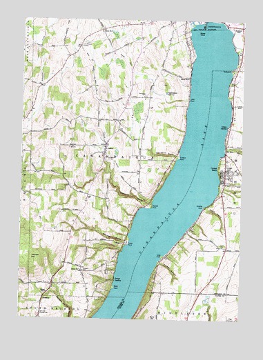
Canandaigua Lake, NY USGS Topographic Map
Click on map above to begin viewing in our Map Viewer.

This topographic map contains these locations and features:
Feature Name Type Latitude Longitude GNIS ID View Map
AcademyLocaleN42.7578°W77.3622°942135View Map
Academy CemeteryCemeteryN42.7702°W77.3390°942140View Map
Barnes GullyValleyN42.7826°W77.3156°943045View Map
Black PointCapeN42.7631°W77.3214°944157View Map
CanandaiguaPopulated PlaceN42.8742°W77.2880°945739View Map
Canandaigua Country ClubLocaleN42.8683°W77.2542°2615361View Map
Canandaigua LakeLakeN42.7781°W77.3050°945740View Map
Canandaigua ReservoirReservoirN42.8446°W77.2935°945742View Map
CheshirePopulated PlaceN42.8215°W77.3275°946536View Map
Cheshire Community ChurchChurchN42.8197°W77.3274°2615702View Map
Cheshire Volunteer Fire DepartmentBuildingN42.8207°W77.3262°2701277View Map
Clark Meadows at Ferris Hills Adult Care FacilityBuildingN42.8649°W77.2886°2614611View Map
Cottage CityPopulated PlaceN42.8112°W77.2594°947515View Map
Crosswinds Wesleyan ChurchChurchN42.8670°W77.2928°2615832View Map
Crystal BeachPopulated PlaceN42.8137°W77.2636°947884View Map
Crystal Beach Census Designated PlaceCensusN42.8095°W77.2582°2631229View Map
Crystal Beach Volunteer Fire DepartmentBuildingN42.8121°W77.2598°2701278View Map
Deep RunStreamN42.8209°W77.2600°948183View Map
Fallbrook Mobile Home ParkPopulated PlaceN42.8713°W77.2520°2618221View Map
First Church of Christ ScientistChurchN42.8684°W77.2920°2615972View Map
Fisher GullyValleyN42.7737°W77.2955°950158View Map
Foster PointCapeN42.7817°W77.3136°950518View Map
Gage GullyValleyN42.7966°W77.2699°950836View Map
Gooding PointCapeN42.7973°W77.2714°951328View Map
Grange LandingPopulated PlaceN42.7665°W77.3211°951494View Map
Greens LandingPopulated PlaceN42.8306°W77.2586°951767View Map
Hope PointCapeN42.8423°W77.2805°953189View Map
Horizons Assisted Living CenterBuildingN42.8750°W77.3051°2614682View Map
Hunn Memorial CemeteryCemeteryN42.8639°W77.3424°953449View Map
Johnson HillSummitN42.7748°W77.3683°954123View Map
Kingdom Hall of Jehovahs WitnessesChurchN42.8608°W77.3485°2616564View Map
Lakeview Manufactured Home CommunityPopulated PlaceN42.8579°W77.2504°2618248View Map
Long PointCapeN42.7767°W77.2944°955893View Map
Lord CemeteryCemeteryN42.7807°W77.2606°952418View Map
Lucas CemeteryCemeteryN42.8007°W77.3371°956126View Map
Menteth GullyValleyN42.7981°W77.3022°956966View Map
Menteth PointCapeN42.7976°W77.3008°956967View Map
Ontario CountyCivilN42.8528°W77.2998°974133View Map
Otetiana PointCapeN42.8545°W77.2566°959536View Map
Pine Bank CemeteryCemeteryN42.8163°W77.3266°960415View Map
Quail Summit Adult Care FacilityBuildingN42.8741°W77.2976°2614759View Map
Randall CemeteryCemeteryN42.7522°W77.3623°962168View Map
Randall-Standish VineyardsLocaleN42.7586°W77.3658°2559141View Map
Remington CemeteryCemeteryN42.8441°W77.3058°962372View Map
Roseland ParkPopulated PlaceN42.8726°W77.2511°962920View Map
School Number 3 (historical)SchoolN42.8701°W77.3305°975270View Map
School Number 4 (historical)SchoolN42.7612°W77.3594°975346View Map
School Number 7 (historical)SchoolN42.7703°W77.3403°975542View Map
School Number 9 (historical)SchoolN42.8512°W77.2811°975643View Map
Squaw IslandIslandN42.8701°W77.2755°966169View Map
Sucker BrookStreamN42.8737°W77.2758°966683View Map
The Church of Jesus Christ of Latter Day SaintsChurchN42.8739°W77.2907°2616321View Map
Tichenor GullyValleyN42.8184°W77.2872°967506View Map
Tichenor PointCapeN42.8181°W77.2858°967507View Map
Town of CanandaiguaCivilN42.8607°W77.3182°978785View Map
WLKA-FM (Canandaigua)TowerN42.7903°W77.3644°978499View Map
WLKA-FM (Canandaigua)TowerN42.8631°W77.3225°978500View Map

Note: Coordinates in the location and feature list above are referenced to NAD83 datum.


Copyright (C) 2008-2024 Ryan Niemi / Sunset Dynamics ... All Rights Reserved