TopoQuest Logo
Do you find TopoQuest useful?
Help keep TopoQuest running and adding new maps/features by donating!
Bitcoin:  19c7KJd3qBynnjoSw5npx9KScwjBe4ifkT
Litecoin:  LXs6TkuXGGXo1vDsWCkWVdjQX94eUKd6ui
Home View Maps Find Maps Find Places Resources & Links


Alpine, New York Topographic Map

USGS Map Title: Alpine, NY
USGS Map MRC: 42076C6
DRG (GeoTIFF) Download: o42076c6.tif


Neighboring USGS Topographic Map Quads:


  Burdett, NY  
42076D7
 

  Mecklenburg, NY  
42076D6
 

  Ithaca West, NY  
42076D5
 

  Montour Falls, NY  
42076C7
 

  Alpine, NY  
42076C6
 

  West Danby, NY  
42076C5
 

  Horseheads, NY  
42076B7
 

  Erin, NY  
42076B6
 

  Van Etten, NY  
42076B5


Map MRC Location:

N43°
W77°
N43°
W76°
H8 H7 H6 H5 H4 H3 H2 H1
G8 G7 G6 G5 G4 G3 G2 G1
F8 F7 F6 F5 F4 F3 F2 F1
E8 E7 E6 E5 E4 E3 E2 E1
D8 D7 D6 D5 D4 D3 D2 D1
C8 C7 C6 C5 C4 C3 C2 C1
B8 B7 B6 B5 B4 B3 B2 B1
A8 A7 A6 A5 A4 A3 A2 A1
N42°
W77°
N42°
W76°

Alpine, NY USGS 1:24K Topographic Map Preview:
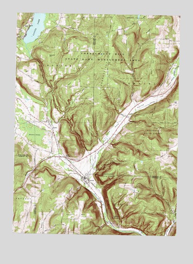
Alpine, NY USGS Topographic Map
Click on map above to begin viewing in our Map Viewer.

This topographic map contains these locations and features:
Feature Name Type Latitude Longitude GNIS ID View Map
AlpinePopulated PlaceN42.3131°W76.7241°942392View Map
Alpine JunctionPopulated PlaceN42.2937°W76.7102°972163View Map
Banfield CreekStreamN42.2623°W76.6263°942958View Map
Bible Baptist FellowshipChurchN42.2944°W76.7207°2615611View Map
Carter CreekStreamN42.3201°W76.6574°945924View Map
CayutaPopulated PlaceN42.2817°W76.6969°946089View Map
Cayuta LakeLakeN42.3670°W76.7354°973997View Map
Cayuta Post OfficePost OfficeN42.2797°W76.6950°2617852View Map
Chaffee CreekStreamN42.3042°W76.6799°946338View Map
Cliffside State ForestForestN42.2817°W76.6774°946873View Map
Connecticut Hill CemeteryCemeteryN42.3645°W76.6790°2514995View Map
Connecticut Hill State Game Management AreaParkN42.3479°W76.6880°974003View Map
Cool Lea CampgroundLocaleN42.3610°W76.7451°2615195View Map
Cornish HollowValleyN42.2592°W76.6252°947481View Map
Doll HillSummitN42.3423°W76.6447°948553View Map
Estabrook CemeteryCemeteryN42.3168°W76.6646°2514994View Map
Hendershot GulfValleyN42.2968°W76.6937°952584View Map
Hinman SwampSwampN42.3065°W76.7338°952886View Map
Hooker CreekStreamN42.2956°W76.7152°953163View Map
Irish HillSummitN42.2726°W76.6561°953761View Map
Kayutah Lake AirportAirportN42.3680°W76.7229°977887View Map
Lawrence CemeteryCemeteryN42.3678°W76.7438°2514447View Map
Lawrence Memorial ChapelChurchN42.3681°W76.7433°955108View Map
Newfield State ForestForestN42.3084°W76.6441°958512View Map
Oak HillSummitN42.3415°W76.7425°959107View Map
Pony HollowValleyN42.2872°W76.6965°960911View Map
Pony Hollow CreekStreamN42.2762°W76.6933°960912View Map
Rowell HillSummitN42.3665°W76.6438°963054View Map
Swan HillSummitN42.3370°W76.7036°966882View Map
The GulfValleyN42.3131°W76.7219°967253View Map
Town of CatharineCivilN42.3451°W76.7445°978799View Map
Town of CayutaCivilN42.2693°W76.6807°978805View Map
VanLone HillSummitN42.3512°W76.7244°968442View Map
Varney HillSummitN42.2609°W76.7088°968466View Map
Wildwood Mobile Home ParkPopulated PlaceN42.3014°W76.7386°2514469View Map

Note: Coordinates in the location and feature list above are referenced to NAD83 datum.


Copyright (C) 2008-2024 Ryan Niemi / Sunset Dynamics ... All Rights Reserved