TopoQuest Logo
Do you find TopoQuest useful?
Help keep TopoQuest running and adding new maps/features by donating!
Bitcoin:  19c7KJd3qBynnjoSw5npx9KScwjBe4ifkT
Litecoin:  LXs6TkuXGGXo1vDsWCkWVdjQX94eUKd6ui
Home View Maps Find Maps Find Places Resources & Links


Bell City, Missouri Topographic Map

USGS Map Title: Bell City, MO
USGS Map MRC: 37089A7
DRG (GeoTIFF) Download: o37089a7.tif


Neighboring USGS Topographic Map Quads:


  Dongola, MO  
37089B8
 

  Whitewater, MO  
37089B7
 

  Chaffee, MO  
37089B6
 

  Advance, MO  
37089A8
 

  Bell City, MO  
37089A7
 

  Oran, MO  
37089A6
 

  Bloomfield, MO  
36089H8
 

  Clines Island, MO  
36089H7
 

  Vanduser, MO  
36089H6


Map MRC Location:

N38°
W90°
N38°
W89°
H8 H7 H6 H5 H4 H3 H2 H1
G8 G7 G6 G5 G4 G3 G2 G1
F8 F7 F6 F5 F4 F3 F2 F1
E8 E7 E6 E5 E4 E3 E2 E1
D8 D7 D6 D5 D4 D3 D2 D1
C8 C7 C6 C5 C4 C3 C2 C1
B8 B7 B6 B5 B4 B3 B2 B1
A8 A7 A6 A5 A4 A3 A2 A1
N37°
W90°
N37°
W89°

Bell City, MO USGS 1:24K Topographic Map Preview:
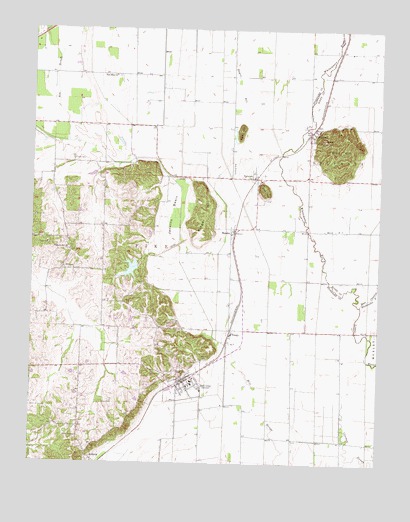
Bell City, MO USGS Topographic Map
Click on map above to begin viewing in our Map Viewer.

This topographic map contains these locations and features:
Feature Name Type Latitude Longitude GNIS ID View Map
Andersons Whippoorwill Farm Lake DamDamN37.0584°W89.8401°765552View Map
ArdeolaPopulated PlaceN37.0012°W89.8529°713375View Map
Ash SloughStreamN37.0923°W89.8623°713421View Map
Bayou BillStreamN37.1009°W89.8023°713761View Map
Bell CityPopulated PlaceN37.0237°W89.8198°713906View Map
Bell City CemeteryCemeteryN37.0306°W89.8134°713907View Map
Bell City Post OfficePost OfficeN37.0240°W89.8192°2783108View Map
Bell City Volunteer Fire DepartmentBuildingN37.0235°W89.8192°2621769View Map
Bird HillSummitN37.0901°W89.7679°731533View Map
ButlerLocaleN37.1187°W89.7648°740290View Map
City of Bell CityCivilN37.0237°W89.8196°2394109View Map
Clolinger School (historical)SchoolN37.0595°W89.8406°748056View Map
Cow HillSummitN37.0789°W89.7929°716408View Map
Darus CemeteryCemeteryN37.0173°W89.8492°716679View Map
E A A Chapter 453 Airport (historical)AirportN37.0917°W89.7945°758849View Map
Georger Farms Airport (historical)AirportN37.1217°W89.8476°758570View Map
Good Hope ChurchChurchN37.0681°W89.8034°759467View Map
HeagyPopulated PlaceN37.0384°W89.8029°719315View Map
Jenkins BasinBasinN37.0714°W89.8248°720288View Map
Lost HillSummitN37.0953°W89.8004°721592View Map
Lost HillsLocaleN37.0803°W89.8034°759468View Map
Lower Whitewater CreekStreamN37.0458°W89.7567°2356889View Map
MesslerPopulated PlaceN37.0662°W89.8034°740002View Map
New Hope ChurchChurchN37.1114°W89.8454°723244View Map
PaintonPopulated PlaceN37.0823°W89.7948°723971View Map
PerkinsPopulated PlaceN37.0948°W89.7754°724226View Map
Perkins Post OfficePost OfficeN37.0938°W89.7754°2783222View Map
Perkins Volunteer Fire DepartmentBuildingN37.0928°W89.7752°2621770View Map
Plainview CemeteryCemeteryN37.0928°W89.7720°724455View Map
Pleasant Hill ChurchChurchN37.0612°W89.8615°724523View Map
Ringer HillSummitN37.0714°W89.8120°725317View Map
Thomas CemeteryCemeteryN37.0937°W89.7717°727576View Map
TillmanPopulated PlaceN37.0553°W89.8643°727660View Map
Tilly BranchStreamN37.0973°W89.8381°727661View Map
Tilman School (historical)SchoolN37.0551°W89.8684°730426View Map
Toga Number 2 SchoolSchoolN37.1114°W89.8337°748054View Map
Township of PikeCivilN37.0299°W89.8456°767421View Map
Tropf School (historical)SchoolN37.0831°W89.8526°748055View Map
Troph CemeteryCemeteryN37.0873°W89.8606°727804View Map

Note: Coordinates in the location and feature list above are referenced to NAD83 datum.


Copyright (C) 2008-2024 Ryan Niemi / Sunset Dynamics ... All Rights Reserved