TopoQuest Logo
Do you find TopoQuest useful?
Help keep TopoQuest running and adding new maps/features by donating!
Bitcoin:  19c7KJd3qBynnjoSw5npx9KScwjBe4ifkT
Litecoin:  LXs6TkuXGGXo1vDsWCkWVdjQX94eUKd6ui
Home View Maps Find Maps Find Places Resources & Links


Belfast, Maine Topographic Map

USGS Map Title: Belfast, ME
USGS Map MRC: 44069D1
DRG (GeoTIFF) Download: o44069d1.tif


Neighboring USGS Topographic Map Quads:


  Brooks West, ME  
44069E2
 

  Brooks East, ME  
44069E1
 

  Mount Waldo, ME  
44068E8
 

  Morrill, ME  
44069D2
 

  Belfast, ME  
44069D1
 

  Searsport, ME  
44068D8
 

  Searsmont, ME  
44069C2
 

  Lincolnville, ME  
44069C1
 

  Islesboro, ME  
44068C8


Map MRC Location:

N45°
W70°
N45°
W69°
H8 H7 H6 H5 H4 H3 H2 H1
G8 G7 G6 G5 G4 G3 G2 G1
F8 F7 F6 F5 F4 F3 F2 F1
E8 E7 E6 E5 E4 E3 E2 E1
D8 D7 D6 D5 D4 D3 D2 D1
C8 C7 C6 C5 C4 C3 C2 C1
B8 B7 B6 B5 B4 B3 B2 B1
A8 A7 A6 A5 A4 A3 A2 A1
N44°
W70°
N44°
W69°

Belfast, ME USGS 1:24K Topographic Map Preview:
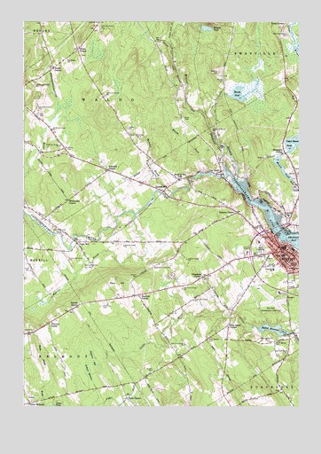
Belfast, ME USGS Topographic Map
Click on map above to begin viewing in our Map Viewer.

This topographic map contains these locations and features:
Feature Name Type Latitude Longitude GNIS ID View Map
BelfastPopulated PlaceN44.4259°W69.0064°562011View Map
Belfast Area High SchoolSchoolN44.4285°W69.0183°2738118View Map
Belfast Free LibraryBuildingN44.4252°W69.0051°2738464View Map
Belfast Municipal AirportAirportN44.4091°W69.0087°581995View Map
Belfast Police DepartmentBuildingN44.4252°W69.0073°2735895View Map
Belfast Post OfficePost OfficeN44.4252°W69.0078°2768982View Map
Belfast Reservoir Number TwoReservoirN44.4000°W69.0112°562014View Map
Belfast Volunteer Fire DepartmentBuildingN44.4244°W69.0197°2552928View Map
Bryants CornerPopulated PlaceN44.4379°W69.0278°563101View Map
Butlers CornerPopulated PlaceN44.4076°W69.1011°579168View Map
Captain Albert Stevens SchoolSchoolN44.4177°W69.0125°2737954View Map
Center BelmontPopulated PlaceN44.3759°W69.1225°579185View Map
City of BelfastCivilN44.4266°W69.0275°582347View Map
City PointPopulated PlaceN44.4512°W69.0350°564006View Map
City Point CemeteryCemeteryN44.4539°W69.0347°2737050View Map
Coastal Regional Reentry CenterBuildingN44.4225°W69.0096°2735965View Map
Cornerspring Montessori SchoolSchoolN44.4209°W69.0223°2738187View Map
Cross CemeteryCemeteryN44.4203°W69.1225°564564View Map
Dog Island CornerPopulated PlaceN44.4015°W69.0314°565169View Map
East Belfast SchoolSchoolN44.4369°W69.0049°565520View Map
Evans CornerPopulated PlaceN44.4906°W69.0998°579302View Map
Evans Corner CemeteryCemeteryN44.4890°W69.0988°2725311View Map
George H Robertson SchoolSchoolN44.4195°W69.0114°574312View Map
Goose River ReservoirReservoirN44.4454°W69.0015°1774038View Map
Governor Anderson SchoolSchoolN44.4295°W69.0136°561252View Map
Grove CemeteryCemeteryN44.4256°W69.0170°567354View Map
Hadley CemeteryCemeteryN44.4653°W69.0775°567415View Map
Halls CornerPopulated PlaceN44.3776°W69.0775°579380View Map
Harvey CemeteryCemeteryN44.4811°W69.0343°567721View Map
Hayford BogSwampN44.3904°W69.0931°567821View Map
Hayford CornerPopulated PlaceN44.4112°W69.0717°579396View Map
Head of the TidePopulated PlaceN44.4487°W69.0539°567843View Map
Head of the Tide CemeteryCemeteryN44.4481°W69.0492°2725334View Map
Hillside CemeteryCemeteryN44.3990°W69.1242°568073View Map
Holmes MillPopulated PlaceN44.4448°W69.0611°568211View Map
Holmes Mill DamDamN44.4446°W69.0630°1773967View Map
Hurds PondReservoirN44.4768°W69.0264°568496View Map
Hurds Pond DamDamN44.4764°W69.0328°1774480View Map
Jackson MeadowSwampN44.3862°W69.0945°568743View Map
Kendalls CornerPopulated PlaceN44.4517°W69.0861°569096View Map
Little River Upper DamDamN44.3989°W69.0040°1774047View Map
Marsh ForkStreamN44.4506°W69.0398°570808View Map
Mason PondReservoirN44.4465°W69.0027°570878View Map
Masons DamDamN44.4571°W69.0064°1774041View Map
National Theatre Workshop of the Handicapped-Crosby SchoolSchoolN44.4242°W69.0062°2630589View Map
Neals CornerPopulated PlaceN44.4851°W69.1114°579550View Map
Nichols PondLakeN44.4978°W69.0419°572161View Map
Park HillSummitN44.4145°W69.0825°572964View Map
Passagassawakeag RiverStreamN44.4306°W69.0078°573042View Map
Passagassawakeag River ReservoirReservoirN44.4446°W69.0630°1773968View Map
Paul CemeteryCemeteryN44.4698°W69.1184°573077View Map
Pierce Elementary SchoolSchoolN44.4209°W69.0011°573320View Map
Piper CemeteryCemeteryN44.4687°W69.0514°573442View Map
Piper StreamStreamN44.4040°W69.0342°573444View Map
Pitcher CemeteryCemeteryN44.4176°W69.0728°573458View Map
Poors MillPopulated PlaceN44.4281°W69.1003°573626View Map
Saint Margaret's Episcopal ChurchChurchN44.4204°W69.0021°574740View Map
Seekens CemeteryCemeteryN44.4831°W69.0359°575225View Map
Shermans CornerPopulated PlaceN44.4581°W69.0064°575395View Map
Shorey CemeteryCemeteryN44.4587°W69.1053°575435View Map
Simmons CemeteryCemeteryN44.4073°W69.0886°575473View Map
Simpsons CornerPopulated PlaceN44.4176°W69.0425°579695View Map
South Belfast CemeteryCemeteryN44.3965°W69.0100°575754View Map
The School Sweetser BelfastSchoolN44.4195°W69.0115°2738206View Map
Toddy Pond SchoolSchoolN44.4973°W69.0291°2738205View Map
Town of BelmontCivilN44.3795°W69.1143°582349View Map
Town of WaldoCivilN44.4748°W69.0910°582785View Map
Troy Howard Middle SchoolSchoolN44.4132°W69.0268°564562View Map
Van Poland SchoolSchoolN44.4879°W69.1050°577689View Map
Vickerys CornerPopulated PlaceN44.4017°W69.1128°579789View Map
Waldo CountyCivilN44.4852°W69.1219°581299View Map
Waldo County JailBuildingN44.4222°W69.0101°2735982View Map
Waldo County Law LibraryBuildingN44.4263°W69.0082°2738378View Map
Waldo County Sheriff's OfficeBuildingN44.4221°W69.0110°2735889View Map
Waldo County Tech Center Region 7 SchoolSchoolN44.4538°W69.0975°2738058View Map
Waldo Fire StationBuildingN44.4526°W69.0902°2553176View Map
Warren BrookStreamN44.4367°W69.0742°577843View Map
Watson CemeteryCemeteryN44.3867°W69.0661°577897View Map
WBMETowerN44.4167°W69.0011°581994View Map
WBME-AM (Belfast)TowerN44.4192°W69.0098°582006View Map
Webster BrookStreamN44.4442°W69.0564°577944View Map
Wescot StreamStreamN44.4487°W69.0278°578010View Map
West Belfast CemeteryCemeteryN44.3967°W69.0409°578026View Map
Whitcombs CornerPopulated PlaceN44.4420°W69.1042°579834View Map
Yorks CornerPopulated PlaceN44.4992°W69.0061°579860View Map

Note: Coordinates in the location and feature list above are referenced to NAD83 datum.


Copyright (C) 2008-2024 Ryan Niemi / Sunset Dynamics ... All Rights Reserved