TopoQuest Logo
Do you find TopoQuest useful?
Help keep TopoQuest running and adding new maps/features by donating!
Bitcoin:  19c7KJd3qBynnjoSw5npx9KScwjBe4ifkT
Litecoin:  LXs6TkuXGGXo1vDsWCkWVdjQX94eUKd6ui
Home View Maps Find Maps Find Places Resources & Links


Almeria, Alabama Topographic Map

USGS Map Title: Almeria, AL
USGS Map MRC: 32085A7
DRG (GeoTIFF) Download: o32085a7.tif


Neighboring USGS Topographic Map Quads:


  Fitzpatrick, AL  
32085B8
 

  Thompson, AL  
32085B7
 

  Union Springs, AL  
32085B6
 

  China Grove, AL  
32085A8
 

  Almeria, AL  
32085A7
 

  Aberfoil, AL  
32085A6
 

  Needmore, AL  
31085H8
 

  Saco, AL  
31085H7
 

  Perote, AL  
31085H6


Map MRC Location:

N33°
W86°
N33°
W85°
H8 H7 H6 H5 H4 H3 H2 H1
G8 G7 G6 G5 G4 G3 G2 G1
F8 F7 F6 F5 F4 F3 F2 F1
E8 E7 E6 E5 E4 E3 E2 E1
D8 D7 D6 D5 D4 D3 D2 D1
C8 C7 C6 C5 C4 C3 C2 C1
B8 B7 B6 B5 B4 B3 B2 B1
A8 A7 A6 A5 A4 A3 A2 A1
N32°
W86°
N32°
W85°

Almeria, AL USGS 1:24K Topographic Map Preview:
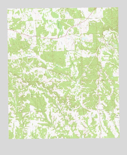
Almeria, AL USGS Topographic Map
Click on map above to begin viewing in our Map Viewer.

This topographic map contains these locations and features:
Feature Name Type Latitude Longitude GNIS ID View Map
Allen LakeReservoirN32.0679°W85.7711°135194View Map
AlmeriaPopulated PlaceN32.0265°W85.8505°155990View Map
Almeria ChurchChurchN32.0065°W85.8541°113041View Map
Almeria Fire DepartmentBuildingN32.0303°W85.8585°2691497View Map
Beaverdam CreekStreamN32.0004°W85.8019°113759View Map
Bethlehem ChurchChurchN32.0985°W85.8436°114126View Map
Bread Tray HillPopulated PlaceN32.0640°W85.7705°149521View Map
BrucevillePopulated PlaceN32.0979°W85.8483°156122View Map
Bullock County Technical High SchoolSchoolN32.0215°W85.7527°155366View Map
Caylers Store (historical)LocaleN32.0143°W85.8505°135204View Map
Deason School (historical)SchoolN32.0349°W85.8180°135214View Map
East CreekStreamN32.0529°W85.7983°117746View Map
Faith TabernacleChurchN32.0282°W85.8622°118167View Map
Goodman LakeReservoirN32.0683°W85.7664°135222View Map
Henderson LakeReservoirN32.0011°W85.7921°130050View Map
Henderson Lake DamDamN32.0002°W85.7916°130051View Map
High Ridge CemeteryCemeteryN32.0232°W85.7724°120064View Map
Hooks CrossroadsPopulated PlaceN32.0515°W85.8527°156492View Map
Hubbard CemeteryCemeteryN32.0326°W85.8166°120491View Map
Hubbards Store (historical)LocaleN32.1104°W85.7894°135230View Map
Inverness CemeteryCemeteryN32.0215°W85.7541°149524View Map
Jenkins CrossroadsPopulated PlaceN32.0263°W85.7744°156528View Map
King DitchCanalN32.0802°W85.7936°121222View Map
Lake VannReservoirN32.1235°W85.7966°130176View Map
Lake Vann DamDamN32.1235°W85.7966°130175View Map
Liberty Baptist ChurchChurchN32.0121°W85.8111°155877View Map
Liberty CemeteryCemeteryN32.0132°W85.8111°149526View Map
Little Sardis ChurchChurchN32.1085°W85.7972°121883View Map
Macedonia Baptist ChurchChurchN32.0421°W85.8497°155143View Map
Magnolia Church (historical)ChurchN32.0671°W85.7691°135238View Map
Martin LakeReservoirN32.0861°W85.7645°135239View Map
Martins Store (historical)LocaleN32.0935°W85.7594°135240View Map
Mascotte (historical)LocaleN32.0460°W85.8302°135241View Map
Mount HillardPopulated PlaceN32.0602°W85.8680°135248View Map
Mount Hilliard ChurchChurchN32.0604°W85.8688°123222View Map
Mountain CreekStreamN32.0727°W85.8030°123509View Map
New Hope ChurchChurchN32.0438°W85.8336°123811View Map
New Hope School (historical)SchoolN32.0393°W85.8341°135258View Map
Old Sardis ChurchChurchN32.0918°W85.7605°135275View Map
Old Town Creek Watershed Dam Number 24DamN32.0652°W85.8050°130104View Map
Old Town Creek Watershed Dam Number 25DamN32.0535°W85.8083°130083View Map
Old Town Creek Watershed Dam Number 26DamN32.0552°W85.7966°130088View Map
Old Town Creek Watershed Lake Number 24ReservoirN32.0652°W85.8050°130103View Map
Old Town Creek Watershed Lake Number 25ReservoirN32.0533°W85.8067°130084View Map
Old Town Creek Watershed Lake Number 26ReservoirN32.0545°W85.7950°130087View Map
Paulk LakeReservoirN32.0954°W85.7885°130125View Map
Paulk Pond DamDamN32.0952°W85.7916°130124View Map
Pitts Gin (historical)LocaleN32.0799°W85.7897°135264View Map
Post Oak Junior High School (historical)SchoolN32.0010°W85.8191°154390View Map
PostoakPopulated PlaceN32.0010°W85.8199°156923View Map
Roughtons Store (historical)LocaleN32.0099°W85.8519°135271View Map
SardisPopulated PlaceN32.0890°W85.7627°126398View Map
Sardis CemeteryCemeteryN32.0882°W85.7616°149535View Map
Sardis School (historical)SchoolN32.0835°W85.7694°135276View Map
SimsvillePopulated PlaceN32.1046°W85.8708°126893View Map
WSCA-FM (Union Springs)TowerN32.0963°W85.8044°161149View Map

Note: Coordinates in the location and feature list above are referenced to NAD83 datum.


Copyright (C) 2008-2024 Ryan Niemi / Sunset Dynamics ... All Rights Reserved