TopoQuest Logo
Do you find TopoQuest useful?
Help keep TopoQuest running and adding new maps/features by donating!
Bitcoin:  19c7KJd3qBynnjoSw5npx9KScwjBe4ifkT
Litecoin:  LXs6TkuXGGXo1vDsWCkWVdjQX94eUKd6ui
Home View Maps Find Maps Find Places Resources & Links


Burro Canyon, Texas Topographic Map

USGS Map Title: Burro Canyon, TX
USGS Map MRC: 31104E6
DRG (GeoTIFF) Download: o31104e6.tif


Neighboring USGS Topographic Map Quads:


  Six Bar Ranch, TX  
31104F7
 

  Chico Draw West, TX  
31104F6
 

  Chico Draw East, TX  
31104F5
 

  Bitter Well Mountain, TX  
31104E7
 

  Burro Canyon, TX  
31104E6
 

  Emory Corral, TX  
31104E5
 

  Figure Two Ranch, TX  
31104D7
 

  Seven Heart Gap NW, TX  
31104D6
 

  Delaware Ranch, TX  
31104D5


Map MRC Location:

N32°
W105°
N32°
W104°
H8 H7 H6 H5 H4 H3 H2 H1
G8 G7 G6 G5 G4 G3 G2 G1
F8 F7 F6 F5 F4 F3 F2 F1
E8 E7 E6 E5 E4 E3 E2 E1
D8 D7 D6 D5 D4 D3 D2 D1
C8 C7 C6 C5 C4 C3 C2 C1
B8 B7 B6 B5 B4 B3 B2 B1
A8 A7 A6 A5 A4 A3 A2 A1
N31°
W105°
N31°
W104°

Burro Canyon, TX USGS 1:24K Topographic Map Preview:
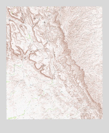
Burro Canyon, TX USGS Topographic Map
Click on map above to begin viewing in our Map Viewer.

This topographic map contains these locations and features:
Feature Name Type Latitude Longitude GNIS ID View Map
Apache TankReservoirN31.5479°W104.6844°1351219View Map
Bitter Well CanyonValleyN31.5591°W104.7399°1352264View Map
Boulder TankReservoirN31.6106°W104.7477°1352721View Map
Burro CanyonValleyN31.5443°W104.6888°1353383View Map
Cistern CanyonValleyN31.5744°W104.7158°1354512View Map
Codorniz CanyonValleyN31.5665°W104.7278°1354722View Map
Cooky Hat PointSummitN31.6115°W104.7138°1354913View Map
Delaware MountainsRangeN31.5975°W104.6496°1355886View Map
Janes WindowGapN31.5596°W104.7019°1360155View Map
Leed TankReservoirN31.6240°W104.6797°1361046View Map
Little Codorniz CanyonValleyN31.6015°W104.7174°1361313View Map
Middle TankReservoirN31.6074°W104.7024°1362759View Map
Nester TankReservoirN31.5299°W104.6798°1363672View Map
No Mans CanyonValleyN31.6053°W104.7257°1363937View Map
Pezuna del CaballoPopulated PlaceN31.5673°W104.6977°1380352View Map
Posey WellWellN31.6110°W104.7472°1365619View Map
Roberts CampLocaleN31.5426°W104.7313°1366582View Map
Twin TanksReservoirN31.5374°W104.7212°1370370View Map

Note: Coordinates in the location and feature list above are referenced to NAD83 datum.


Copyright (C) 2008-2024 Ryan Niemi / Sunset Dynamics ... All Rights Reserved