TopoQuest Logo
Do you find TopoQuest useful?
Help keep TopoQuest running and adding new maps/features by donating!
Bitcoin:  19c7KJd3qBynnjoSw5npx9KScwjBe4ifkT
Litecoin:  LXs6TkuXGGXo1vDsWCkWVdjQX94eUKd6ui
Home View Maps Find Maps Find Places Resources & Links


Burnt Peak, Washington Topographic Map

USGS Map Title: Burnt Peak, WA
USGS Map MRC: 46121A8
DRG (GeoTIFF) Download: o46121a8.tif


Neighboring USGS Topographic Map Quads:


  Smith Creek Butte, WA  
46122B1
 

  Spencer Butte, WA  
46121B8
 

  Quartz Creek Butte, WA  
46121B7
 

  Cedar Flats, WA  
46122A1
 

  Burnt Peak, WA  
46121A8
 

  Lone Butte, WA  
46121A7
 

  Bare Mountain, WA  
45122H1
 

  Termination Point, WA  
45121H8
 

  Gifford Peak, WA  
45121H7


Map MRC Location:

N47°
W122°
N47°
W121°
H8 H7 H6 H5 H4 H3 H2 H1
G8 G7 G6 G5 G4 G3 G2 G1
F8 F7 F6 F5 F4 F3 F2 F1
E8 E7 E6 E5 E4 E3 E2 E1
D8 D7 D6 D5 D4 D3 D2 D1
C8 C7 C6 C5 C4 C3 C2 C1
B8 B7 B6 B5 B4 B3 B2 B1
A8 A7 A6 A5 A4 A3 A2 A1
N46°
W122°
N46°
W121°

Burnt Peak, WA USGS 1:24K Topographic Map Preview:
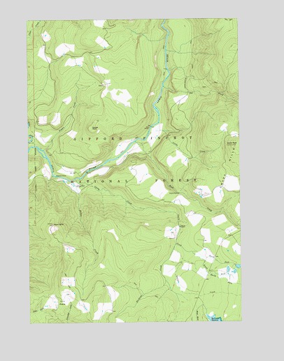
Burnt Peak, WA USGS Topographic Map
Click on map above to begin viewing in our Map Viewer.

This topographic map contains these locations and features:
Feature Name Type Latitude Longitude GNIS ID View Map
Big CreekStreamN46.0968°W121.9204°1516484View Map
Big Creek FallsLocaleN46.0943°W121.9087°1529582View Map
Big Creek Falls ViewpointLocaleN46.0957°W121.9101°1529583View Map
Bolt ShelterLocaleN46.0804°W121.9295°1529466View Map
Burnt PeakSummitN46.0723°W121.8804°1517131View Map
Burnt Peak LookoutLocaleN46.0726°W121.8804°1530099View Map
Crazy HillsRangeN46.0680°W121.8754°1518301View Map
Curly CreekStreamN46.0593°W121.9731°1518420View Map
Curly Creek CampgroundLocaleN46.0565°W121.9679°1518421View Map
Curly Creek FallsFallsN46.0582°W121.9720°1529581View Map
Curly Creek Falls ViewpointLocaleN46.0590°W121.9751°1529580View Map
Hardtime CreekStreamN46.0321°W121.9143°1520542View Map
House RockSummitN46.0801°W121.9640°1520984View Map
Kum Back ShelterLocaleN46.0984°W121.9020°1529298View Map
Little CreekStreamN46.0821°W121.9229°1522191View Map
Miller CreekStreamN46.0582°W121.9759°1523176View Map
North Fork Curley CreekStreamN46.0287°W121.9045°1523765View Map
North Fork Outlaw CreekStreamN46.0259°W121.9106°1523815View Map
North Skamania DivisionCivilN46.0877°W121.9144°1939514View Map
Outlaw CreekStreamN46.0307°W121.9154°1524102View Map
Outlaw Ridge Volcanic ViewpointLocaleN46.0359°W121.9012°1529297View Map
Pepper CreekStreamN46.0712°W121.9923°1524332View Map
Point 3670CliffN46.0404°W121.9865°1524531View Map
Point 3670 LookoutLocaleN46.0407°W121.9868°1530215View Map
Rush CreekStreamN46.0746°W121.9373°1525286View Map
Skamania CountyCivilN46.0230°W121.9148°1529220View Map
South Fork Curley CreekStreamN46.0287°W121.9045°1526185View Map
Two Times Four PrairieFlatN46.0084°W121.9818°1527570View Map

Note: Coordinates in the location and feature list above are referenced to NAD83 datum.


Copyright (C) 2008-2024 Ryan Niemi / Sunset Dynamics ... All Rights Reserved