TopoQuest Logo
Do you find TopoQuest useful?
Help keep TopoQuest running and adding new maps/features by donating!
Bitcoin:  19c7KJd3qBynnjoSw5npx9KScwjBe4ifkT
Litecoin:  LXs6TkuXGGXo1vDsWCkWVdjQX94eUKd6ui
Home View Maps Find Maps Find Places Resources & Links


Abes Knob, Idaho Topographic Map

USGS Map Title: Abes Knob, ID
USGS Map MRC: 46116H4
DRG (GeoTIFF) Download: o46116h4.tif


Neighboring USGS Topographic Map Quads:


  Emida, ID  
47116A5
 

  Fernwood, ID  
47116A4
 

  Clarkia, ID  
47116A3
 

  Sand Mountain, ID  
46116H5
 

  Abes Knob, ID  
46116H4
 

  Bechtel Butte, ID  
46116H3
 

  Deary, ID  
46116G5
 

  Bovill, ID  
46116G4
 

  McGary Butte, ID  
46116G3


Map MRC Location:

N47°
W117°
N47°
W116°
H8 H7 H6 H5 H4 H3 H2 H1
G8 G7 G6 G5 G4 G3 G2 G1
F8 F7 F6 F5 F4 F3 F2 F1
E8 E7 E6 E5 E4 E3 E2 E1
D8 D7 D6 D5 D4 D3 D2 D1
C8 C7 C6 C5 C4 C3 C2 C1
B8 B7 B6 B5 B4 B3 B2 B1
A8 A7 A6 A5 A4 A3 A2 A1
N46°
W117°
N46°
W116°

Abes Knob, ID USGS 1:24K Topographic Map Preview:
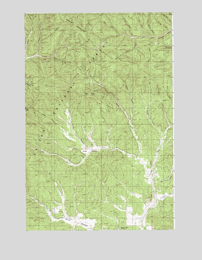
Abes Knob, ID USGS Topographic Map
Click on map above to begin viewing in our Map Viewer.

This topographic map contains these locations and features:
Feature Name Type Latitude Longitude GNIS ID View Map
Abes KnobSummitN46.9524°W116.4454°376459View Map
Cougar CreekStreamN46.9213°W116.4440°379896View Map
Cougar MeadowsFlatN46.9207°W116.4465°379906View Map
Feather CreekStreamN46.9152°W116.4040°381636View Map
Fern CreekStreamN46.9757°W116.4913°381666View Map
Flat CreekStreamN46.9868°W116.3999°381832View Map
Highline CreekStreamN46.9855°W116.4077°383187View Map
Laguna CreekStreamN46.9371°W116.4121°384337View Map
Mizpah MineMineN46.9991°W116.4927°387059View Map
Moose MeadowsFlatN46.8788°W116.4507°387196View Map
Nat Brown CreekStreamN46.9016°W116.3943°387478View Map
Pee Wee GulchValleyN46.9907°W116.3807°400033View Map
Pittwood CreekStreamN46.9835°W116.4874°388575View Map
Porcupine CreekStreamN46.9338°W116.3782°388753View Map
Post CreekStreamN46.9871°W116.4202°388798View Map
PurdueLocaleN46.8899°W116.3963°394880View Map
Purdue CreekStreamN46.8918°W116.3910°388930View Map
Sheep CreekStreamN46.9293°W116.3832°390194View Map
Swamp CreekStreamN46.9855°W116.4090°391708View Map
Talapus CreekStreamN46.9305°W116.4599°391821View Map
West Fork Potlatch RiverStreamN46.9071°W116.3974°393172View Map
Wolf CreekStreamN46.9405°W116.3824°400177View Map

Note: Coordinates in the location and feature list above are referenced to NAD83 datum.


Copyright (C) 2008-2024 Ryan Niemi / Sunset Dynamics ... All Rights Reserved