TopoQuest Logo
Do you find TopoQuest useful?
Help keep TopoQuest running and adding new maps/features by donating!
Bitcoin:  19c7KJd3qBynnjoSw5npx9KScwjBe4ifkT
Litecoin:  LXs6TkuXGGXo1vDsWCkWVdjQX94eUKd6ui
Home View Maps Find Maps Find Places Resources & Links


Allamoore, Texas Topographic Map

USGS Map Title: Allamoore, TX
USGS Map MRC: 31105A1
DRG (GeoTIFF) Download: o31105a1.tif


Neighboring USGS Topographic Map Quads:


  Dome Peak, TX  
31105B2
 

  Bean Hills, TX  
31105B1
 

  Sheep Peak, TX  
31104B8
 

  Grayton Lake, TX  
31105A2
 

  Allamoore, TX  
31105A1
 

  Hackett Peak, TX  
31104A8
 

  Eagle Mountains NW, TX  
30105H2
 

  Eagle Mountains NE, TX  
30105H1
 

  Bass Canyon, TX  
30104H8


Map MRC Location:

N32°
W106°
N32°
W105°
H8 H7 H6 H5 H4 H3 H2 H1
G8 G7 G6 G5 G4 G3 G2 G1
F8 F7 F6 F5 F4 F3 F2 F1
E8 E7 E6 E5 E4 E3 E2 E1
D8 D7 D6 D5 D4 D3 D2 D1
C8 C7 C6 C5 C4 C3 C2 C1
B8 B7 B6 B5 B4 B3 B2 B1
A8 A7 A6 A5 A4 A3 A2 A1
N31°
W106°
N31°
W105°

Allamoore, TX USGS 1:24K Topographic Map Preview:
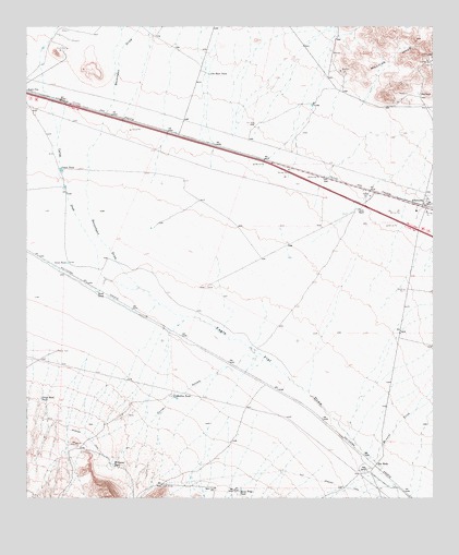
Allamoore, TX USGS Topographic Map
Click on map above to begin viewing in our Map Viewer.

This topographic map contains these locations and features:
Feature Name Type Latitude Longitude GNIS ID View Map
AllamoorePopulated PlaceN31.0782°W105.0036°1380817View Map
Booth RanchLocaleN31.0768°W105.0233°1352685View Map
Camel DrawValleyN31.0557°W105.0908°1372881View Map
Camel TankReservoirN31.0870°W105.1150°1353597View Map
Corral ArroyoValleyN31.0348°W105.0638°1353859View Map
Dees RanchLocaleN31.1074°W105.0047°1355874View Map
Espy RanchLocaleN31.0079°W105.0208°1357075View Map
Goat CanyonValleyN31.0298°W105.1095°1358081View Map
Horse Trap TankReservoirN31.0025°W105.0595°1359613View Map
Hot WellsLocaleN31.0087°W105.0183°1359694View Map
Jim Bean TankReservoirN31.1125°W105.0694°1360253View Map
Martin TankReservoirN31.0270°W105.0800°1362230View Map
Mineral CreekStreamN31.0110°W105.0177°1374966View Map
Road TankReservoirN31.0548°W105.1036°1366546View Map
Seventeen DrawValleyN31.0557°W105.0908°1376073View Map
Silva TankReservoirN31.0624°W105.1129°1368272View Map
Stage Road TankReservoirN31.0264°W105.1210°1369083View Map
Williams TankReservoirN31.0094°W105.0988°1371587View Map

Note: Coordinates in the location and feature list above are referenced to NAD83 datum.


Copyright (C) 2008-2024 Ryan Niemi / Sunset Dynamics ... All Rights Reserved