TopoQuest Logo
Do you find TopoQuest useful?
Help keep TopoQuest running and adding new maps/features by donating!
Bitcoin:  19c7KJd3qBynnjoSw5npx9KScwjBe4ifkT
Litecoin:  LXs6TkuXGGXo1vDsWCkWVdjQX94eUKd6ui
Home View Maps Find Maps Find Places Resources & Links


Bronson, Texas Topographic Map

USGS Map Title: Bronson, TX
USGS Map MRC: 31094C1
DRG (GeoTIFF) Download: o31094c1.tif


Neighboring USGS Topographic Map Quads:


  Norwood, TX  
31094D2
 

  Chinquapin, TX  
31094D1
 

  Geneva, TX  
31093D8
 

  Harvey Creek, TX  
31094C2
 

  Bronson, TX  
31094C1
 

  Pineland North, TX  
31093C8
 

  Veach, TX  
31094B2
 

  Buck Bay, TX  
31094B1
 

  Pineland South, TX  
31093B8


Map MRC Location:

N32°
W95°
N32°
W94°
H8 H7 H6 H5 H4 H3 H2 H1
G8 G7 G6 G5 G4 G3 G2 G1
F8 F7 F6 F5 F4 F3 F2 F1
E8 E7 E6 E5 E4 E3 E2 E1
D8 D7 D6 D5 D4 D3 D2 D1
C8 C7 C6 C5 C4 C3 C2 C1
B8 B7 B6 B5 B4 B3 B2 B1
A8 A7 A6 A5 A4 A3 A2 A1
N31°
W95°
N31°
W94°

Bronson, TX USGS 1:24K Topographic Map Preview:
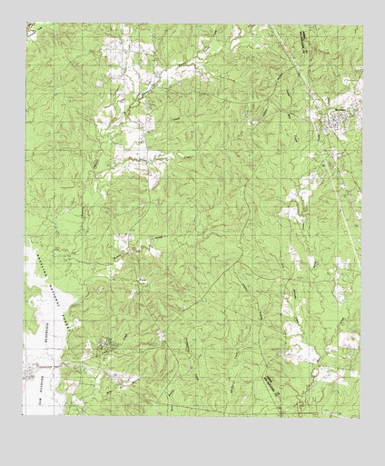
Bronson, TX USGS Topographic Map
Click on map above to begin viewing in our Map Viewer.

This topographic map contains these locations and features:
Feature Name Type Latitude Longitude GNIS ID View Map
Anthony HarborPopulated PlaceN31.2655°W94.1232°1383722View Map
Beauchamp Family CemeteryCemeteryN31.3000°W94.0247°2575478View Map
Blue SpringsPopulated PlaceN31.2766°W94.0741°1381468View Map
Bobbitt CemeteryCemeteryN31.3080°W94.0860°1381471View Map
Bobbitt CreekStreamN31.2935°W94.1027°1381473View Map
BronsonPopulated PlaceN31.3441°W94.0135°1381518View Map
Bronson CemeteryCemeteryN31.3483°W94.0181°2575484View Map
Bronson Post OfficePost OfficeN31.3430°W94.0134°2731740View Map
Bronson Rural Volunteer Fire DepartmentBuildingN31.3452°W94.0107°2655209View Map
Caney CreekStreamN31.3485°W94.0860°1381586View Map
Caney CreekStreamN31.3724°W94.1249°1381587View Map
Centerview CemeteryCemeteryN31.2982°W94.0088°1381619View Map
Chiamon BayouStreamN31.2899°W94.1185°1383062View Map
Copelle CreekStreamN31.2763°W94.1171°1383071View Map
Dickey CreekStreamN31.3241°W94.0980°1381760View Map
Farrise CreekStreamN31.3649°W94.0616°1381866View Map
Glen OaksPopulated PlaceN31.2691°W94.0982°1383721View Map
Goose BranchStreamN31.2530°W94.1196°1381929View Map
Horton CemeteryCemeteryN31.3741°W94.0363°1382037View Map
Jack Williams CreekStreamN31.2699°W94.0146°1382070View Map
Little CreekStreamN31.2582°W94.0977°1382168View Map
Little CreekStreamN31.2946°W94.0991°1382169View Map
Little Flock Missionary ChurchChurchN31.3457°W94.0791°1382178View Map
Martin CemeteryCemeteryN31.2627°W94.0038°1382232View Map
McBride CemeteryCemeteryN31.3261°W94.0158°2575515View Map
McClelland Family CemeteryCemeteryN31.2900°W94.0281°2575516View Map
Old Centerview CemeteryCemeteryN31.2981°W94.0075°2575489View Map
Sabine County Constable's Office Precinct 2BuildingN31.3505°W94.0023°2751468View Map
Sandy CreekStreamN31.2741°W94.0124°1388208View Map
Sandy CreekStreamN31.2907°W94.1196°1382716View Map
Steep Mile CreekStreamN31.3288°W94.0244°1382809View Map
Tiger CreekStreamN31.3382°W94.0966°1382862View Map
Tilde CreekStreamN31.2596°W94.1216°1382866View Map
Whitton Family CemeteryCemeteryN31.2822°W94.0017°2575545View Map
Woods CemeteryCemeteryN31.2535°W94.1088°1382992View Map

Note: Coordinates in the location and feature list above are referenced to NAD83 datum.


Copyright (C) 2008-2024 Ryan Niemi / Sunset Dynamics ... All Rights Reserved