TopoQuest Logo
Do you find TopoQuest useful?
Help keep TopoQuest running and adding new maps/features by donating!
Bitcoin:  19c7KJd3qBynnjoSw5npx9KScwjBe4ifkT
Litecoin:  LXs6TkuXGGXo1vDsWCkWVdjQX94eUKd6ui
Home View Maps Find Maps Find Places Resources & Links


Alexis, Illinois Topographic Map

USGS Map Title: Alexis, IL
USGS Map MRC: 41090A5
DRG (GeoTIFF) Download: o41090a5.tif


Neighboring USGS Topographic Map Quads:


  Aledo East, IL  
41090B6
 

  Viola, IL  
41090B5
 

  New Windsor, IL  
41090B4
 

  Little York, IL  
41090A6
 

  Alexis, IL  
41090A5
 

  North Henderson, IL  
41090A4
 

  Monmouth, IL  
40090H6
 

  Cameron, IL  
40090H5
 

  Galesburg West, IL  
40090H4


Map MRC Location:

N42°
W91°
N42°
W90°
H8 H7 H6 H5 H4 H3 H2 H1
G8 G7 G6 G5 G4 G3 G2 G1
F8 F7 F6 F5 F4 F3 F2 F1
E8 E7 E6 E5 E4 E3 E2 E1
D8 D7 D6 D5 D4 D3 D2 D1
C8 C7 C6 C5 C4 C3 C2 C1
B8 B7 B6 B5 B4 B3 B2 B1
A8 A7 A6 A5 A4 A3 A2 A1
N41°
W91°
N41°
W90°

Alexis, IL USGS 1:24K Topographic Map Preview:
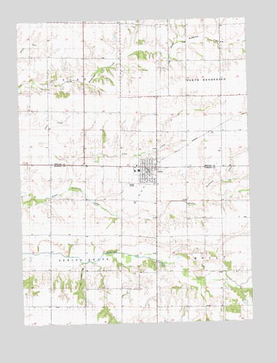
Alexis, IL USGS Topographic Map
Click on map above to begin viewing in our Map Viewer.

This topographic map contains these locations and features:
Feature Name Type Latitude Longitude GNIS ID View Map
AlexisPopulated PlaceN41.0634°W90.5560°403405View Map
Alexis Elementary SchoolSchoolN41.0628°W90.5624°1823681View Map
Alexis Fire Protection DistrictBuildingN41.0614°W90.5550°2640587View Map
Alexis High SchoolSchoolN41.0631°W90.5604°1823682View Map
Alexis North Henderson Ambulance ServiceBuildingN41.0613°W90.5548°2674013View Map
Alexis Police DepartmentBuildingN41.0640°W90.5552°2757028View Map
Alexis Post OfficePost OfficeN41.0625°W90.5560°2788216View Map
Center School (historical)SchoolN41.0161°W90.6090°405831View Map
Center School (historical)SchoolN41.1106°W90.6243°405832View Map
Indian Grove School (historical)SchoolN41.0078°W90.5704°410857View Map
Mohler School (historical)SchoolN41.0370°W90.5857°413706View Map
Pioneer School (historical)SchoolN41.1084°W90.5324°415729View Map
Pleasant Hill School (historical)SchoolN41.0809°W90.6099°415860View Map
Republican School (historical)SchoolN41.0434°W90.5340°416541View Map
Sedwick School (historical)SchoolN41.1245°W90.5893°418182View Map
Shadyside School (historical)SchoolN41.0878°W90.5690°418264View Map
Sunnyside School (historical)SchoolN41.0789°W90.5332°419398View Map
Toms CreekStreamN41.0575°W90.5996°419775View Map
Township of Spring GroveCivilN41.0223°W90.6103°429788View Map
Township of SuezCivilN41.1098°W90.6082°429807View Map
Village of AlexisCivilN41.0629°W90.5554°2397929View Map

Note: Coordinates in the location and feature list above are referenced to NAD83 datum.


Copyright (C) 2008-2024 Ryan Niemi / Sunset Dynamics ... All Rights Reserved