TopoQuest Logo
Do you find TopoQuest useful?
Help keep TopoQuest running and adding new maps/features by donating!
Bitcoin:  19c7KJd3qBynnjoSw5npx9KScwjBe4ifkT
Litecoin:  LXs6TkuXGGXo1vDsWCkWVdjQX94eUKd6ui
Home View Maps Find Maps Find Places Resources & Links


Woodstock, New York Topographic Map

USGS Map Title: Woodstock, NY
USGS Map MRC: 42074A1
DRG (GeoTIFF) Download: o42074a1.tif


Neighboring USGS Topographic Map Quads:


  Hunter, NY  
42074B2
 

  Kaaterskill Clove, NY  
42074B1
 

  Cementon, NY  
42073B8
 

  Bearsville, NY  
42074A2
 

  Woodstock, NY  
42074A1
 

  Saugerties, NY  
42073A8
 

  Ashokan, NY  
41074H2
 

  Kingston West, NY  
41074H1
 

  Kingston East, NY  
41073H8


Map MRC Location:

N43°
W75°
N43°
W74°
H8 H7 H6 H5 H4 H3 H2 H1
G8 G7 G6 G5 G4 G3 G2 G1
F8 F7 F6 F5 F4 F3 F2 F1
E8 E7 E6 E5 E4 E3 E2 E1
D8 D7 D6 D5 D4 D3 D2 D1
C8 C7 C6 C5 C4 C3 C2 C1
B8 B7 B6 B5 B4 B3 B2 B1
A8 A7 A6 A5 A4 A3 A2 A1
N42°
W75°
N42°
W74°

Woodstock, NY USGS 1:24K Topographic Map Preview:
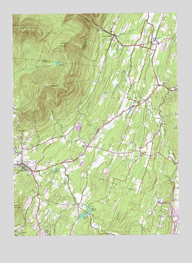
Woodstock, NY USGS Topographic Map
Click on map above to begin viewing in our Map Viewer.

This topographic map contains these locations and features:
Feature Name Type Latitude Longitude GNIS ID View Map
Blue MountainPopulated PlaceN42.1084°W74.0199°944314View Map
Blue Mountain Reformed ChurchChurchN42.1091°W74.0203°2598109View Map
Center for Photography at WoodstockBuildingN42.0403°W74.1203°2599451View Map
CentervillePopulated PlaceN42.0843°W74.0132°946216View Map
Centerville Fire CompanyBuildingN42.0838°W74.0135°2718441View Map
Chestnut Hill CemeteryCemeteryN42.0638°W74.0543°946548View Map
Christs Lutheran ChurchChurchN42.0403°W74.1174°2598320View Map
DaisyPopulated PlaceN42.0559°W74.0876°947992View Map
Echo LakeLakeN42.0971°W74.0907°949340View Map
Elliot Mobile Home ParkPopulated PlaceN42.0035°W74.0261°2599359View Map
Fish CreekPopulated PlaceN42.0620°W74.0129°950124View Map
High WoodsPopulated PlaceN42.0456°W74.0285°952770View Map
High Woods Reformed ChurchChurchN42.0446°W74.0283°2598117View Map
Indian Head MountainSummitN42.1162°W74.1146°953655View Map
Kingston Reservoir Number FourReservoirN42.0110°W74.0732°954688View Map
Kingston Reservoir Number OneReservoirN42.0140°W74.0677°954686View Map
Kingston Reservoir Number TwoReservoirN42.0372°W74.0936°954687View Map
Lewis HollowValleyN42.0514°W74.0828°955249View Map
Lucas KillStreamN42.1204°W74.0185°956127View Map
Morse SchoolSchoolN42.1075°W74.0139°2597247View Map
Mount Marion Elementary SchoolSchoolN42.0413°W74.0002°2598094View Map
Overlook MountainSummitN42.0851°W74.0932°959659View Map
Pine Grove SchoolSchoolN42.0748°W74.0293°960454View Map
Plattekill CloveValleyN42.1156°W74.0582°960692View Map
Plattekill MountainSummitN42.1073°W74.0865°960694View Map
Rip Van Winkle CampgroundLocaleN42.0921°W74.0210°2599409View Map
RubyPopulated PlaceN42.0181°W74.0149°963066View Map
Ruby Post OfficePost OfficeN42.0178°W74.0143°2599334View Map
Ruby Volunteer Fire DepartmentBuildingN42.0157°W74.0180°2735454View Map
Saint Gregory Episcopal ChurchChurchN42.0377°W74.1032°2598325View Map
Saint John the Evangelist ChurchChurchN42.0807°W74.0162°2598131View Map
Saint Johns Roman Catholic ChurchChurchN42.0168°W74.1086°2598132View Map
Saugerties ReservoirReservoirN42.1102°W74.0177°964503View Map
School Number 14 (historical)SchoolN42.0445°W74.0290°975076View Map
School Number 15 (historical)SchoolN42.0543°W74.0760°975100View Map
School Number 3 (historical)SchoolN42.0195°W74.0040°975239View Map
Shultis CornersPopulated PlaceN42.0504°W74.0688°965187View Map
Strip In the Woods AirportAirportN42.0170°W74.0478°978377View Map
Trinity Baptist ChurchChurchN42.0718°W74.0742°2598136View Map
Trinka's Mobile Home ParkPopulated PlaceN42.0423°W74.0405°2599380View Map
WAMK-FM (Kingston)TowerN42.0731°W74.1071°978533View Map
West Hurley Census Designated PlaceCensusN42.0083°W74.1121°2390478View Map
West Hurley Public LibraryBuildingN42.0004°W74.1039°2599436View Map
West SaugertiesPopulated PlaceN42.1126°W74.0482°970859View Map
WFGB-FM (Kingston)TowerN42.0731°W74.1071°978532View Map
WoodstockPopulated PlaceN42.0409°W74.1182°971721View Map
Woodstock Census Designated PlaceCensusN42.0414°W74.1177°2390539View Map
Woodstock Elementary SchoolSchoolN42.0351°W74.1117°2598097View Map
Woodstock Fire and Rescue DepartmentBuildingN42.0405°W74.1216°2718494View Map
Woodstock Fire District Training FacilityBuildingN42.0640°W74.0758°2735498View Map
Woodstock Fire District Zena Company 4BuildingN42.0162°W74.0768°2718763View Map
Woodstock Golf ClubLocaleN42.0340°W74.1077°2599419View Map
Woodstock Public LibraryBuildingN42.0409°W74.1224°2599437View Map
Woodstock Reformed ChurchChurchN42.0412°W74.1191°2598140View Map
WTZA-TV (Kingston)TowerN42.0851°W74.0996°978633View Map
ZenaPopulated PlaceN42.0168°W74.0763°971869View Map
Zena Census Designated PlaceCensusN42.0210°W74.0855°2390555View Map
Zena Elementary SchoolSchoolN42.0167°W74.0733°2598098View Map

Note: Coordinates in the location and feature list above are referenced to NAD83 datum.


Copyright (C) 2008-2024 Ryan Niemi / Sunset Dynamics ... All Rights Reserved