TopoQuest Logo
Do you find TopoQuest useful?
Help keep TopoQuest running and adding new maps/features by donating!
Bitcoin:  19c7KJd3qBynnjoSw5npx9KScwjBe4ifkT
Litecoin:  LXs6TkuXGGXo1vDsWCkWVdjQX94eUKd6ui
Home View Maps Find Maps Find Places Resources & Links


Winters, California Topographic Map

USGS Map Title: Winters, CA
USGS Map MRC: 38121E8
DRG (GeoTIFF) Download: o38121e8.tif


Neighboring USGS Topographic Map Quads:


  Esparto, CA  
38122F1
 

  Madison, CA  
38121F8
 

  Woodland, CA  
38121F7
 

  Monticello Dam, CA  
38122E1
 

  Winters, CA  
38121E8
 

  Merritt, CA  
38121E7
 

  Mount Vaca, CA  
38122D1
 

  Allendale, CA  
38121D8
 

  Dixon, CA  
38121D7


Map MRC Location:

N39°
W122°
N39°
W121°
H8 H7 H6 H5 H4 H3 H2 H1
G8 G7 G6 G5 G4 G3 G2 G1
F8 F7 F6 F5 F4 F3 F2 F1
E8 E7 E6 E5 E4 E3 E2 E1
D8 D7 D6 D5 D4 D3 D2 D1
C8 C7 C6 C5 C4 C3 C2 C1
B8 B7 B6 B5 B4 B3 B2 B1
A8 A7 A6 A5 A4 A3 A2 A1
N38°
W122°
N38°
W121°

Winters, CA USGS 1:24K Topographic Map Preview:
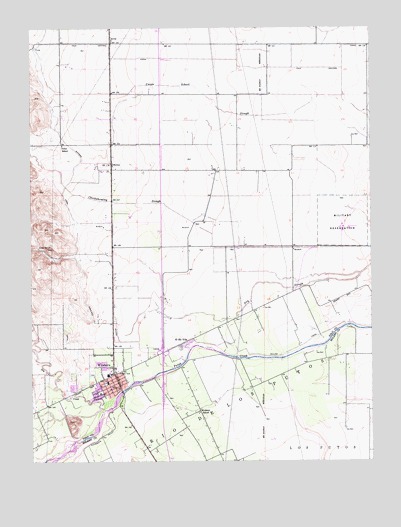
Winters, CA USGS Topographic Map
Click on map above to begin viewing in our Map Viewer.

This topographic map contains these locations and features:
Feature Name Type Latitude Longitude GNIS ID View Map
ArrozPopulated PlaceN38.6207°W121.9711°252618View Map
City of WintersCivilN38.5320°W121.9781°2412288View Map
Dixon Ridge FarmsLocaleN38.5189°W121.9011°2676145View Map
Dry CreekStreamN38.5146°W121.9741°222622View Map
El Rio VillaPopulated PlaceN38.5346°W121.9441°1658483View Map
Felica Diaz ParkParkN38.5199°W121.9758°1703151View Map
Highland CanalCanalN38.5457°W121.9866°225286View Map
John Clayton KinderschoolSchoolN38.5227°W121.9733°1703170View Map
Liwaito (historical)Populated PlaceN38.5221°W121.9708°1703175View Map
NortonPopulated PlaceN38.5860°W121.9711°252753View Map
Rio De Los PutosCivilN38.5216°W121.9219°231619View Map
Union SchoolSchoolN38.5913°W121.9891°236847View Map
Valley Oak ParkParkN38.5194°W121.9889°1703207View Map
Waggoner Elementary SchoolSchoolN38.5213°W121.9778°1703222View Map
Willow CanalCanalN38.5346°W121.9636°237875View Map
WintersPopulated PlaceN38.5249°W121.9708°1652656View Map
Winters Branch Yolo County LibraryBuildingN38.5207°W121.9697°1703231View Map
Winters CemeteryCemeteryN38.5259°W121.9790°1703212View Map
Winters City HallBuildingN38.5219°W121.9708°1703232View Map
Winters Fire DepartmentBuildingN38.5222°W121.9698°2623831View Map
Winters High SchoolSchoolN38.5251°W121.9731°1703233View Map
Winters Middle SchoolSchoolN38.5278°W121.9798°1703213View Map
Winters Mobile Home ParkPopulated PlaceN38.5222°W121.9839°2507914View Map
Winters Police DepartmentBuildingN38.5219°W121.9828°2755684View Map
Winters Post OfficePost OfficeN38.5238°W121.9702°1703214View Map
Wolfskill SchoolSchoolN38.5141°W121.9394°238099View Map
Yolo Central CanalCanalN38.6149°W121.8858°238265View Map

Note: Coordinates in the location and feature list above are referenced to NAD83 datum.


Copyright (C) 2008-2024 Ryan Niemi / Sunset Dynamics ... All Rights Reserved