TopoQuest Logo
Do you find TopoQuest useful?
Help keep TopoQuest running and adding new maps/features by donating!
Bitcoin:  19c7KJd3qBynnjoSw5npx9KScwjBe4ifkT
Litecoin:  LXs6TkuXGGXo1vDsWCkWVdjQX94eUKd6ui
Home View Maps Find Maps Find Places Resources & Links


Wind Gap, Pennsylvania Topographic Map

USGS Map Title: Wind Gap, PA
USGS Map MRC: 40075G3
DRG (GeoTIFF) Download: o40075g3.tif


Neighboring USGS Topographic Map Quads:


  Brodheadsville, PA  
40075H4
 

  Saylorsburg, PA  
40075H3
 

  Stroudsburg, PA  
40075H2
 

  Kunkletown, PA  
40075G4
 

  Wind Gap, PA  
40075G3
 

  Bangor, PA  
40075G2
 

  Catasauqua, PA  
40075F4
 

  Nazareth, PA  
40075F3
 

  Easton, PA  
40075F2


Map MRC Location:

N41°
W76°
N41°
W75°
H8 H7 H6 H5 H4 H3 H2 H1
G8 G7 G6 G5 G4 G3 G2 G1
F8 F7 F6 F5 F4 F3 F2 F1
E8 E7 E6 E5 E4 E3 E2 E1
D8 D7 D6 D5 D4 D3 D2 D1
C8 C7 C6 C5 C4 C3 C2 C1
B8 B7 B6 B5 B4 B3 B2 B1
A8 A7 A6 A5 A4 A3 A2 A1
N40°
W76°
N40°
W75°

Wind Gap, PA USGS 1:24K Topographic Map Preview:
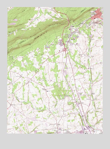
Wind Gap, PA USGS Topographic Map
Click on map above to begin viewing in our Map Viewer.

This topographic map contains these locations and features:
Feature Name Type Latitude Longitude GNIS ID View Map
AlphaPopulated PlaceN40.8520°W75.2849°1168220View Map
AlutaPopulated PlaceN40.7709°W75.3168°1192070View Map
BelfastPopulated PlaceN40.7807°W75.2780°1169137View Map
Belfast Census Designated PlaceCensusN40.7832°W75.2755°2389193View Map
Belfast JunctionPopulated PlaceN40.7679°W75.2724°1169138View Map
Benders ChurchChurchN40.8198°W75.2527°1169231View Map
Blue Mountain DamDamN40.8745°W75.3321°1208703View Map
Borough of Pen ArgylCivilN40.8676°W75.2535°1215500View Map
Borough of StockertownCivilN40.7547°W75.2628°1215503View Map
Borough of Wind GapCivilN40.8484°W75.2917°1215508View Map
BoultonPopulated PlaceN40.7743°W75.2880°1210883View Map
Bushkill CenterPopulated PlaceN40.7937°W75.3246°1170771View Map
Bushkill ChurchChurchN40.8070°W75.3571°1170772View Map
Bushkill SchoolSchoolN40.8204°W75.3535°1211992View Map
Bushkill Township Elementary SchoolSchoolN40.7923°W75.3224°1211000View Map
Bushkill Township Police DepartmentBuildingN40.7991°W75.3323°2781176View Map
Bushkill Township Volunteer Fire Company / Bushkill Volunteer Ambulance CorpsBuildingN40.8005°W75.3320°2652724View Map
Center SchoolSchoolN40.7837°W75.3477°1211993View Map
Central SchoolSchoolN40.8068°W75.2874°1211990View Map
Cherry HillPopulated PlaceN40.7582°W75.3093°1171636View Map
Chicola LakeLakeN40.8493°W75.3700°1171774View Map
Chicola Lake DamDamN40.8482°W75.3730°1208979View Map
ChurchvillePopulated PlaceN40.7520°W75.2502°1192268View Map
ClearfieldPopulated PlaceN40.8009°W75.3468°1171974View Map
CopellaPopulated PlaceN40.8001°W75.3685°1213085View Map
Douglassville (historical)Populated PlaceN40.7751°W75.3363°1210882View Map
East LawnPopulated PlaceN40.7504°W75.2943°1173833View Map
Eastlawn GardensPopulated PlaceN40.7507°W75.2957°1867485View Map
EdelmanPopulated PlaceN40.7904°W75.2649°1173989View Map
Evergreen CemeteryCemeteryN40.8512°W75.2588°1174366View Map
FiletownPopulated PlaceN40.7732°W75.3005°1192461View Map
FriedenthalPopulated PlaceN40.7523°W75.2707°1196126View Map
Global Medical Transportation ServicesBuildingN40.7791°W75.3699°2722111View Map
Grand CentralPopulated PlaceN40.8443°W75.2641°1175929View Map
Haynes MillPopulated PlaceN40.7843°W75.3605°1211994View Map
Horn SpringsSpringN40.8382°W75.3430°1177420View Map
Interdenominational ChurchChurchN40.8062°W75.3566°1177823View Map
Jackson SchoolSchoolN40.8245°W75.3210°1211991View Map
Jacobsburg (historical)Populated PlaceN40.7968°W75.2996°1196125View Map
Jacobsburg State ParkParkN40.7876°W75.3013°1198249View Map
KatellenPopulated PlaceN40.8248°W75.3674°1205057View Map
KnechtsPopulated PlaceN40.8109°W75.3352°1178603View Map
Leiberts SchoolSchoolN40.7523°W75.2949°1179169View Map
Lookout Fire Company 1 Station 32BuildingN40.8689°W75.2559°2653010View Map
Mill DamDamN40.7843°W75.3613°1196124View Map
Mill DamDamN40.7707°W75.3130°1208868View Map
Mill DamDamN40.8215°W75.2824°1208869View Map
Mill Grove SchoolSchoolN40.7673°W75.3216°1211997View Map
MillersPopulated PlaceN40.8265°W75.2646°1192944View Map
MoorestownPopulated PlaceN40.7787°W75.3696°1181518View Map
Mount View Park RacetrackLocaleN40.8276°W75.3346°1213293View Map
NiskyPopulated PlaceN40.7518°W75.2846°1211998View Map
Northampton CountyCivilN40.7542°W75.3076°1209185View Map
Pen ArgylPopulated PlaceN40.8687°W75.2549°1193097View Map
Pen Argyl Junior-Senior High SchoolSchoolN40.8715°W75.2596°1210881View Map
Pen Argyl Post OfficePost OfficeN40.8683°W75.2550°2772900View Map
Pennsylvania State Police Troop M Belfast StationBuildingN40.7738°W75.2689°2777350View Map
Pennsylvania Turnpike Interchange 2CrossingN40.8154°W75.3310°1196067View Map
Plainfield Township Elementary SchoolSchoolN40.7887°W75.2782°1210885View Map
Plainfield Township Volunteer Fire Company / Plainfield Township Ambulance CorpsBuildingN40.8199°W75.2904°2653199View Map
RasleytownPopulated PlaceN40.8148°W75.2660°1205077View Map
RismillerPopulated PlaceN40.8398°W75.3155°1185109View Map
Ross CommonPopulated PlaceN40.8651°W75.3060°1205080View Map
Ross Common DamDamN40.8651°W75.3032°1208977View Map
Saint Charles ChurchChurchN40.7993°W75.3480°1185870View Map
Saint Peters Union ChurchChurchN40.8276°W75.2780°1186686View Map
Saylorsburg Junction (historical)LocaleN40.8509°W75.3088°1211989View Map
SchoeneckPopulated PlaceN40.7554°W75.3082°1187094View Map
Schoeneck Moravian ChurchChurchN40.7533°W75.3083°2071998View Map
Slate Belt Regional Police DepartmentBuildingN40.8082°W75.2871°2781184View Map
Sobers RunStreamN40.7851°W75.3024°2063060View Map
Sours MillsPopulated PlaceN40.7745°W75.3107°1211996View Map
StockertownPopulated PlaceN40.7540°W75.2621°1193471View Map
Stockertown Borough Police DepartmentBuildingN40.7561°W75.2631°2781166View Map
Stockertown Post OfficePost OfficeN40.7560°W75.2631°2772994View Map
Township of BushkillCivilN40.7976°W75.3281°1216898View Map
Township of PlainfieldCivilN40.8185°W75.2609°1216908View Map
Union CemeteryCemeteryN40.7820°W75.2818°1190107View Map
Upper Nazareth Fire DepartmentBuildingN40.7502°W75.2984°2653463View Map
WardsburgPopulated PlaceN40.7854°W75.2816°1210884View Map
Warren SchoolSchoolN40.7629°W75.3488°1211995View Map
WerkheiserPopulated PlaceN40.7859°W75.2660°1205098View Map
Wesley ChurchChurchN40.7884°W75.2721°1190862View Map
West Branch Sobers RunStreamN40.8011°W75.3092°2420849View Map
West Pen ArgylPopulated PlaceN40.8573°W75.2705°1191088View Map
Wind GapPopulated PlaceN40.8482°W75.2916°1200133View Map
Wind GapGapN40.8620°W75.2941°1191563View Map
Wind Gap AmbulanceBuildingN40.8553°W75.2912°2722189View Map
Wind Gap Fire Company Station 35BuildingN40.8506°W75.2906°2652914View Map
Wind Gap Post OfficePost OfficeN40.8509°W75.2919°2779705View Map
Windgap Post Office (historical)Post OfficeN40.8276°W75.2796°1214121View Map

Note: Coordinates in the location and feature list above are referenced to NAD83 datum.


Copyright (C) 2008-2024 Ryan Niemi / Sunset Dynamics ... All Rights Reserved