TopoQuest Logo
Do you find TopoQuest useful?
Help keep TopoQuest running and adding new maps/features by donating!
Bitcoin:  19c7KJd3qBynnjoSw5npx9KScwjBe4ifkT
Litecoin:  LXs6TkuXGGXo1vDsWCkWVdjQX94eUKd6ui
Home View Maps Find Maps Find Places Resources & Links


Wilton, Iowa Topographic Map

USGS Map Title: Wilton, IA
USGS Map MRC: 41091E1
DRG (GeoTIFF) Download: o41091e1.tif


Neighboring USGS Topographic Map Quads:


  Rochester, IA  
41091F2
 

  Lime City, IA  
41091F1
 

  Bennett, IA  
41090F8
 

  Atalissa, IA  
41091E2
 

  Wilton, IA  
41091E1
 

  Durant, IA  
41090E8
 

  Muscatine NW, IA  
41091D2
 

  Muscatine, IA  
41091D1
 

  Illinois City, IL  
41090D8


Map MRC Location:

N42°
W92°
N42°
W91°
H8 H7 H6 H5 H4 H3 H2 H1
G8 G7 G6 G5 G4 G3 G2 G1
F8 F7 F6 F5 F4 F3 F2 F1
E8 E7 E6 E5 E4 E3 E2 E1
D8 D7 D6 D5 D4 D3 D2 D1
C8 C7 C6 C5 C4 C3 C2 C1
B8 B7 B6 B5 B4 B3 B2 B1
A8 A7 A6 A5 A4 A3 A2 A1
N41°
W92°
N41°
W91°

Wilton, IA USGS 1:24K Topographic Map Preview:
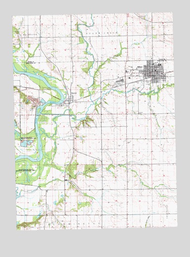
Wilton, IA USGS Topographic Map
Click on map above to begin viewing in our Map Viewer.

This topographic map contains these locations and features:
Feature Name Type Latitude Longitude GNIS ID View Map
Cedar Valley School (historical)SchoolN41.5228°W91.1013°465059View Map
Champion Hill School (historical)SchoolN41.5745°W91.1199°465062View Map
Cherrydale ParkParkN41.5828°W91.0174°464913View Map
City of WiltonCivilN41.5899°W91.0270°2397334View Map
Duff CemeteryCemeteryN41.5839°W91.0765°465071View Map
First Presbyterian ChurchChurchN41.5900°W91.0193°2000554View Map
Grace United Church of ChristChurchN41.5900°W91.0179°2000553View Map
Healey CemeteryCemeteryN41.6000°W91.0985°465093View Map
Heartland Fellowship ChurchChurchN41.5942°W91.0224°2000552View Map
Hebron CemeteryCemeteryN41.6222°W91.1210°2001670View Map
Jack Shuger Memorial ParkParkN41.5750°W91.0849°2000447View Map
Klein CemeteryCemeteryN41.5311°W91.0843°465102View Map
Langes Ferry (historical)LocaleN41.5756°W91.0963°465518View Map
Methodist ChurchChurchN41.5984°W91.0174°2000551View Map
MoscowLocaleN41.5736°W91.0824°2001514View Map
MoscowPopulated PlaceN41.5750°W91.0827°465126View Map
Moscow CemeteryCemeteryN41.5745°W91.0849°2000610View Map
Moscow Post OfficePost OfficeN41.5750°W91.0827°2000454View Map
Moscow QuarryMineN41.5753°W91.1100°2571516View Map
Mud CreekStreamN41.5728°W91.0635°465129View Map
Oak Hill School (historical)SchoolN41.5489°W91.0793°465132View Map
Oakdale CemeteryCemeteryN41.5845°W91.0254°465133View Map
Otter CreekStreamN41.5886°W91.0635°465135View Map
Peace ChurchChurchN41.5500°W91.0379°465138View Map
Saint Mary's CemeteryCemeteryN41.5778°W91.0279°465154View Map
Saint Marys Catholic ChurchChurchN41.5878°W91.0077°2000536View Map
Sharon CemeteryCemeteryN41.6227°W91.0259°465162View Map
South Towne ParkPopulated PlaceN41.5859°W91.0057°2000537View Map
Sugar CreekStreamN41.5553°W91.1052°465169View Map
Sugar Creek MillsLocaleN41.6125°W91.0704°466074View Map
Sugar Creek Post Office (historical)Post OfficeN41.6111°W91.0724°2001525View Map
SummitPopulated PlaceN41.5086°W91.0224°465517View Map
Summit (historical)LocaleN41.5084°W91.0210°2000453View Map
Summit Post Office (historical)Post OfficeN41.5070°W91.0182°2000452View Map
Summit Ridge Post Office (historical)Post OfficeN41.5084°W91.0210°2000451View Map
Township of MoscowCivilN41.5517°W91.0848°468412View Map
West View ParkParkN41.5936°W91.0293°464914View Map
White Prairie School (historical)SchoolN41.5595°W91.0582°465183View Map
Wildasin CemeteryCemeteryN41.5667°W91.0279°2000614View Map
Wildsan CemeteryCemeteryN41.5670°W91.0285°465184View Map
WiltonLocaleN41.5875°W91.0215°2000548View Map
WiltonPopulated PlaceN41.5889°W91.0168°465185View Map
Wilton Care CenterHospitalN41.5953°W91.0118°2000555View Map
Wilton City HallBuildingN41.5886°W91.0163°2000544View Map
Wilton DepotBuildingN41.5875°W91.0179°2000542View Map
Wilton Elementary SchoolSchoolN41.5913°W91.0147°2000556View Map
Wilton Fire DepartmentBuildingN41.5895°W91.0130°2000543View Map
Wilton First RespondersBuildingN41.5895°W91.0130°2599802View Map
Wilton Junior - Senior High SchoolSchoolN41.5950°W91.0107°2000557View Map
Wilton Police DepartmentBuildingN41.5885°W91.0187°2000545View Map
Wilton Post OfficePost OfficeN41.5886°W91.0157°2000547View Map
Wilton Public LibraryBuildingN41.5886°W91.0163°2000546View Map
Wilton Water Treatment PlantLocaleN41.5886°W91.0281°2728217View Map
Zion Lutheran ChurchChurchN41.5950°W91.0165°2000550View Map
Zion Lutheran SchoolSchoolN41.5953°W91.0157°2000558View Map
Zion Lutheran SchoolSchoolN41.5954°W91.0157°464915View Map

Note: Coordinates in the location and feature list above are referenced to NAD83 datum.


Copyright (C) 2008-2024 Ryan Niemi / Sunset Dynamics ... All Rights Reserved