TopoQuest Logo
Do you find TopoQuest useful?
Help keep TopoQuest running and adding new maps/features by donating!
Bitcoin:  19c7KJd3qBynnjoSw5npx9KScwjBe4ifkT
Litecoin:  LXs6TkuXGGXo1vDsWCkWVdjQX94eUKd6ui
Home View Maps Find Maps Find Places Resources & Links


Borregos Ranch, Texas Topographic Map

USGS Map Title: Borregos Ranch, TX
USGS Map MRC: 26098G6
DRG (GeoTIFF) Download: o26098g6.tif


Neighboring USGS Topographic Map Quads:


  San Antonio Viejo, TX  
26098H7
 

  Agua Nueva NW, TX  
26098H6
 

  Agua Nueva, TX  
26098H5
 

  Cuevitas, TX  
26098G7
 

  Borregos Ranch, TX  
26098G6
 

  Agua Nueva SE, TX  
26098G5
 

  Viboras, TX  
26098F7
 

  Las Islas Ranch, TX  
26098F6
 

  La Gloria, TX  
26098F5


Map MRC Location:

N27°
W99°
N27°
W98°
H8 H7 H6 H5 H4 H3 H2 H1
G8 G7 G6 G5 G4 G3 G2 G1
F8 F7 F6 F5 F4 F3 F2 F1
E8 E7 E6 E5 E4 E3 E2 E1
D8 D7 D6 D5 D4 D3 D2 D1
C8 C7 C6 C5 C4 C3 C2 C1
B8 B7 B6 B5 B4 B3 B2 B1
A8 A7 A6 A5 A4 A3 A2 A1
N26°
W99°
N26°
W98°

Borregos Ranch, TX USGS 1:24K Topographic Map Preview:
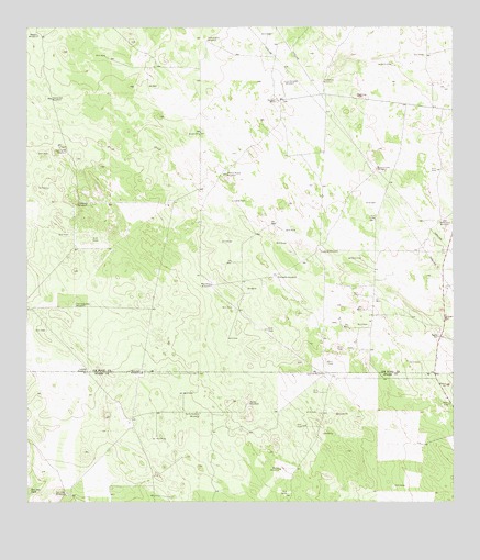
Borregos Ranch, TX USGS Topographic Map
Click on map above to begin viewing in our Map Viewer.

This topographic map contains these locations and features:
Feature Name Type Latitude Longitude GNIS ID View Map
Borregos RanchLocaleN26.8562°W98.6756°1331095View Map
Buena Vista WindmillLocaleN26.8381°W98.6472°1331543View Map
Buenos Aires RanchLocaleN26.7661°W98.6344°2371829View Map
Calavazas WindmillLocaleN26.8287°W98.7356°1331860View Map
Camote WindmillLocaleN26.7848°W98.7328°1331937View Map
Charco Nuevo WindmillLocaleN26.8364°W98.6917°1332683View Map
Granjenitos RanchLocaleN26.7722°W98.7203°2371827View Map
Huisache WindmillLocaleN26.8095°W98.6767°1338257View Map
Juanitas RanchLocaleN26.7844°W98.6611°2371828View Map
Lobitos WindmillLocaleN26.7837°W98.6631°1340299View Map
Los Corrales WindmillLocaleN26.8606°W98.6745°1340584View Map
Mescalito WindmillLocaleN26.8073°W98.6964°1341398View Map
Mirasoles WindmillLocaleN26.8239°W98.6281°1341735View Map
Moriea WindmillLocaleN26.7589°W98.6761°1341920View Map
Realero WindmillLocaleN26.8731°W98.7470°1344874View Map
Sacatones WindmillLocaleN26.8609°W98.6631°1345810View Map
San Carlos WindmillLocaleN26.8426°W98.7386°1346320View Map
San Jose TankReservoirN26.7528°W98.7495°1346389View Map
San Jose WindmillLocaleN26.7526°W98.7392°1346392View Map
San Juan WindmillsLocaleN26.7845°W98.7167°1346416View Map
Santa Barbara WindmillLocaleN26.7734°W98.6997°1346624View Map
Sordo WindmillLocaleN26.7759°W98.6850°1347385View Map
Sufrimiento WindmillLocaleN26.8720°W98.6972°1348028View Map
Tiradores WindmillLocaleN26.8167°W98.6645°1348598View Map
Tres Esquinas WindmillLocaleN26.8020°W98.7361°1348751View Map
Viente dos WindmillLocaleN26.8567°W98.7431°1349273View Map

Note: Coordinates in the location and feature list above are referenced to NAD83 datum.


Copyright (C) 2008-2024 Ryan Niemi / Sunset Dynamics ... All Rights Reserved