TopoQuest Logo
Do you find TopoQuest useful?
Help keep TopoQuest running and adding new maps/features by donating!
Bitcoin:  19c7KJd3qBynnjoSw5npx9KScwjBe4ifkT
Litecoin:  LXs6TkuXGGXo1vDsWCkWVdjQX94eUKd6ui
Home View Maps Find Maps Find Places Resources & Links


Whitney, Texas Topographic Map

USGS Map Title: Whitney, TX
USGS Map MRC: 31097H3
DRG (GeoTIFF) Download: o31097h3.tif


Neighboring USGS Topographic Map Quads:


  Lakeside Village, TX  
32097A4
 

  Blanton, TX  
32097A3
 

  Hillsboro West, TX  
32097A2
 

  Allen Bend, TX  
31097H4
 

  Whitney, TX  
31097H3
 

  Peoria, TX  
31097H2
 

  Laguna Park, TX  
31097G4
 

  Smiths Bend, TX  
31097G3
 

  Aquilla, TX  
31097G2


Map MRC Location:

N32°
W98°
N32°
W97°
H8 H7 H6 H5 H4 H3 H2 H1
G8 G7 G6 G5 G4 G3 G2 G1
F8 F7 F6 F5 F4 F3 F2 F1
E8 E7 E6 E5 E4 E3 E2 E1
D8 D7 D6 D5 D4 D3 D2 D1
C8 C7 C6 C5 C4 C3 C2 C1
B8 B7 B6 B5 B4 B3 B2 B1
A8 A7 A6 A5 A4 A3 A2 A1
N31°
W98°
N31°
W97°

Whitney, TX USGS 1:24K Topographic Map Preview:
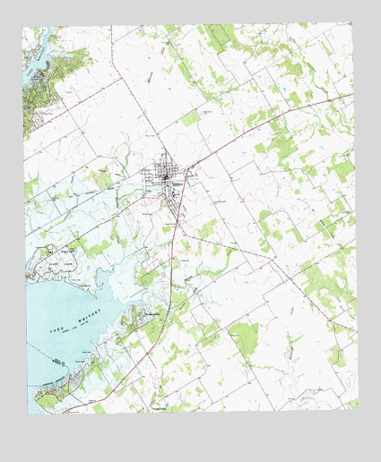
Whitney, TX USGS Topographic Map
Click on map above to begin viewing in our Map Viewer.

This topographic map contains these locations and features:
Feature Name Type Latitude Longitude GNIS ID View Map
Bethlehem CemeteryCemeteryN31.9710°W97.3078°1330523View Map
Cedar Creek ParkParkN31.9946°W97.3695°1373018View Map
Juniper Cove ParkParkN31.9829°W97.3683°1338929View Map
Lake Whitney Medical CenterHospitalN31.9513°W97.3197°2015786View Map
Lake Whitney State ParkParkN31.9254°W97.3653°2028989View Map
Lake Whitney State ParkParkN31.9224°W97.3603°1374448View Map
Lake Whitney State Park Airport (historical)AirportN31.9255°W97.3644°1387742View Map
Lake Whitney State Park Hiking TrailTrailN31.9260°W97.3642°2033497View Map
Lofers Bend ParkParkN31.8854°W97.3614°1374646View Map
Missionary Baptist ChurchChurchN31.9529°W97.3225°2020960View Map
Oak Grove CemeteryCemeteryN31.9943°W97.3183°1342963View Map
Prairie ValleyPopulated PlaceN31.8771°W97.3283°1378905View Map
Prairie Valley CemeteryCemeteryN31.8760°W97.3317°1852117View Map
Towash ChurchChurchN31.9240°W97.3167°1348667View Map
Towash CreekStreamN31.9088°W97.3395°1348668View Map
Town of WhitneyCivilN31.9520°W97.3193°2413482View Map
WhitneyPopulated PlaceN31.9518°W97.3214°1350023View Map
Whitney City HallBuildingN31.9517°W97.3220°2754043View Map
Whitney CreekStreamN31.9121°W97.3447°1350025View Map
Whitney DivisionCivilN31.9034°W97.2927°1939324View Map
Whitney High SchoolSchoolN31.9604°W97.3220°2006339View Map
Whitney Junior High SchoolSchoolN31.9524°W97.3206°2006341View Map
Whitney Police DepartmentBuildingN31.9485°W97.3213°2739279View Map
Whitney Post OfficePost OfficeN31.9519°W97.3157°2731164View Map
Whitney-Towash CemeteryCemeteryN31.9421°W97.3045°1350027View Map
Woodland HillsPopulated PlaceN31.9021°W97.3339°1350533View Map
Yates CemeteryCemeteryN31.9390°W97.2522°1350649View Map

Note: Coordinates in the location and feature list above are referenced to NAD83 datum.


Copyright (C) 2008-2024 Ryan Niemi / Sunset Dynamics ... All Rights Reserved