TopoQuest Logo
Do you find TopoQuest useful?
Help keep TopoQuest running and adding new maps/features by donating!
Bitcoin:  19c7KJd3qBynnjoSw5npx9KScwjBe4ifkT
Litecoin:  LXs6TkuXGGXo1vDsWCkWVdjQX94eUKd6ui
Home View Maps Find Maps Find Places Resources & Links


West Paris, Maine Topographic Map

USGS Map Title: West Paris, ME
USGS Map MRC: 44070C5
DRG (GeoTIFF) Download: o44070c5.tif


Neighboring USGS Topographic Map Quads:


  Bryant Pond, ME  
44070D6
 

  Mount Zircon, ME  
44070D5
 

  Worthley Pond, ME  
44070D4
 

  Greenwood, ME  
44070C6
 

  West Paris, ME  
44070C5
 

  West Sumner, ME  
44070C4
 

  Waterford Flat, ME  
44070B6
 

  Norway, ME  
44070B5
 

  Oxford, ME  
44070B4


Map MRC Location:

N45°
W71°
N45°
W70°
H8 H7 H6 H5 H4 H3 H2 H1
G8 G7 G6 G5 G4 G3 G2 G1
F8 F7 F6 F5 F4 F3 F2 F1
E8 E7 E6 E5 E4 E3 E2 E1
D8 D7 D6 D5 D4 D3 D2 D1
C8 C7 C6 C5 C4 C3 C2 C1
B8 B7 B6 B5 B4 B3 B2 B1
A8 A7 A6 A5 A4 A3 A2 A1
N44°
W71°
N44°
W70°

West Paris, ME USGS 1:24K Topographic Map Preview:
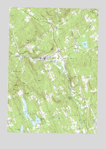
West Paris, ME USGS Topographic Map
Click on map above to begin viewing in our Map Viewer.

This topographic map contains these locations and features:
Feature Name Type Latitude Longitude GNIS ID View Map
Agnes Gray Elementary SchoolSchoolN44.3272°W70.5695°1907911View Map
Andrews BrookStreamN44.3234°W70.5556°561256View Map
Andrews CemeteryCemeteryN44.3654°W70.5171°2736843View Map
Bacon Paine CemeteryCemeteryN44.3219°W70.6214°2736845View Map
Bates Dean CemeteryCemeteryN44.3177°W70.5100°2736846View Map
Berry LedgeCliffN44.3337°W70.5645°562089View Map
Bisco FallsFallsN44.2851°W70.5362°562372View Map
Bog BrookStreamN44.3423°W70.5195°562665View Map
Cobble HillSummitN44.2819°W70.5551°564123View Map
Cole BrookStreamN44.2726°W70.5187°564207View Map
Courthouse SquareParkN44.2612°W70.5017°1907974View Map
Curtis HillSummitN44.3509°W70.5884°564686View Map
Curtis Hill CemeteryCemeteryN44.3420°W70.5906°564687View Map
Durham CemeteryCemeteryN44.3702°W70.5370°2736855View Map
Eastman HillSummitN44.3022°W70.5833°565743View Map
Fifield Day CemeteryCemeteryN44.3472°W70.6207°2724643View Map
Finnish CemeteryCemeteryN44.3259°W70.5618°2736859View Map
Forestdale School (historical)SchoolN44.3615°W70.5528°566383View Map
Fuller HillSummitN44.3664°W70.6226°566647View Map
Hamlin Memorial LibraryBuildingN44.2601°W70.5023°1908032View Map
Hedgehog HillSummitN44.2627°W70.5768°567884View Map
Legion Memorial School (historical)SchoolN44.3265°W70.5703°1908065View Map
Little Androscoggin River ReservoirReservoirN44.3230°W70.5747°1774198View Map
Mission Congregational ChurchChurchN44.3256°W70.5745°1908089View Map
Moody BrookStreamN44.2737°W70.5187°571542View Map
Moose PondLakeN44.3391°W70.5187°571615View Map
Moose Pond BrookStreamN44.3106°W70.5470°571630View Map
Nobles CornerPopulated PlaceN44.2615°W70.6248°572213View Map
North ParisPopulated PlaceN44.3376°W70.5292°572374View Map
North Paris CemeteryCemeteryN44.3442°W70.5340°572375View Map
North Paris Federated ChurchChurchN44.3353°W70.5267°1908108View Map
North PondReservoirN44.2660°W70.5988°572385View Map
North Pond DamDamN44.2686°W70.6056°1774087View Map
Oxford County Jail (historical)BuildingN44.2606°W70.5028°1908130View Map
Paine PondLakeN44.2644°W70.5563°572930View Map
ParisPopulated PlaceN44.2598°W70.5006°572962View Map
Paris Hill Bible ChurchChurchN44.2612°W70.5017°1908139View Map
Pleasant Valley CemeteryCemeteryN44.2845°W70.5187°573522View Map
Porter District CemeteryCemeteryN44.2939°W70.5575°2736387View Map
Richardson Hollow CemeteryCemeteryN44.2917°W70.6103°574172View Map
Rock DundeeSummitN44.2994°W70.6050°574339View Map
Shaw LedgeCliffN44.2976°W70.6137°575325View Map
Snow FallsLocaleN44.3048°W70.5398°575679View Map
Snow Falls GorgeValleyN44.3020°W70.5379°1908185View Map
South WoodstockPopulated PlaceN44.3548°W70.5573°575928View Map
South Woodstock CemeteryCemeteryN44.3538°W70.5619°2736400View Map
Stearns HillSummitN44.3056°W70.5309°576290View Map
Stearns Hill CemeteryCemeteryN44.3059°W70.5139°576291View Map
Town of West ParisCivilN44.3211°W70.5338°582809View Map
Trap CornerPopulated PlaceN44.3315°W70.5553°577276View Map
Tri Town Ambulance and Emergency Rescue ServicesBuildingN44.3326°W70.5550°2666761View Map
Twitchell BrookStreamN44.3267°W70.6209°577494View Map
Wayside CemeteryCemeteryN44.3260°W70.5662°2736907View Map
West ParisPopulated PlaceN44.3242°W70.5740°578184View Map
West Paris Baptist ChurchChurchN44.3251°W70.5759°1908245View Map
West Paris DamDamN44.3230°W70.5747°1774197View Map
West Paris Fire DepartmentBuildingN44.3258°W70.5716°2553173View Map
West Paris Post OfficePost OfficeN44.3240°W70.5747°1908246View Map
West Paris Public LibraryBuildingN44.3251°W70.5735°1907918View Map
Whitman MountainSummitN44.3431°W70.5948°578405View Map
Witt HillSummitN44.2890°W70.5981°578634View Map
Woodstock Seventh Day ChurchChurchN44.3598°W70.5512°1908255View Map

Note: Coordinates in the location and feature list above are referenced to NAD83 datum.


Copyright (C) 2008-2024 Ryan Niemi / Sunset Dynamics ... All Rights Reserved