TopoQuest Logo
Do you find TopoQuest useful?
Help keep TopoQuest running and adding new maps/features by donating!
Bitcoin:  19c7KJd3qBynnjoSw5npx9KScwjBe4ifkT
Litecoin:  LXs6TkuXGGXo1vDsWCkWVdjQX94eUKd6ui
Home View Maps Find Maps Find Places Resources & Links


West Glacier, Montana Topographic Map

USGS Map Title: West Glacier, MT
USGS Map MRC: 48113D8
DRG (GeoTIFF) Download: o48113d8.tif


Neighboring USGS Topographic Map Quads:


  McGee Meadow, MT  
48114E1
 

  Lake McDonald West, MT  
48113E8
 

  Lake McDonald East, MT  
48113E7
 

  Hungry Horse, MT  
48114D1
 

  West Glacier, MT  
48113D8
 

  Nyack, MT  
48113D7
 

  Doris Mountain, MT  
48114C1
 

  Nyack SW, MT  
48113C8
 

  Mount Grant, MT  
48113C7


Map MRC Location:

N49°
W114°
N49°
W113°
H8 H7 H6 H5 H4 H3 H2 H1
G8 G7 G6 G5 G4 G3 G2 G1
F8 F7 F6 F5 F4 F3 F2 F1
E8 E7 E6 E5 E4 E3 E2 E1
D8 D7 D6 D5 D4 D3 D2 D1
C8 C7 C6 C5 C4 C3 C2 C1
B8 B7 B6 B5 B4 B3 B2 B1
A8 A7 A6 A5 A4 A3 A2 A1
N48°
W114°
N48°
W113°

West Glacier, MT USGS 1:24K Topographic Map Preview:
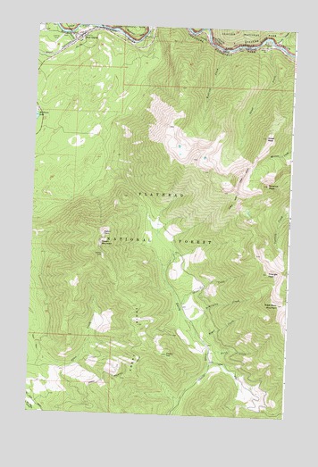
West Glacier, MT USGS Topographic Map
Click on map above to begin viewing in our Map Viewer.

This topographic map contains these locations and features:
Feature Name Type Latitude Longitude GNIS ID View Map
BeltonLocaleN48.4961°W113.9787°1796074View Map
Belton PointSummitN48.4330°W113.9661°779681View Map
Coram - West Glacier Volunteer Fire DepartmentBuildingN48.4949°W113.9849°2546474View Map
Coram Experimental ForestParkN48.3977°W113.9809°801922View Map
Desert MountainSummitN48.4314°W113.9665°782311View Map
Emery HillSummitN48.3945°W113.9331°783185View Map
Emery RidgeRidgeN48.4040°W113.9473°783187View Map
Great Bear MountainSummitN48.4112°W113.8799°784255View Map
John F Stevens CanyonValleyN48.4990°W113.9791°785509View Map
Kootenai CreekStreamN48.4930°W113.9076°785836View Map
Lincoln CreekStreamN48.4952°W113.8848°786161View Map
Oliver CreekStreamN48.4097°W113.9262°788439View Map
Ousel CreekStreamN48.4961°W113.8865°788520View Map
Ousel PeakSummitN48.4657°W113.8875°788522View Map
Ousel Peak TrailTrailN48.4489°W113.9004°788523View Map
Pyramid PeakSummitN48.4496°W113.8869°789250View Map
Remington CreekStreamN48.4041°W113.9218°789524View Map
Royal CreekStreamN48.3989°W113.9154°793900View Map
Ryan FieldAirportN48.4828°W113.9601°2650681View Map
Silvertip (historical)LocaleN48.4916°W113.8765°1796044View Map
Strife CreekStreamN48.3961°W113.9126°791602View Map
Triangle PeakSummitN48.4213°W113.8855°792372View Map
West GlacierPopulated PlaceN48.5000°W113.9787°793105View Map
West Glacier Census Designated PlaceCensusN48.4916°W113.9961°2583863View Map
West Glacier Post OfficePost OfficeN48.4953°W113.9823°1796075View Map
West Glacier SchoolSchoolN48.4971°W113.9790°1796278View Map

Note: Coordinates in the location and feature list above are referenced to NAD83 datum.


Copyright (C) 2008-2024 Ryan Niemi / Sunset Dynamics ... All Rights Reserved