TopoQuest Logo
Do you find TopoQuest useful?
Help keep TopoQuest running and adding new maps/features by donating!
Bitcoin:  19c7KJd3qBynnjoSw5npx9KScwjBe4ifkT
Litecoin:  LXs6TkuXGGXo1vDsWCkWVdjQX94eUKd6ui
Home View Maps Find Maps Find Places Resources & Links


West Gilgo Beach, New York Topographic Map

USGS Map Title: West Gilgo Beach, NY
USGS Map MRC: 40073E4
DRG (GeoTIFF) Download: o40073e4.tif


Neighboring USGS Topographic Map Quads:


  Freeport, NY  
40073F5
 

  Amityville, NY  
40073F4
 

  Bay Shore West, NY  
40073F3
 

  Jones Inlet, NY  
40073E5
 

  West Gilgo Beach, NY  
40073E4


Map MRC Location:

N41°
W74°
N41°
W73°
H8 H7 H6 H5 H4 H3 H2 H1
G8 G7 G6 G5 G4 G3 G2 G1
F8 F7 F6 F5 F4 F3 F2 F1
E8 E7 E6 E5 E4 E3 E2 E1
D8 D7 D6 D5 D4 D3 D2 D1
C8 C7 C6 C5 C4 C3 C2 C1
B8 B7 B6 B5 B4 B3 B2 B1
A8 A7 A6 A5 A4 A3 A2 A1
N40°
W74°
N40°
W73°

West Gilgo Beach, NY USGS 1:24K Topographic Map Preview:
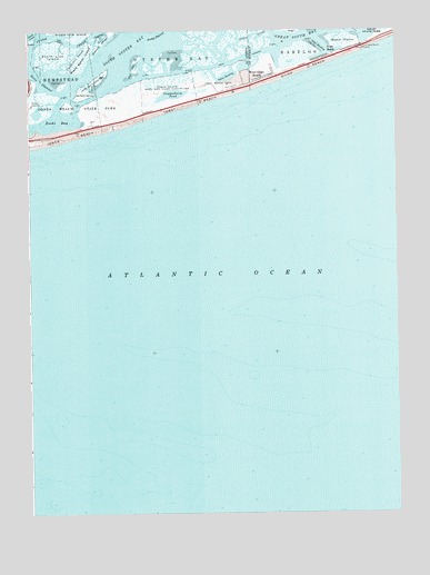
West Gilgo Beach, NY USGS Topographic Map
Click on map above to begin viewing in our Map Viewer.

This topographic map contains these locations and features:
Feature Name Type Latitude Longitude GNIS ID View Map
Amityville CutChannelN40.6209°W73.4162°971932View Map
Beach ThatchSwampN40.6226°W73.3923°943224View Map
Black Banks IslandIslandN40.6179°W73.4815°944075View Map
Cheshires CreekGutN40.6193°W73.4835°946538View Map
Diamond ShoalsBarN40.6220°W73.4751°948423View Map
Gilgo BeachBeachN40.6143°W73.4060°951105View Map
Gilgo BeachPopulated PlaceN40.6184°W73.3976°951106View Map
Gilgo HeadingBayN40.6195°W73.3996°951107View Map
Gugenheim PondLakeN40.6084°W73.4510°951892View Map
Jonas CreekGutN40.6234°W73.4240°954150View Map
Jones Beach IslandIslandN40.6154°W73.3998°978654View Map
Jones Beach Life Boat Station (historical)LocaleN40.6200°W73.3853°2368032View Map
Jones Beach Life Saving Station (historical)LocaleN40.6119°W73.4372°2369516View Map
Middle Line IslandIslandN40.6248°W73.4835°957120View Map
NEW York State Boat ChannelCanalN40.6090°W73.4746°973888View Map
Sanford IslandIslandN40.6107°W73.4804°964451View Map
South Line IslandIslandN40.6195°W73.4912°965808View Map
Stone CreekChannelN40.6232°W73.4890°966496View Map
Tobay BeachBeachN40.6059°W73.4451°967584View Map
Tobay Beach Bird and Game SanctuaryParkN40.6101°W73.4529°967585View Map
Tobay Beach ParkParkN40.6118°W73.4343°967586View Map
Tobay Beach Park HeliportAirportN40.6109°W73.4318°978136View Map
Tobay HeadingBayN40.6134°W73.4326°967587View Map
West Gilgo BeachPopulated PlaceN40.6129°W73.4196°969237View Map
Zachs Inlet Life Saving Station (historical)LocaleN40.6033°W73.4794°2369517View Map

Note: Coordinates in the location and feature list above are referenced to NAD83 datum.


Copyright (C) 2008-2024 Ryan Niemi / Sunset Dynamics ... All Rights Reserved