TopoQuest Logo
Do you find TopoQuest useful?
Help keep TopoQuest running and adding new maps/features by donating!
Bitcoin:  19c7KJd3qBynnjoSw5npx9KScwjBe4ifkT
Litecoin:  LXs6TkuXGGXo1vDsWCkWVdjQX94eUKd6ui
Home View Maps Find Maps Find Places Resources & Links


Wayah Bald, North Carolina Topographic Map

USGS Map Title: Wayah Bald, NC
USGS Map MRC: 35083B5
DRG (GeoTIFF) Download: o35083b5.tif


Neighboring USGS Topographic Map Quads:


  Hewitt, NC  
35083C6
 

  Wesser, NC  
35083C5
 

  Alarka, NC  
35083C4
 

  Topton, NC  
35083B6
 

  Wayah Bald, NC  
35083B5
 

  Franklin, NC  
35083B4
 

  Shooting Creek, NC  
35083A6
 

  Rainbow Springs, NC  
35083A5
 

  Prentiss, NC  
35083A4


Map MRC Location:

N36°
W84°
N36°
W83°
H8 H7 H6 H5 H4 H3 H2 H1
G8 G7 G6 G5 G4 G3 G2 G1
F8 F7 F6 F5 F4 F3 F2 F1
E8 E7 E6 E5 E4 E3 E2 E1
D8 D7 D6 D5 D4 D3 D2 D1
C8 C7 C6 C5 C4 C3 C2 C1
B8 B7 B6 B5 B4 B3 B2 B1
A8 A7 A6 A5 A4 A3 A2 A1
N35°
W84°
N35°
W83°

Wayah Bald, NC USGS 1:24K Topographic Map Preview:
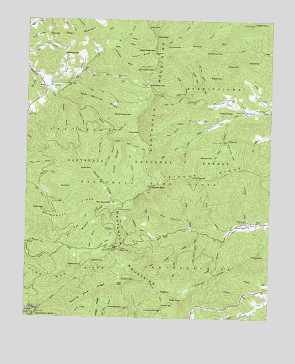
Wayah Bald, NC USGS Topographic Map
Click on map above to begin viewing in our Map Viewer.

This topographic map contains these locations and features:
Feature Name Type Latitude Longitude GNIS ID View Map
Arrowwood CreekStreamN35.1651°W83.5102°980292View Map
Arrowwood Glade Picnic AreaLocaleN35.1659°W83.5121°1018146View Map
Arrowwood Glade Rearing PoolsLocaleN35.1665°W83.5113°980293View Map
Bateman BranchStreamN35.2256°W83.6149°980614View Map
Bateman GapGapN35.2356°W83.6060°980616View Map
Batey BranchStreamN35.2290°W83.5977°980618View Map
Bear CoveValleyN35.1597°W83.5594°980701View Map
Bearpen CreekStreamN35.1806°W83.6218°980753View Map
Bearpen GapGapN35.1931°W83.5357°980755View Map
Ben CreekStreamN35.2287°W83.5968°980979View Map
Berties FallsFallsN35.1540°W83.5756°981051View Map
Big BranchStreamN35.2370°W83.5860°981331View Map
Big Laurel CreekStreamN35.1979°W83.5741°981420View Map
Big Oak GapGapN35.1487°W83.5904°981430View Map
Big StampGapN35.1359°W83.5540°981458View Map
Black BaldSummitN35.2470°W83.5635°1019192View Map
Boardtree BranchStreamN35.1318°W83.5052°981659View Map
Bridge BranchStreamN35.2181°W83.5435°981871View Map
Brushy BranchStreamN35.1576°W83.5227°982058View Map
Buck MountainSummitN35.1706°W83.5563°1019371View Map
Burningtown BaldSummitN35.2290°W83.5602°1019424View Map
Burningtown BranchStreamN35.2370°W83.5860°982289View Map
Burningtown GapGapN35.2229°W83.5624°982290View Map
Camp BranchStreamN35.1623°W83.5393°982498View Map
Chestnut KnobSummitN35.1468°W83.6024°1019630View Map
Cold Spring Appalachian Trail ShelterLocaleN35.2304°W83.5610°1023604View Map
Cold Spring CreekStreamN35.2268°W83.6191°983352View Map
Colts RidgeRidgeN35.1895°W83.5779°983401View Map
Conley Camp BranchStreamN35.1529°W83.5918°983454View Map
Copper KnobSummitN35.2484°W83.5096°983527View Map
Copper RidgeRidgeN35.2351°W83.5668°983531View Map
Copper Ridge BaldSummitN35.2365°W83.5596°983532View Map
Crawford CoveValleyN35.1596°W83.5616°983723View Map
De Weese BranchStreamN35.2059°W83.5293°984024View Map
Dirty John CreekStreamN35.1545°W83.6043°984199View Map
Dry BranchStreamN35.2426°W83.5741°984352View Map
Fall BranchStreamN35.2026°W83.5002°984970View Map
Fire Gap RidgeRidgeN35.1434°W83.6049°985074View Map
Flat KnobSummitN35.2393°W83.5418°1020271View Map
Flint Rock GapGapN35.2384°W83.5477°985222View Map
Goat BaldSummitN35.1801°W83.6071°1020457View Map
Gold Pit CreekStreamN35.2256°W83.6010°985778View Map
Grape Cove BranchStreamN35.1568°W83.5371°985934View Map
Holloway BranchStreamN35.2162°W83.6068°986940View Map
Horse Cove BranchStreamN35.2181°W83.5452°987086View Map
Indian Camp CreekStreamN35.2170°W83.5335°987341View Map
Jarrett BaldSummitN35.1709°W83.6216°1020935View Map
Joe Dave BranchStreamN35.2226°W83.5357°987623View Map
Kit Spring BranchStreamN35.2015°W83.5835°988028View Map
KylePopulated PlaceN35.2212°W83.6154°988065View Map
Larry Brush BranchStreamN35.2351°W83.5902°988151View Map
Left Prong Burningtown CreekStreamN35.2129°W83.5102°988325View Map
Left Prong Ray BranchStreamN35.1970°W83.5432°988326View Map
Left Prong Rough ForkStreamN35.1509°W83.5471°988327View Map
Licklog GapGapN35.2029°W83.5674°988461View Map
Little Laurel CreekStreamN35.1979°W83.5738°988695View Map
Locust Tree BranchStreamN35.1618°W83.5199°988853View Map
Locust Tree GapGapN35.1840°W83.5329°988854View Map
Long BranchStreamN35.2068°W83.5452°988895View Map
Mc Donald RidgeRidgeN35.1698°W83.5993°989513View Map
Middle BranchStreamN35.2384°W83.5818°989765View Map
Middle RidgeRidgeN35.1651°W83.5899°989791View Map
Milksick KnobSummitN35.1518°W83.5090°1021448View Map
Mount Sinai ChurchChurchN35.2115°W83.5124°990572View Map
Muskrat RidgeRidgeN35.1401°W83.5277°990818View Map
Nantahala MountainsRidgeN35.1404°W83.5641°1013870View Map
Nantahala National ForestForestN35.2085°W83.5646°1008600View Map
NC Noname One-Hundred Thirty-Nine DamDamN35.2151°W83.5199°998597View Map
Oakdale ChurchChurchN35.2126°W83.5032°991460View Map
Otter GapGapN35.2434°W83.6141°991717View Map
Otter MountainSummitN35.2462°W83.5841°991718View Map
Panther GapGapN35.1304°W83.5540°991834View Map
Panther KnobSummitN35.1281°W83.5563°991836View Map
Pol Miller HollowValleyN35.2083°W83.5209°992625View Map
Pound Mill GapGapN35.2118°W83.5265°992757View Map
Rartram TrailTrailN35.1837°W83.5429°1018063View Map
Rattlesnake KnobSummitN35.2365°W83.5340°1022156View Map
Rattlesnake SpringSpringN35.1703°W83.5774°993057View Map
Ray BranchStreamN35.2059°W83.5293°993074View Map
Right Prong Ray BranchStreamN35.1970°W83.5432°993357View Map
Right Prong Rough ForkStreamN35.1509°W83.5471°993358View Map
Roaring ForkStreamN35.1276°W83.6188°993429View Map
Roaring Fork RidgeRidgeN35.1359°W83.5879°1014946View Map
Robin BranchStreamN35.1529°W83.5916°1014968View Map
Rocky BaldSummitN35.1876°W83.5971°1022335View Map
Rocky Bald BranchStreamN35.1995°W83.5804°1015016View Map
Rocky Bald RidgeRidgeN35.1801°W83.5849°1015017View Map
Rocky CoveValleyN35.1258°W83.5206°1015033View Map
Rocky KnobSummitN35.2329°W83.5118°1022350View Map
Roper KnobSummitN35.2262°W83.5310°1022388View Map
Rough ForkStreamN35.1609°W83.5352°1015100View Map
Rufus Morgan TrailTrailN35.1540°W83.5446°1018147View Map
Sally CoveValleyN35.2263°W83.6202°1015182View Map
Sassafras BranchStreamN35.2118°W83.5982°1015263View Map
Sheep KnobSummitN35.1326°W83.5502°1022570View Map
Shot Pouch CreekStreamN35.1581°W83.5691°1015489View Map
Siler BaldSummitN35.1393°W83.5771°1022631View Map
Siler Bald ShelterLocaleN35.1451°W83.5727°1018149View Map
Slickrock FordPopulated PlaceN35.1993°W83.5249°1022660View Map
Snowbird GapGapN35.1415°W83.5679°1015649View Map
Split Whiteoak BranchStreamN35.2051°W83.5810°1015732View Map
Split Whiteoak GapGapN35.2101°W83.5718°1015733View Map
Split Whiteoak RidgeRidgeN35.2154°W83.5860°1015734View Map
Tellico BaldSummitN35.2431°W83.5591°1022901View Map
Thorn MountainSummitN35.1293°W83.5738°1016127View Map
Thorn Mountain TrailTrailN35.1315°W83.6035°1018150View Map
Tippet CemeteryCemeteryN35.2173°W83.5193°1016161View Map
Tom Bryan CoveValleyN35.1995°W83.5241°1016176View Map
Township of BurningtownCivilN35.2428°W83.5147°1026901View Map
Trail RidgeRidgeN35.2423°W83.6196°1016219View Map
Wayah BaldSummitN35.1804°W83.5604°1016476View Map
Wayah Bald Recreation SiteLocaleN35.1787°W83.5618°1018148View Map
Wayah Crest Camp GroundLocaleN35.1534°W83.5804°1016479View Map
Wayah DepotPopulated PlaceN35.1648°W83.5118°1023137View Map
Wayah GapGapN35.1534°W83.5804°1016480View Map
Whiteoak Flats ChurchChurchN35.2226°W83.6124°1016622View Map
Wildes KnobSummitN35.2318°W83.5229°1023249View Map
Wilson Lick Ranger StationLocaleN35.1626°W83.5838°1016731View Map
Wine Spring BaldSummitN35.1731°W83.5807°1023281View Map

Note: Coordinates in the location and feature list above are referenced to NAD83 datum.


Copyright (C) 2008-2024 Ryan Niemi / Sunset Dynamics ... All Rights Reserved